|
| *****SWAAG_ID***** | 200 |
| Date Entered | 26/05/2011 |
| Updated on | 13/06/2011 |
| Recorded by | Alan and Judith Mills |
| Category | Mining Related |
| Record Type | Mining |
| SWAAG Site Name | |
| Site Type | |
| Site Name | |
| Site Description | |
| Site Access | Private |
| Record Date | 23/03/2011 |
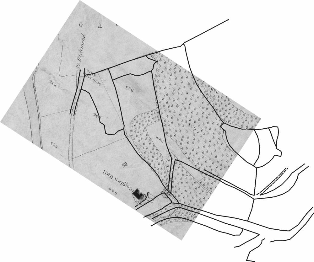
| Location | Cogden Hall farmland |
| Civil Parish | Grinton |
| Brit. National Grid | SE 05717 97690 |
| Altitude | 200m |
| Geology | Pasture over sandstone. British Geological Survey shows ML (Middle Limestone) |
| Record Name | Shallow shafts at Cogden Hall |
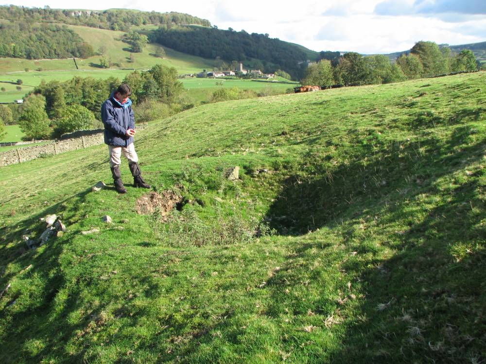
| Record Description | This area, to the West of Stolerston Stile, in what was earlier the Manor of Grinton, contains a number of shallow shafts, at least 13 in number, together with what appear to be 2 or 3 levels driven into the steep bank to the South. This area is shown as 'Old shafts (Lead)' on the 1st edition OS map (1857). The initial impression of the area is of a line of shallow shafts trending in a North-West to South-East direction and probably following a small lead vein or string. On closer examination, the spoil around the shafts consists mainly of small broken flag (sandstone) whilst the larger pieces outside the blocked up levels are also sandstone. There is no evidence of any limestone nor of any mineralisation.
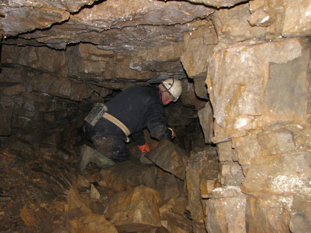
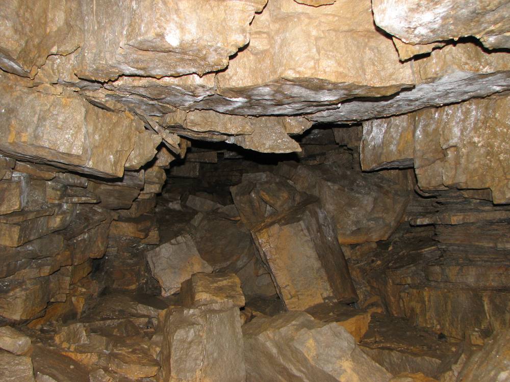
The blocked level at SE 05809 97669 was opened up with the landowner's permission and entered. It is in a dangerous state but was clearly worked for flagstone as indicated by spoil in the pack-walls.
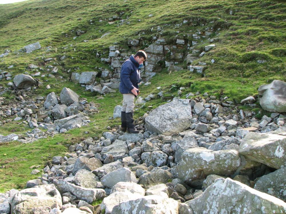
At first it seems unlikely that stone should be quarried underground with access by shafts, when there is a now disused stone quarry close nearby (SE 05697 97770) and extensive surface working for stone in the adjoining field to the East of Stolerston Stile. Historically though, the latter field was in the Manor of Ellerton and therefore the property of a different Lord of the Manor. However, this method of working for good quality flag stone via shallow shafts is not unheard of, apparently being relatively common around Wakefield, West Yorkshire,(source Les Tyson), and is known as 'gallery' working (source David Carlisle). Ian Spensley suggests that the working might be of some antiquity, possibly pre-dating the dissolution of the nearby Marrick Priory and Ellerton Abbey in the 16th century.
SE 05717 97690 to SE 05862 97660 |
| Dimensions | |
| Geographical area | |
| Species | |
| Scientific Name | |
| Common / Notable Species | |
| Tree and / or Stem Girth | |
| Tree: Position / Form / Status | |
| Tree Site ID | 0 |
| Associated Site SWAAG ID | 0 |
| Additional Notes | |
| Image 1 ID | 688 Click image to enlarge |
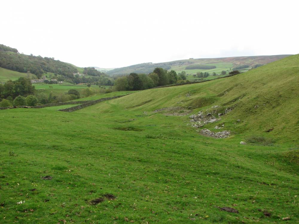
| Image 1 Description | General view of area of shafts | 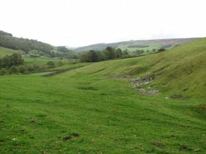 |
| Image 2 ID | 689 Click image to enlarge |
| Image 2 Description | Two of the shallow shafts | 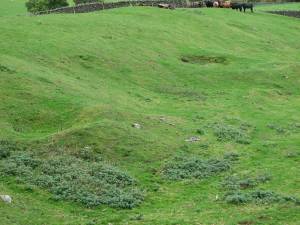 |
| Image 3 ID | 690 Click image to enlarge |
| Image 3 Description | Blocked entrance to a level | 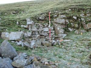 |
| Image 4 ID | 691 Click image to enlarge |
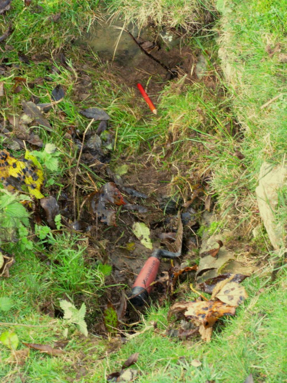
| Image 4 Description | Close up of shaft 1 | 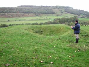 |
| Image 5 ID | 692 Click image to enlarge |
| Image 5 Description | Shaft 4 showing top of the lining ? |  |
| Image 6 ID | 693 Click image to enlarge |
| Image 6 Description | Close up of shaft 12 |  |
| Image 7 ID | 694 Click image to enlarge |
| Image 7 Description | Spoil outside the blocked level |  |
| Image 8 ID | 695 Click image to enlarge |
| Image 8 Description | Mining map of 1774 over the 1840 tithe map showing changes to field boundaries |  |
| Image 9 ID | 696 Click image to enlarge |
| Image 9 Description | Ian Spensley in the level | 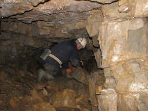 |
| Image 10 ID | 697 Click image to enlarge |
| Image 10 Description | Inside the level showing pack-wall on left & stone working | 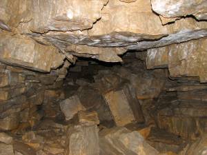 |