|
| *****SWAAG_ID***** | 219 |
| Date Entered | 04/06/2011 |
| Updated on | 27/08/2012 |
| Recorded by | Alan and Judith Mills |
| Category | Mining Related |
| Record Type | Mining |
| SWAAG Site Name | |
| Site Type | |
| Site Name | |
| Site Description | |
| Site Access | Public Access Land |
| Record Date | 04/06/2011 |
| Location | Below Whaw Edge |
| Civil Parish | Arkengarthdale |
| Brit. National Grid | NY 97524 03517 |
| Altitude | 1490 ft |
| Geology | Main Limestone |
| Record Name | Danby Level |
| Record Description | Easterby, Hall & Co began running the Arkengarthdale mines in January 1800. In November of that year they were "driving no fewer than nine horse levels and spending £300 per week" (1). Danby Level was one of them and seems to have been begun around this time. It is on the North side of the Great Blackside Vein and was driven to work veins in the Main Limestone including Martin, Dam Rigg, Lucks All and Wetshaw Head veins (2). Unusually, the level contains an underground horse whim above a shaft, to enable working of the Danby Underlevel some 11 fathoms below (3). At times it was quite productive, raising 1600 tons of ore in the three years 1882-4 (4). The mine was worked out by the close of the 19th century.
(1) Swaledale, its mines & smelt mills; Mike Gill. (2) Geology of the Northern pennine Orefield Vol 2; Dunham & Wilson. (3) British Mining No. 53 The Arkengarthdale Mines; L.O. Tyson. (4) British Mining No. 72 The Mines of Yorkshire; Gill & Burt
Photos taken June - August 2003, copyright Alan Mills. |
| Dimensions | |
| Geographical area | |
| Species | |
| Scientific Name | |
| Common / Notable Species | |
| Tree and / or Stem Girth | |
| Tree: Position / Form / Status | |
| Tree Site ID | 0 |
| Associated Site SWAAG ID | 0 |
| Additional Notes | Gill & Burt 2003, state that Danby Level output in tons was: 1749 2.80, 1750 3.50, 1782 53.30, 1871 5.15, 1872 2.05, 1874 11.10, 1875 5.15, 1882 600.10, 1883 442.50, 1884 577.80, 1885 97.25, 1886 32.75, 1887 26.90. The 1700's returns although listed under Danby Level are likely to be from Danby Hush. |
| Image 1 ID | 742 Click image to enlarge |
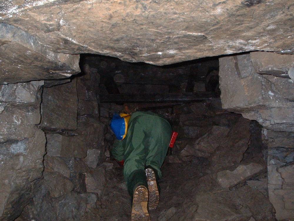
| Image 1 Description | Negotiating the first fall through an old oil drum | 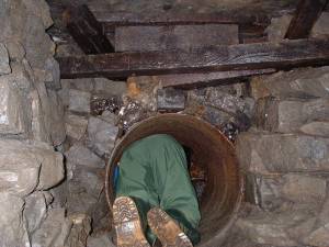 |
| Image 2 ID | 743 Click image to enlarge |
| Image 2 Description | Negotiating another fall |  |
| Image 3 ID | 744 Click image to enlarge |
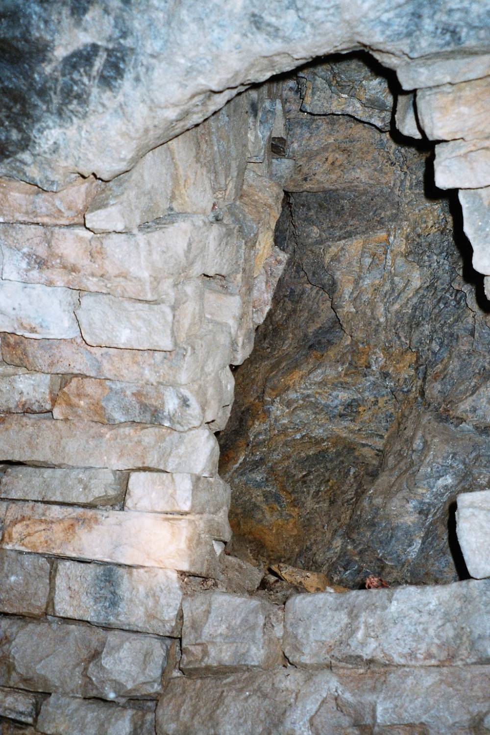
| Image 3 Description | Examining the geology | 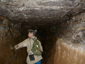 |
| Image 4 ID | 746 Click image to enlarge |
| Image 4 Description | Negotiating yet another fall | 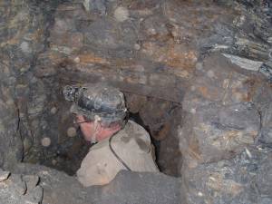 |
| Image 5 ID | 747 Click image to enlarge |
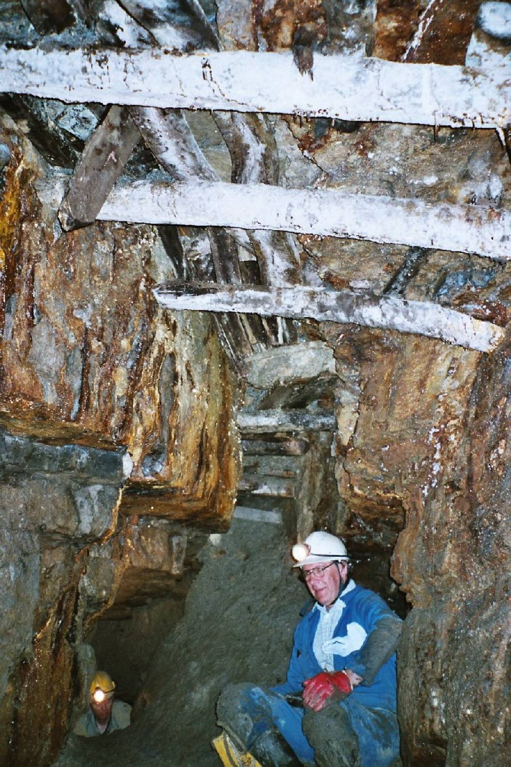
| Image 5 Description | Sitting below hanging death - deads (spoil) stacked above the level on old timbers (stemples) | 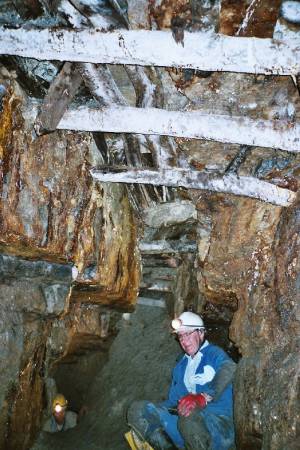 |
| Image 6 ID | 748 Click image to enlarge |
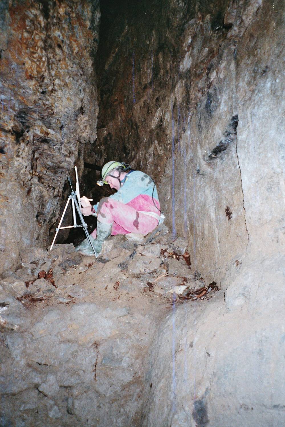
| Image 6 Description | Plane-table surveying | 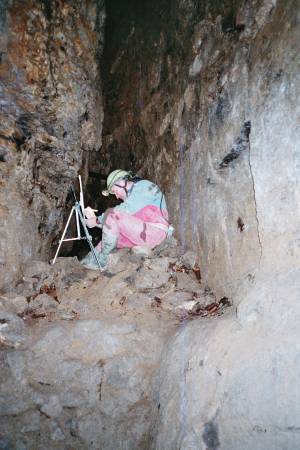 |
| Image 7 ID | 749 Click image to enlarge |
| Image 7 Description | An ore chute from workings above (stoping) |  |
| Image 8 ID | 750 Click image to enlarge |
| Image 8 Description | Detonator boxes | 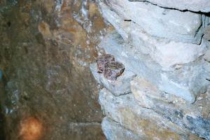 |
| Image 9 ID | 751 Click image to enlarge |
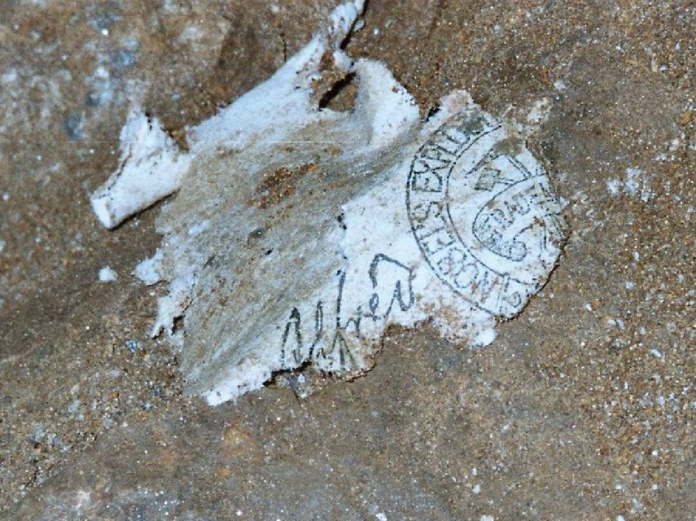
| Image 9 Description | Nobel explosives wrapper; at first I thought this was dynamite, patented 1867, but could be gelignite, patent 1876, One of the cheapest explosives, it burns slower, cannot explode without a detonator, is safer, so better for use underground. | 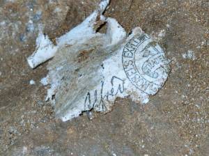 |
| Image 10 ID | 752 Click image to enlarge |
| Image 10 Description | Blast marks - probably from black powder rather than dynamite as little fracturing of rock | 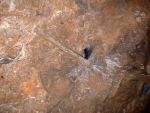 |
| Image 11 ID | 753 |
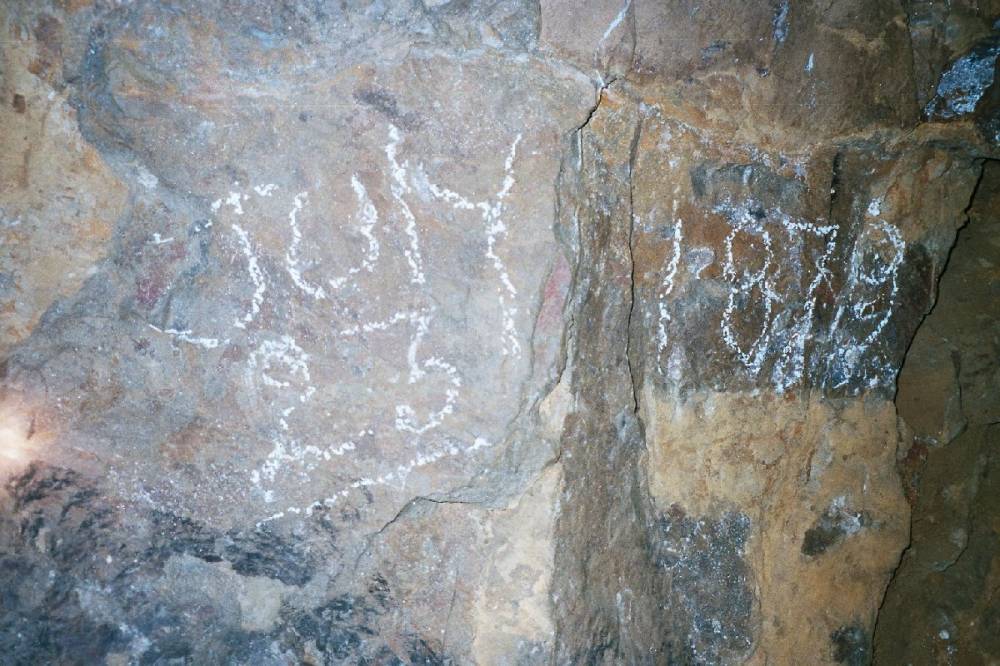
| Image 11 Description | Surveyor's mark, possibly indicating extent of level at 23 June 1879 |  |
| Image 12 ID | 754 |
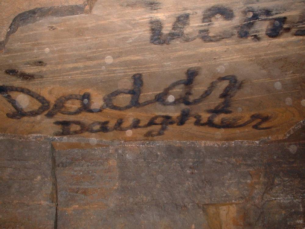
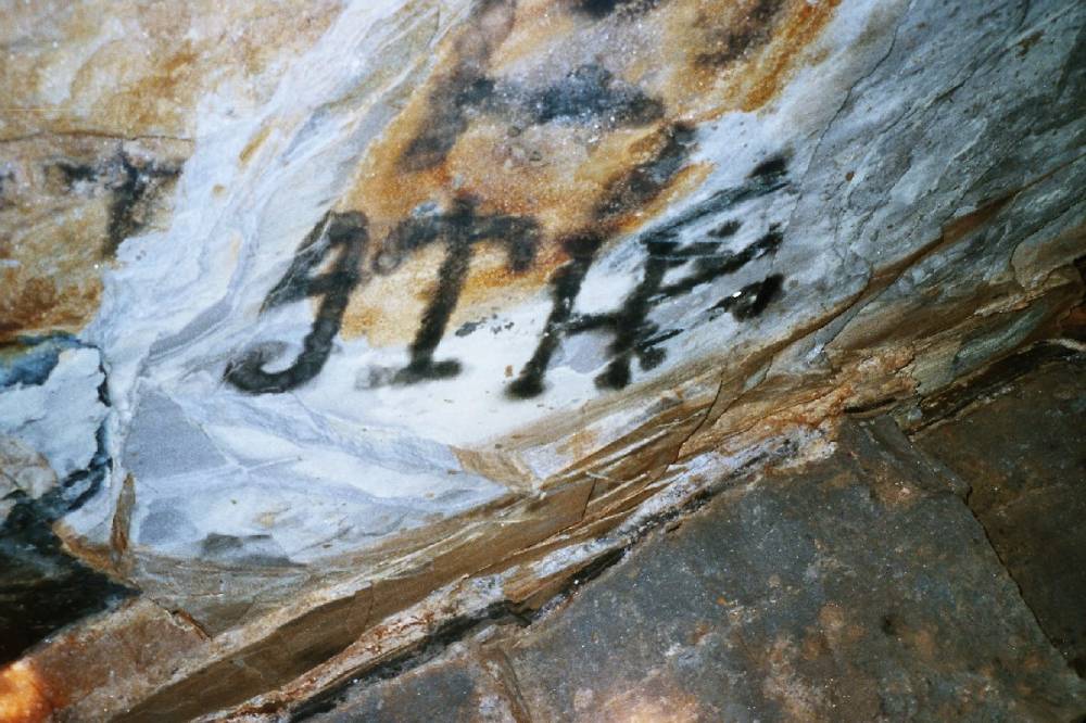
| Image 12 Description | Graffiti - written on flat roof with smoke from candle | 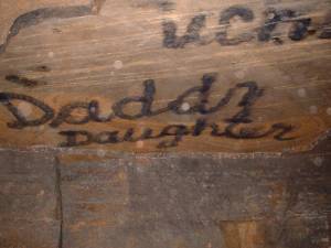 |
| Image 13 ID | 755 |
| Image 13 Description | As above | 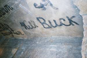 |
| Image 14 ID | 756 |
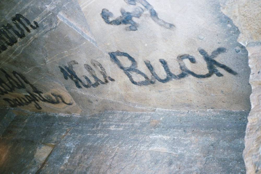
| Image 14 Description | As above - probably the initials of James Thomas Hird - a local miner - born ca. 1863, son of James Hird, lead miner, and Ruth. In the 1871 & 1881 censuses he is shown as living at Low Level, Arkengarthdale, (Moulds?) with his mother, a widow. |  |