|
| *****SWAAG_ID***** | 221 |
| Date Entered | 07/06/2011 |
| Updated on | 31/08/2011 |
| Recorded by | Alan and Judith Mills |
| Category | Mining Related |
| Record Type | Mining |
| SWAAG Site Name | |
| Site Type | |
| Site Name | |
| Site Description | |
| Site Access | Private |
| Record Date | 07/06/2011 |
| Location | Arkengarthdale |
| Civil Parish | Arkengarthdale |
| Brit. National Grid | NY 99628 02556 |
| Altitude | 1140 ft |
| Geology | |
| Record Name | Moulds Horse Level aka Moulds Level aka Old Moulds |
| Record Description | Easterby, Hall & Co began operating the Arkengarthdale mines in January 1800. In November of that year they were "driving no fewer than nine horse levels and spending £300 per week" (1). Moulds Level was one of them, with work beginning around 1801. References to Mould level being as early as 1682 (2), probably refer to Moulds Hush Level. Mould Level was driven primarily to work the complex Moulds group of veins in the Main Limestone(2). It became the principal centre of operations in Arkengarthdale in the 19th century, with at least 2 miles of drivage plus a further extensive link into the Surrender ground. This latter link to Surrender Level, which itself is said to have linked to the Old Gang mines, apparently made it possible to walk underground from Gunnerside Gill through to Moulds (5). Data on production levels in the early years is missing and it would appear that by the 1870's the mine was largely worked out although it did manage to produce an average of 35 tons of ore in the 5 years 1880-84 (4). The mine was worked out by the close of the 19th century but was re-opened around 1922 and worked until 1932 as an underground chert quarry (3). A local legend of a mining disaster in the mines of Arkengarthdale in the late 18th or early 19th century holds that as many as half the adult male population of Booze was killed. Research using contemporary sources identifies the most likely source of the legend as being in 1812 when an inrush of water, probably in Moulds level, resulted in the deaths of three miners (6).
(1) Swaledale, its mines & smelt mills; Mike Gill. (2) Geology of the Northern pennine Orefield Vol 2; Dunham & Wilson. (3) British Mining No. 53 The Arkengarthdale Mines; L.O. Tyson. (4) British Mining No. 72 The Mines of Yorkshire; Gill & Burt (5) Raistrick The Lead Industry of Wensleydale & Swaledale Vol 1 The Mines 1975 (6)British Mining No. 83 Memoirs 2007; An investigation into the legend of a mining disaster ... Alan Mills. br> Images 383/4/5 taken November 2010, copyright Chris Twigg. Other photos taken June - August 2003, copyright Alan Mills. Drawing by Marjorie Daniels; copyright 2007. |
| Dimensions | |
| Geographical area | |
| Species | |
| Scientific Name | |
| Common / Notable Species | |
| Tree and / or Stem Girth | |
| Tree: Position / Form / Status | |
| Tree Site ID | 0 |
| Associated Site SWAAG ID | 0 |
| Additional Notes | |
| Image 1 ID | 383 Click image to enlarge |
| Image 1 Description | Moulds level portal | 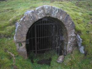 |
| Image 2 ID | 384 Click image to enlarge |
| Image 2 Description | Chert workings in Moulds | 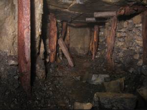 |
| Image 3 ID | 786 Click image to enlarge |
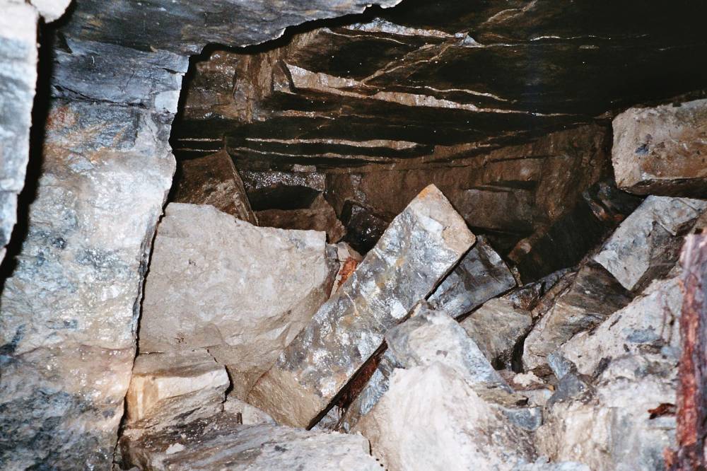
| Image 3 Description | Chert workings in Moulds with a block of chert showing | 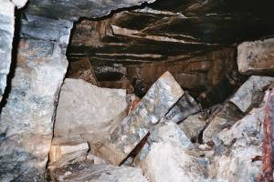 |
| Image 4 ID | 787 Click image to enlarge |
| Image 4 Description | A prop in the chert workings about to fail under the load | 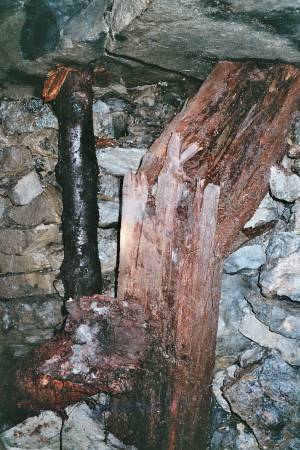 |
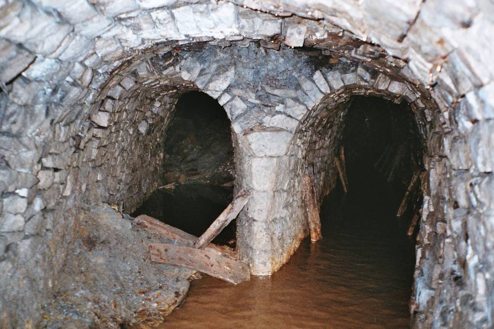
| Image 5 ID | 385 Click image to enlarge |
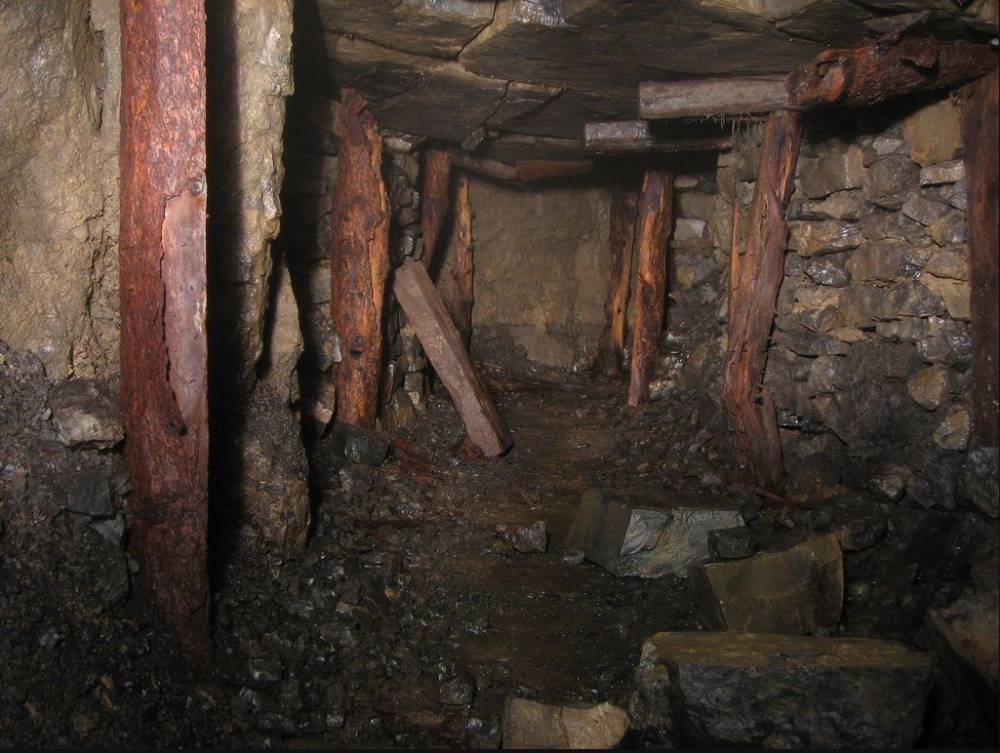
| Image 5 Description | Workings in Moulds on two levels | 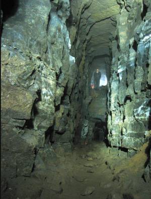 |
| Image 6 ID | 788 Click image to enlarge |
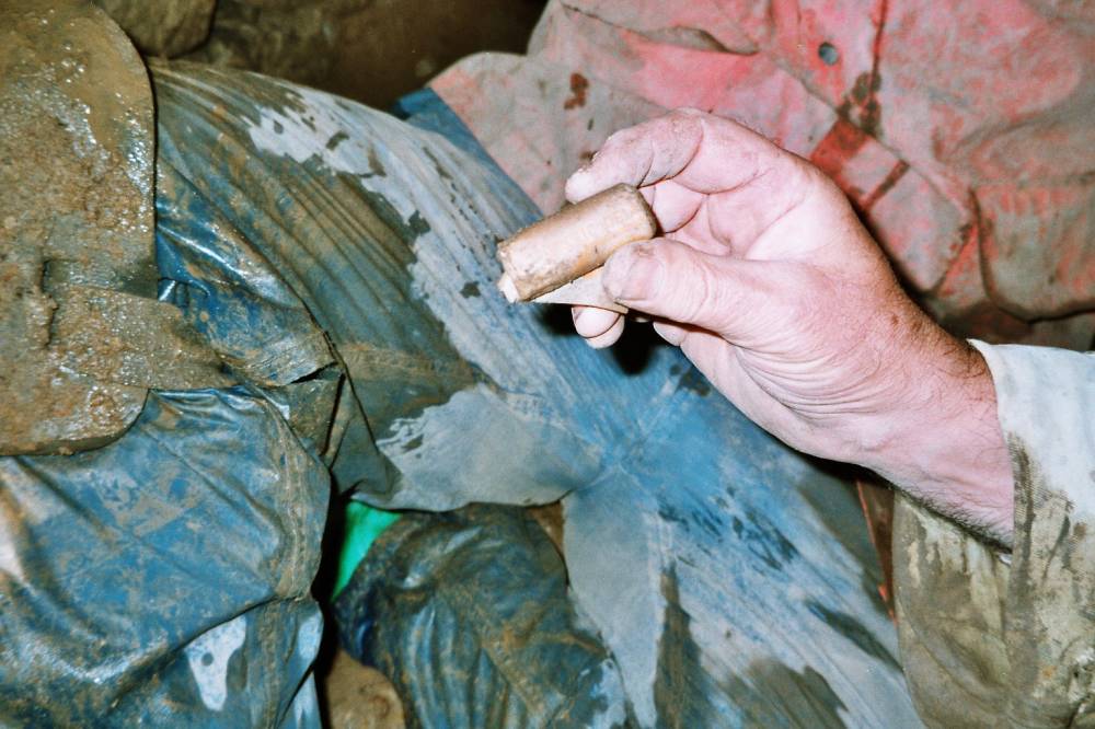
| Image 6 Description | Gelignite? left behind |  |
| Image 7 ID | 789 Click image to enlarge |
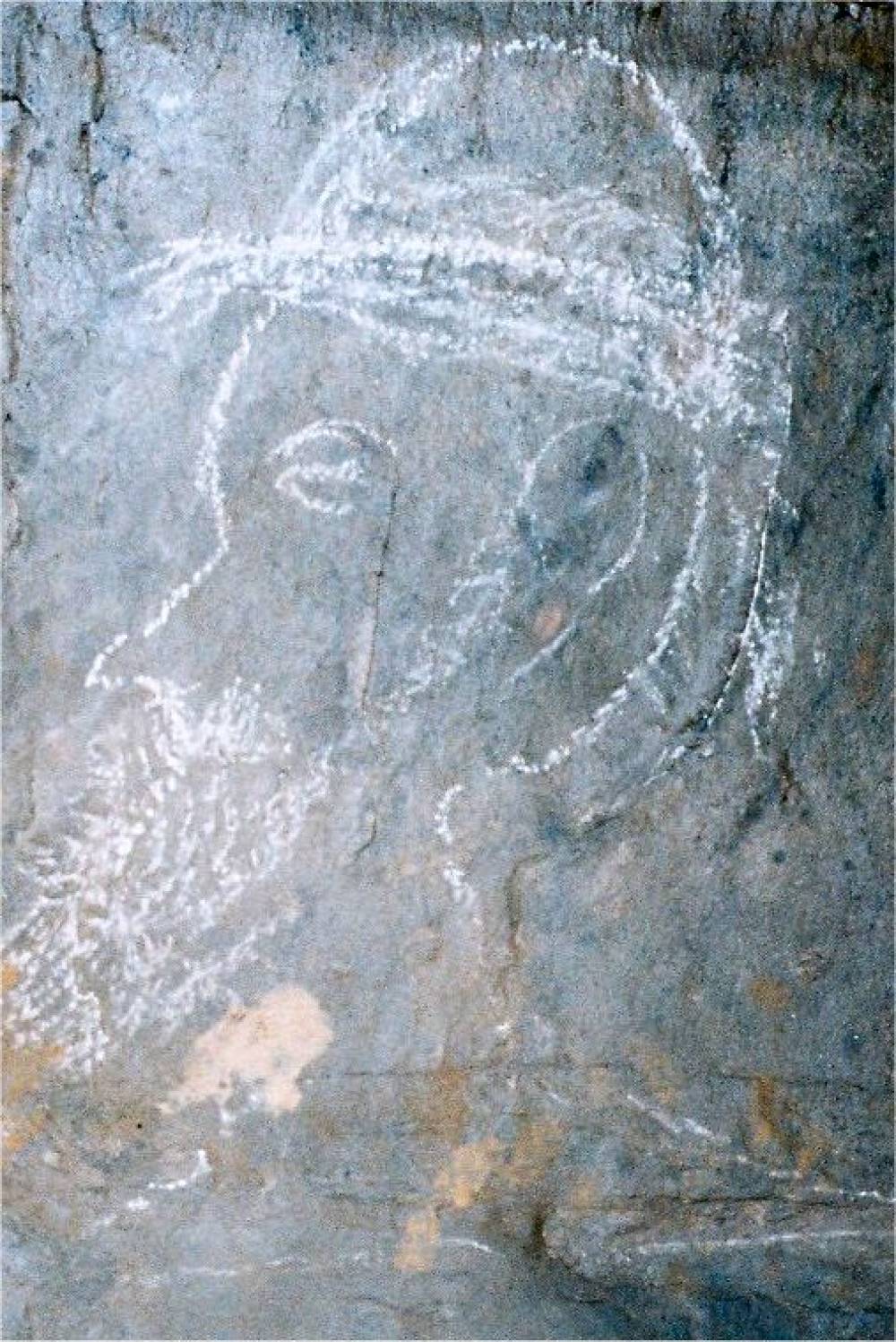
| Image 7 Description | Graffiti in Moulds | 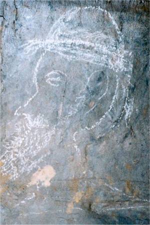 |
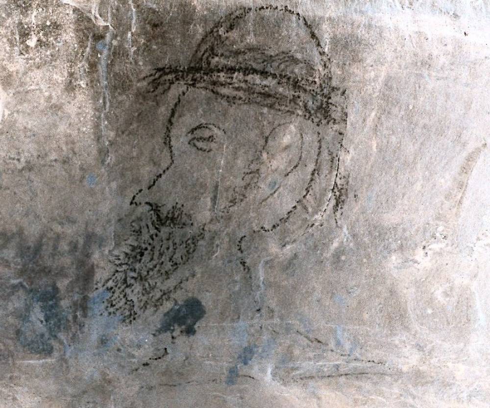
| Image 8 ID | 790 Click image to enlarge |
| Image 8 Description | The same graffiti but as a negative | 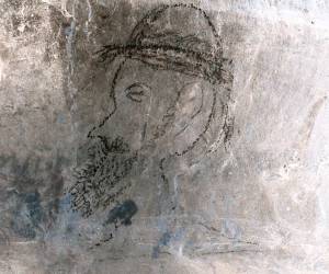 |
| Image 9 ID | 791 Click image to enlarge |
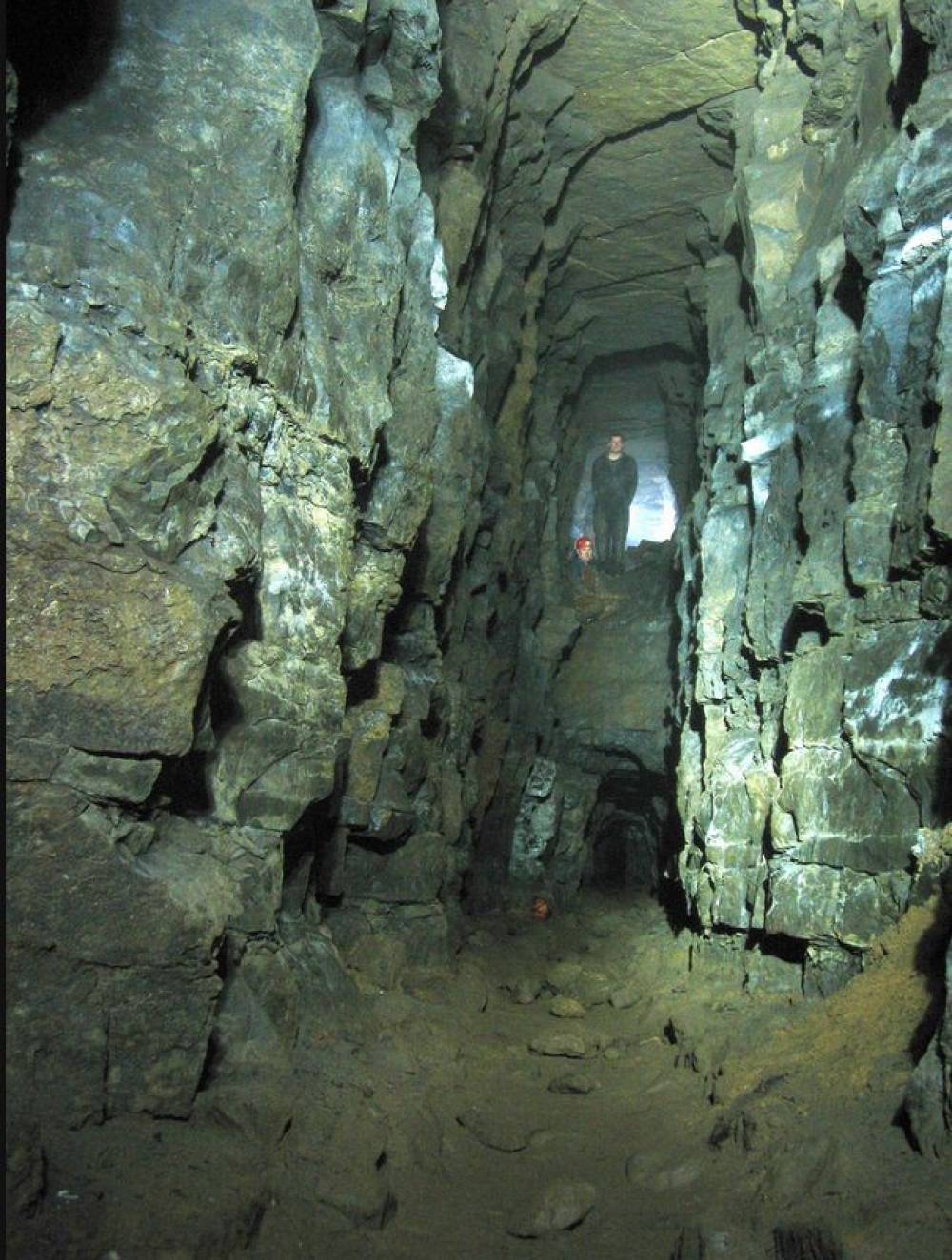
| Image 9 Description | The level branches | 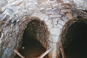 |
| Image 10 ID | 792 Click image to enlarge |
| Image 10 Description | A later branch with the left hand level run-in |  |
| Image 11 ID | 793 |
| Image 11 Description | The remains of an inscription, opposite a rise or old shaft. Perhaps a memorial to the 3 men killed in 1812? | 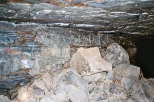 |
| Image 12 ID | 802 |
| Image 12 Description | Ramsay Hutchinson lived in Langthwaite all his life & told of a major incident in Moulds Level, in 19th C; an inrush of water which killed several miners. One lad escaped clinging onto the tail of a pit-pony! | 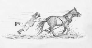 |