|
| *****SWAAG_ID***** | 574 |
| Date Entered | 03/07/2012 |
| Updated on | 29/08/2012 |
| Recorded by | Will Swales |
| Category | Vernacular Record |
| Record Type | General HER |
| SWAAG Site Name | |
| Site Type | |
| Site Name | |
| Site Description | |
| Site Access | Public Access Land |
| Record Date | 03/07/2012 |
| Location | Grovebeck Moss |
| Civil Parish | Grinton |
| Brit. National Grid | SE 021 959 |
| Altitude | 510m |
| Geology | |
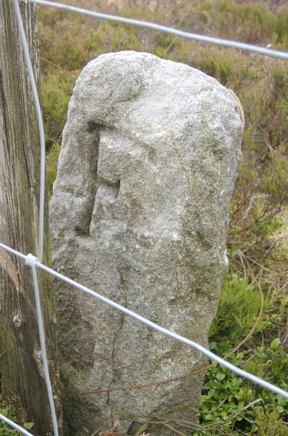
| Record Name | Boundary stone at Grovebeck Moss |
| Record Description | GRI- 20 is boundary stone number 20 of the first 21 around Grinton Parish starting from Stolerston Stile and reaching as far as Gibbon Hill. It stands on the Grinton-Bolton watershed, on Grovebeck Moss, more or less equidistant between the Height of Greets and the Summit of Gibbon Hill, and on the Grinton side of a boundary fence. Suggestions for the meanings of the inscriptions F and B are invited. |
| Dimensions | |
| Geographical area | |
| Species | |
| Scientific Name | |
| Common / Notable Species | |
| Tree and / or Stem Girth | |
| Tree: Position / Form / Status | |
| Tree Site ID | 0 |
| Associated Site SWAAG ID | 0 |
| Additional Notes | |
| Image 1 ID | 3135 Click image to enlarge |
| Image 1 Description | Grinton-Bolton boundary stone at Grovebeck Moss – south face | 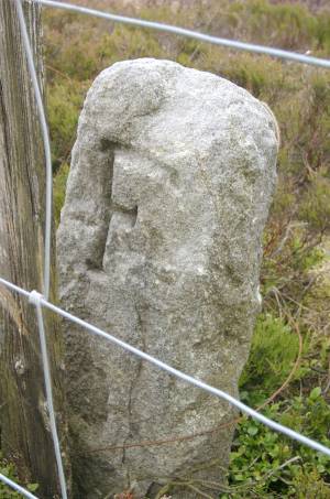 |
| Image 2 ID | 3136 Click image to enlarge |
| Image 2 Description | Grinton-Bolton boundary stone at Grovebeck Moss – north face | 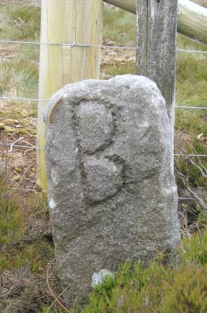 |