|
*****SWAAG_ID***** | 579 |
Date Entered | 21/07/2012 |
Updated on | 21/07/2012 |
Recorded by | Tim Laurie |
Category | Geological Record |
Record Type | Geological HER |
SWAAG Site Name | |
Site Type | |
Site Name | |
Site Description | |
Site Access | Private |
Record Date | 14/07/2012 |
Location | Leyburn Moor Quarry |
Civil Parish | Leyburn |
Brit. National Grid | SE 097 913 |
Altitude | 250m |
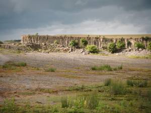
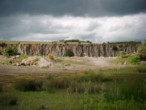
Geology | Quarried exposure of the Main Limestone in the face of this disused quarry. Now a commercial tip site -No access without permission. |
Record Name | Leyburn Moor Quarry. The Main Limestone. |
Record Description | Exposure of the Main Limestone in the face of the now disused Leyburn Moor Quarry. Photographed during a visit to the quarry by members of the BSBI. |
Dimensions | |
Geographical area | |
Species | |
Scientific Name | |
Common / Notable Species | |
Tree and / or Stem Girth | |
Tree: Position / Form / Status | |
Tree Site ID | 0 |
Associated Site SWAAG ID | 0 |
Additional Notes | |
Image 1 ID | 3165 Click image to enlarge |
Image 1 Description | |  |
Image 2 ID | 3166 Click image to enlarge |
Image 2 Description | |  |