|
| *****SWAAG_ID***** | 718 |
| Date Entered | 22/04/2013 |
| Updated on | 17/01/2014 |
| Recorded by | Tim Laurie |
| Category | Burnt Mound |
| Record Type | Archaeology |
| SWAAG Site Name | |
| Site Type | |
| Site Name | |
| Site Description | |
| Site Access | Public Access Land |
| Record Date | 01/01/2005 |
| Location | Marrick Moor. Copperthwaite Allotment. Spring rise East of Raygill. |
| Civil Parish | Marrick |
| Brit. National Grid | NZ 0933 0248 |
| Altitude | 340m |
| Geology | Richmond cherts. |
| Record Name | Burnt mound on Copperthwaite Allotment east of Raygill |
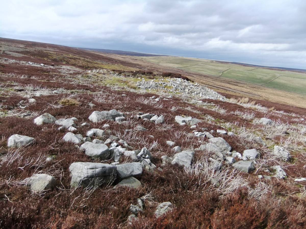
| Record Description | Very large burnt mound of characteristic crescentic form 12mx8mx1.5m high. Undisturbed but with visible burnt stone. At spring rise on open moorland today but on lightly wooded grassland in the Bronze Age.
This large and isolated burnt mound should be considered in context with the small curvilinear stone banked enclosure which is situated just 70m upslope from the burnt mound. See SWAAG Record No 719 to follow.
|
| Dimensions | 12m*8m*1.5m |
| Geographical area | |
| Species | |
| Scientific Name | |
| Common / Notable Species | |
| Tree and / or Stem Girth | |
| Tree: Position / Form / Status | |
| Tree Site ID | 0 |
| Associated Site SWAAG ID | 0 |
| Additional Notes | Together, the settlement enclosure and burnt mound provide evidence for seasonal transhumant occupation during the Bronze Age close to the spring line on Copperthwaite Allotment. The existence os several similar small settlement enclosures lower downslope and the group of four burnt mounds at Stelling Springs confirms extensive activity on Cpperthwaite Allotment predating but the forerunner to the coaxial field system.
Reference:
Laurie, T.C. Mahaffy, N. and White, R. 2011. |
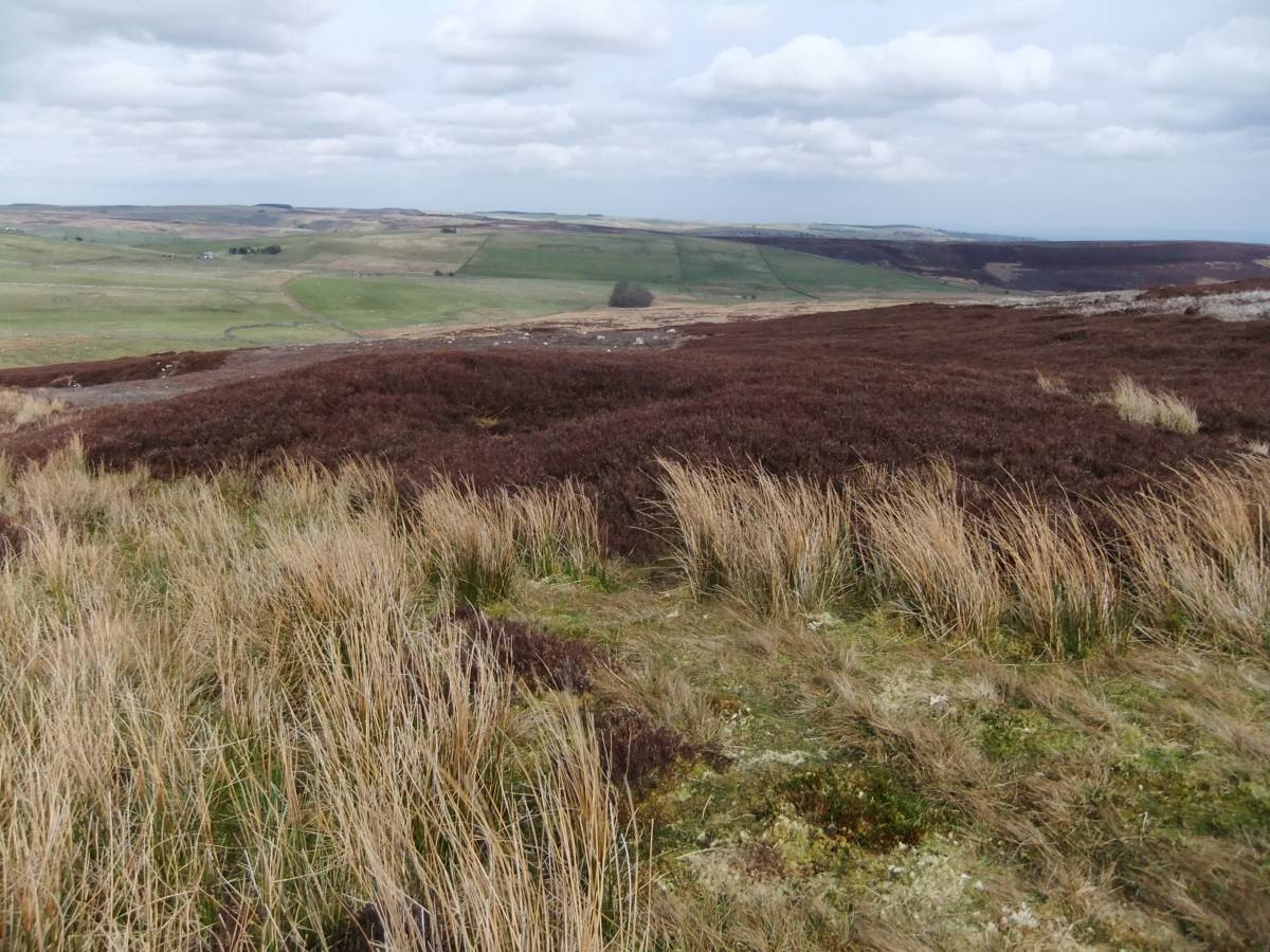
| Image 1 ID | 4388 Click image to enlarge |
| Image 1 Description | The burnt mound east of Raygill. |  |
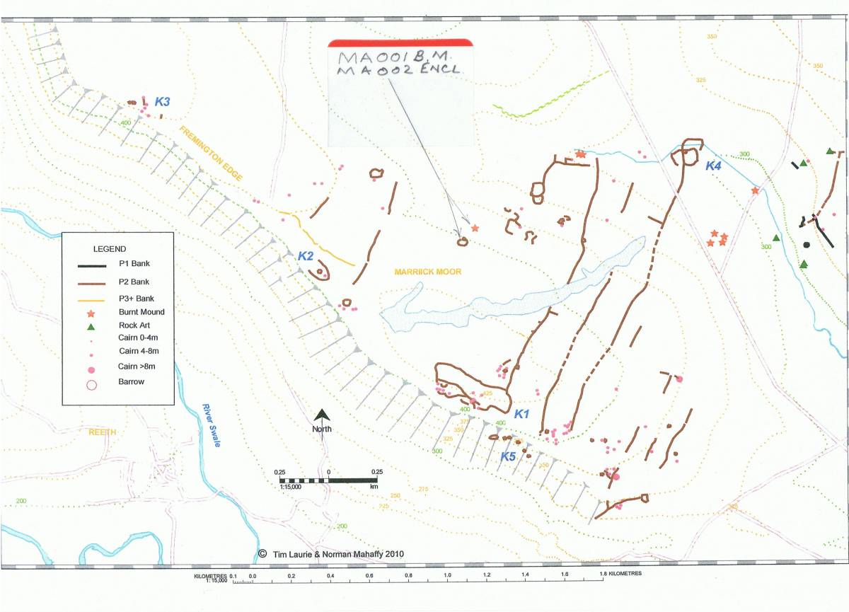
| Image 2 ID | 4391 Click image to enlarge |
| Image 2 Description | Location of the burnt mound and adjacent small settlement enclosure. Laurie et al 2011, Figure 6.17 |  |
| Image 3 ID | 4389 Click image to enlarge |
| Image 3 Description | The enclosure with overlying lead shaft mound. | 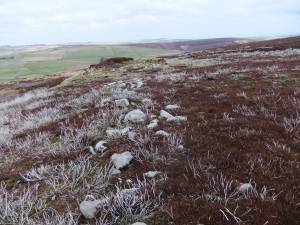 |
| Image 4 ID | 4390 Click image to enlarge |
| Image 4 Description | The enclosure with two hut circles. | 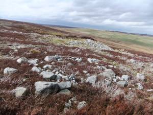 |