|
| *****SWAAG_ID***** | 681 |
| Date Entered | 16/01/2013 |
| Updated on | 17/01/2013 |
| Recorded by | Tim Laurie |
| Category | Geographical Record |
| Record Type | Geomorphology |
| SWAAG Site Name | |
| Site Type | |
| Site Name | |
| Site Description | |
| Site Access | Public Access Land |
| Record Date | 03/11/2010 |
| Location | Arkengarthdale and Stainmore |
| Civil Parish | Arkengarthdale |
| Brit. National Grid | NY 955 088 |
| Altitude | 410m |
| Geology | The Stainmore Trough, for details of this very significant structure and the relationship of the deep Stainmore Trough and the adjacent Cotherstone Syncline Structures to the uplifted North Pennine Alston Block see Dunham and Wilson 1985. BGS 'The North Pennine Orefield. Volume 2. Stainmore to Craven. Chapter Three and Figure 4.' and also BGS Map 1:50000 sheet 31 Drift Edition, Main Section.
Only SWAAG Members can see these images due to copyright restrictions |
| Record Name | Coney Seat Hill and the Stainmore Trough seen through Dale Head from Hungry Hushes |
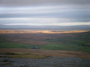
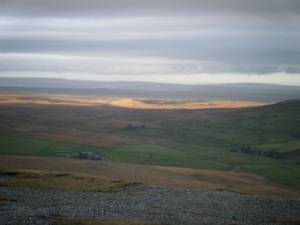
| Record Description | The view from above Hungry Hushes over Dale Head Common at the head of Arkengarthdale to Coney Seat Hill and across Stainmore Forest to Mickle Fell and the High North Pennines is in my opinion one of the most interesting and impressive in Arkengathdale, see photo images No 1 and 2. The geological significance of this view arises from the relationship between the mainly horizontal strata of the uplifted Alston Block with the steeply dipping strata of the Stainmore Trough. The Alston Block is bounded on the west by the Pennine Escarpment and the Pre-Carboniferous Strata of the Cross Fell Inlier to the west and the Permo-Triassic Strata of the Vale of Eden. To the east the Alston Block is defined by the Cotherstone Syncline which extends from the Lunedale Fault to the River Tees at Cotherstone in the North- East. The southern limit of the Stainmore Trough is considered to be at the Stockdale Disturbance which runs the length of Swaledale. Present day interest arises from the fact that the Stainmore Pass, much admired by lovers of the A66 Road, provides the easiest and lowest route through the Pennines from the Vale of Mowbray and the south and east to the Vale of Eden and the north and west. |
| Dimensions | See photos |
| Geographical area | |
| Species | |
| Scientific Name | |
| Common / Notable Species | |
| Tree and / or Stem Girth | |
| Tree: Position / Form / Status | |
| Tree Site ID | 0 |
| Associated Site SWAAG ID | 0 |
| Additional Notes | Coney Seat Hill is the largest of a series of glacial morainic hills at Sleightholme. The trail of Shap Granite, Lake District Volcanic and Triassic Brockram eratic boulders dumped by the Stainmore Ice in Teesdale is of special interest. |
| Image 1 ID | 3989 Click image to enlarge |
| Image 1 Description | Stainmore from Hungry Hushes. |  |
| Image 2 ID | 3990 Click image to enlarge |
| Image 2 Description | Coney Seat Hill and Sleightholme caught by the final evening winter sun. |  |
| Image 3 ID | 3991 Click image to enlarge |
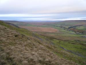
| Image 3 Description | View through Dale Head Common to Stainmore. |  |
| Image 4 ID | 3992 Click image to enlarge |
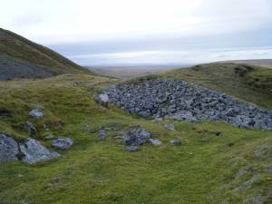
| Image 4 Description | View across Stainmore to Mickle Fell and the HIgh Pennine escarpment. |  |


