|
| *****SWAAG_ID***** | 680 |
| Date Entered | 15/01/2013 |
| Updated on | 15/01/2013 |
| Recorded by | Tim Laurie |
| Category | Geological Record |
| Record Type | Geological HER |
| SWAAG Site Name | |
| Site Type | |
| Site Name | |
| Site Description | |
| Site Access | Public Access Land |
| Record Date | 22/12/2012 |
| Location | Oxnop Scar |
| Civil Parish | Muker |
| Brit. National Grid | |
| Altitude | 495m |
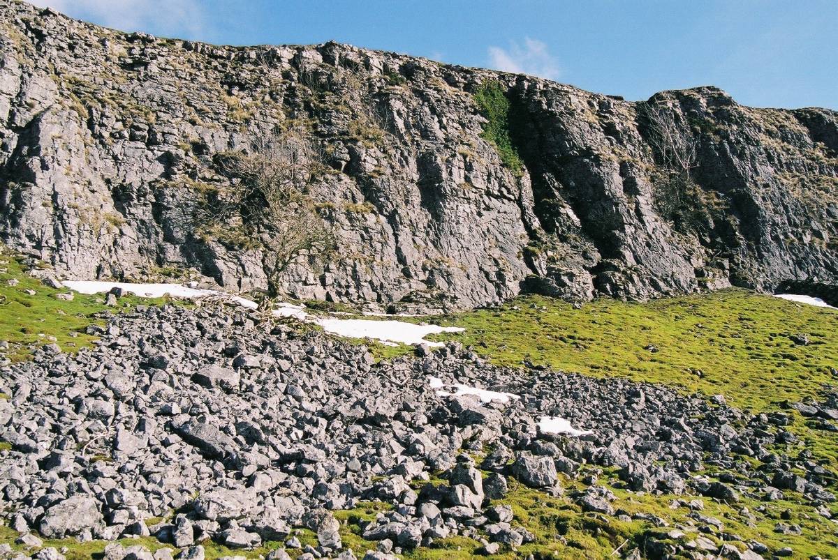
| Geology | The Main Limestone exposed as a fine cliff or Scar facing west with scree and pro- talus rampart below. This cliff has an interesting early post glacial relict tree flora with prostrate juniper and aspen. In addition, ash, blackthorn and downy rose all grow at their local altitudinal limit. See SWAAG Record No 350 for details of the vegetation. |
| Record Name | Oxnop Scar. A fine high limestone cliff formed by the Main Limestone. |
| Record Description | The Main Limestone is he re exposed as a fine cliff or Scar some 1000m in length, sheer and dangerous to approach, facing west with scree and pro- talus rampart below. This cliff, in sharp contrast to the similar limestone cliffs of Wensleydale which are largely barren of trees, has an interesting early post glacial relict tree flora with prostrate juniper and aspen. In addition, ash, blackthorn and downy rose all grow at their local altitudinal limit. See SWAAG Record No 350 for details of the vegetation.The Main Limestone, so named by Phillips (1836) was also known by the Miners of Swaledale as the Twelve Fathom Limestone bec Vol. 2 Stainmore to Craven because of its fairly constant thickness, typically some 70-80ft or 21-24m in the mineral field (Reference: Dunham, K.C. and Wilson, A.A.1985.BGS 'Geology of the North Pennine Orefield.' Chapter Five: Namurian and Westphalian Stratigraphy.) |
| Dimensions | 1km in length 20m high maximum |
| Geographical area | |
| Species | |
| Scientific Name | |
| Common / Notable Species | |
| Tree and / or Stem Girth | |
| Tree: Position / Form / Status | |
| Tree Site ID | 0 |
| Associated Site SWAAG ID | 0 |
| Additional Notes | |
| Image 1 ID | 3976 Click image to enlarge |
| Image 1 Description | Oxnop Scar in winter, photographed from Oxnop Gill. | 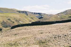 |
| Image 2 ID | 3977 Click image to enlarge |
| Image 2 Description | |  |
| Image 3 ID | 3978 Click image to enlarge |
| Image 3 Description | The Scar with limestone scree below. | 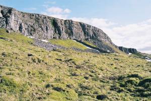 |
| Image 4 ID | 3979 Click image to enlarge |
| Image 4 Description | The Scar, detail. | 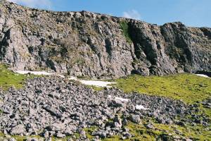 |
| Image 5 ID | 3985 Click image to enlarge |
| Image 5 Description | Prostrate juniper at top edge of the Scar. | 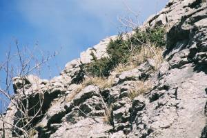 |
| Image 6 ID | 3984 Click image to enlarge |
| Image 6 Description | View northward down Oxnop Gill from the Scar | 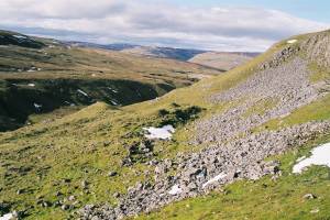 |