|
| *****SWAAG_ID***** | 508 |
| Date Entered | 02/05/2012 |
| Updated on | 02/02/2014 |
| Recorded by | Tim Laurie |
| Category | Tree Site Record |
| Record Type | Botanical HER |
| SWAAG Site Name | |
| Site Type | |
| Site Name | |
| Site Description | |
| Site Access | Public Access Land |
| Location | Gunnerside Gill West Bank |
| Civil Parish | Melbecks |
| Brit. National Grid | NY 9383 0029 |
| Altitude | 402m |
| Geology | Drift over Yoredale Series. |
| Record Name | Relict woodland on West Bank of Gunnerside Gill above the Sir Francis Level. |
| Record Description | This record details depleted relict limestone ash woodland at 345m AOD above the stream near the Sir Francis Mine together with evidence that this woodland once extended across the open fell to an elevation of at least 440m AOD. |
| Dimensions | From Bodger Gill to the track from the Sir Francis Mine. |
| Geographical area | Mid Swaledale |
| Species | Downy birch. |
| Scientific Name | Betula pubescens |
| Common / Notable Species | Sallow, occasional Hazel and Alder. |
| Tree and / or Stem Girth | |
| Tree: Position / Form / Status | |
| Tree Site ID | 0 |
| Associated Site SWAAG ID | 0 |
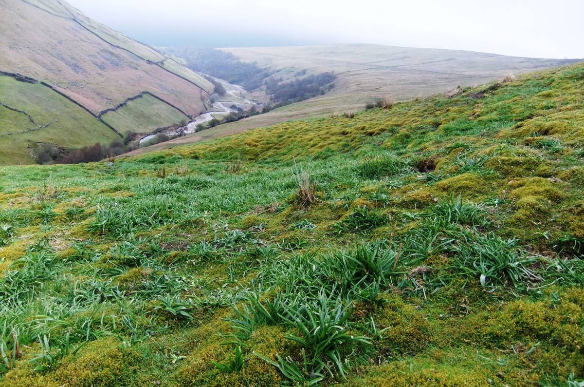
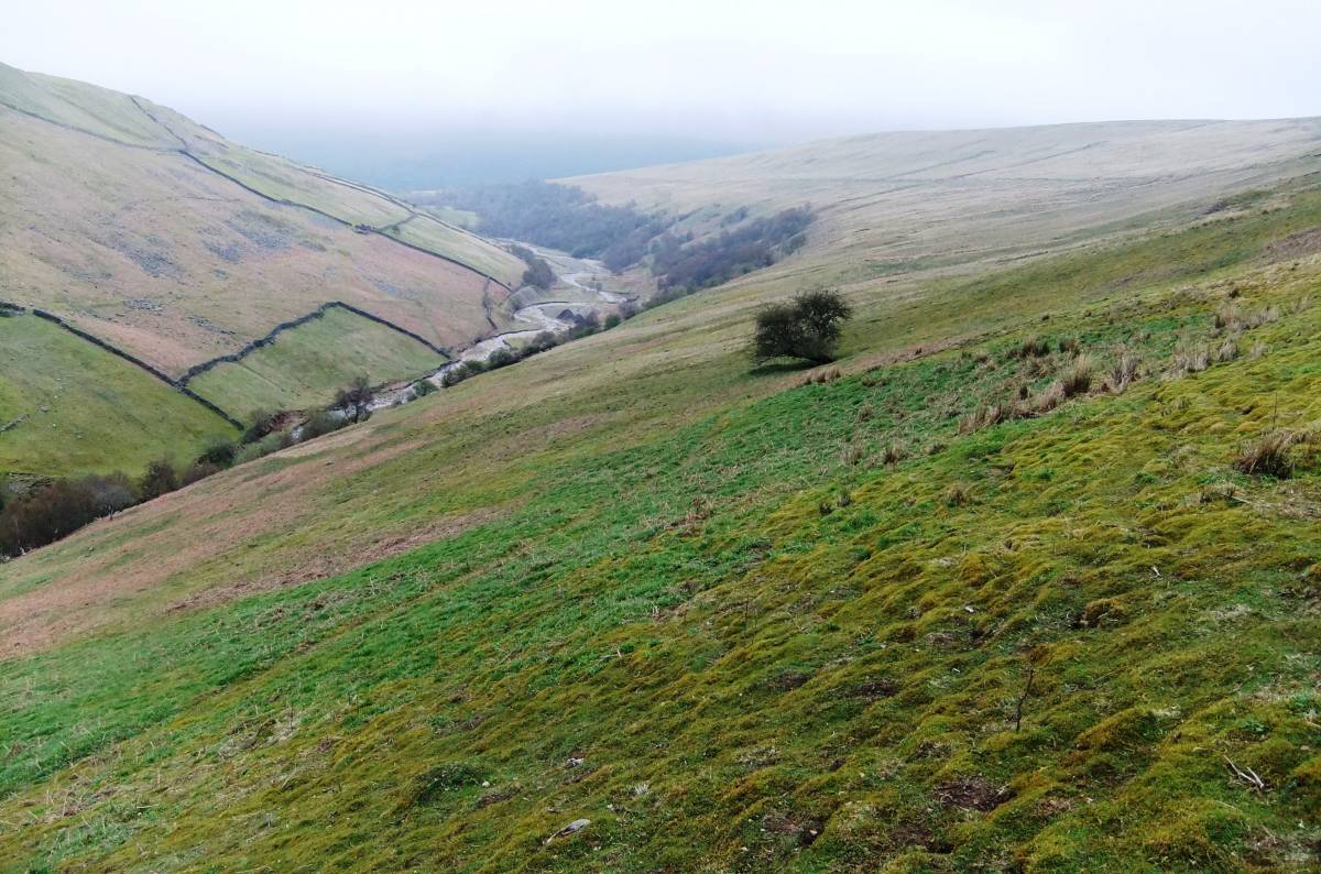
| Additional Notes | Wood anemone and other indicator plants of woodland on the open fell at NY9374300214, 433m AOD. Massed blue bells cover the whole hillslope above the limit of woodland at 345m up to 410m AOD.
Downy birch, Sallow, Rowan, Hazel and Alders the only tree species present today near the stream.
The occasional ancient pollarded alders may represent survivors from the height of the mining operations. |
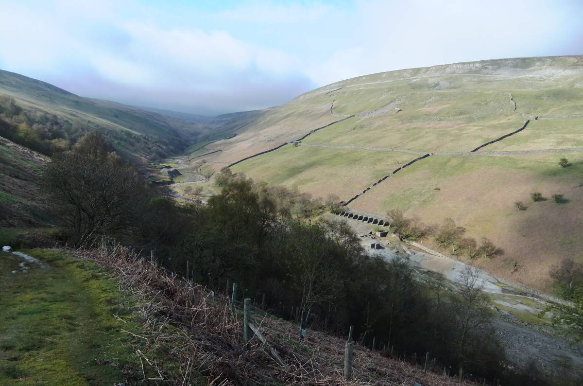
| Image 1 ID | 2753 Click image to enlarge |
| Image 1 Description | View towards the Sir Francis Mine from the track. The woodland is mainly downy birch with alders, hazel and sallow. The presence of bluebells and other indicator plants confirm that woodlan once extended across the open fell to around 450m AOD. | 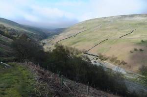 |
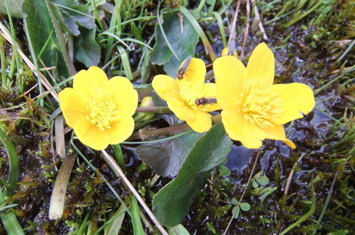
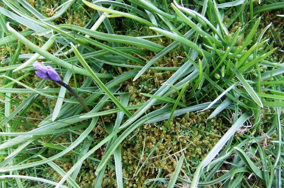
| Image 2 ID | 2743 Click image to enlarge |
| Image 2 Description | Wood anemone on the open fell at 433m aod. | 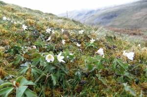 |
| Image 3 ID | 2744 Click image to enlarge |
| Image 3 Description | | 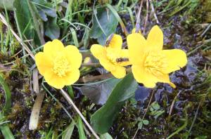 |
| Image 4 ID | 2745 Click image to enlarge |
| Image 4 Description | Massed bluebells on open fell. |  |
| Image 5 ID | 2746 Click image to enlarge |
| Image 5 Description | Anemones and primroses. |  |
| Image 6 ID | 2747 Click image to enlarge |
| Image 6 Description | |  |
| Image 7 ID | 2748 Click image to enlarge |
| Image 7 Description | |  |
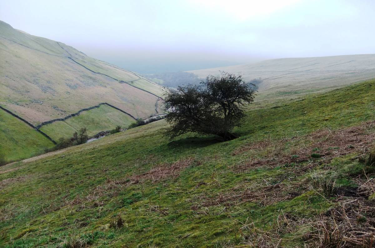
| Image 8 ID | 2749 Click image to enlarge |
| Image 8 Description | Isolated hawthorn, sole survivor of the woodland. | 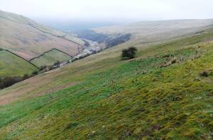 |
| Image 9 ID | 2750 Click image to enlarge |
| Image 9 Description | Isolated hawthorn |  |
| Image 10 ID | 2751 Click image to enlarge |
| Image 10 Description | Isolated hawthorn, detail |  |