|
| *****SWAAG_ID***** | 499 |
| Date Entered | 16/04/2012 |
| Updated on | 07/05/2012 |
| Recorded by | Stephen Eastmead |
| Category | Mining Related |
| Record Type | Mining |
| SWAAG Site Name | |
| Site Type | |
| Site Name | |
| Site Description | |
| Site Access | Public Footpath |
| Record Date | 16/04/2012 |
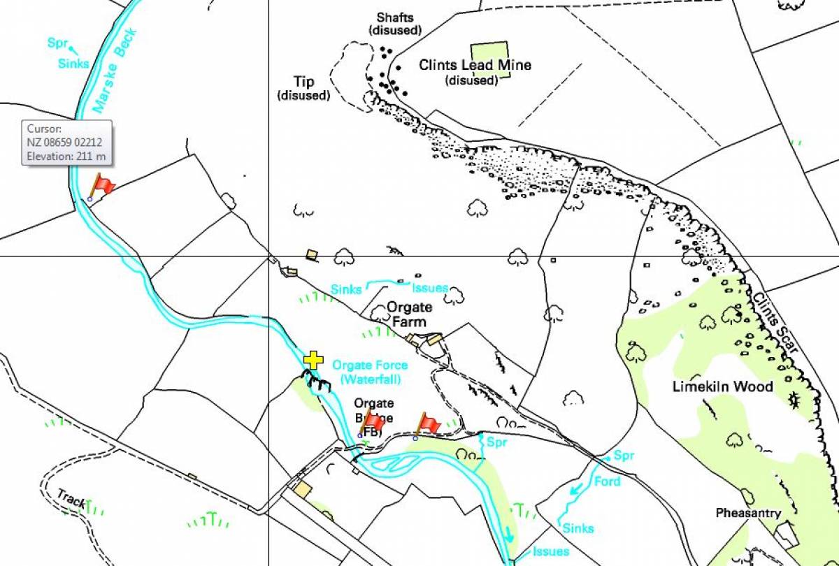
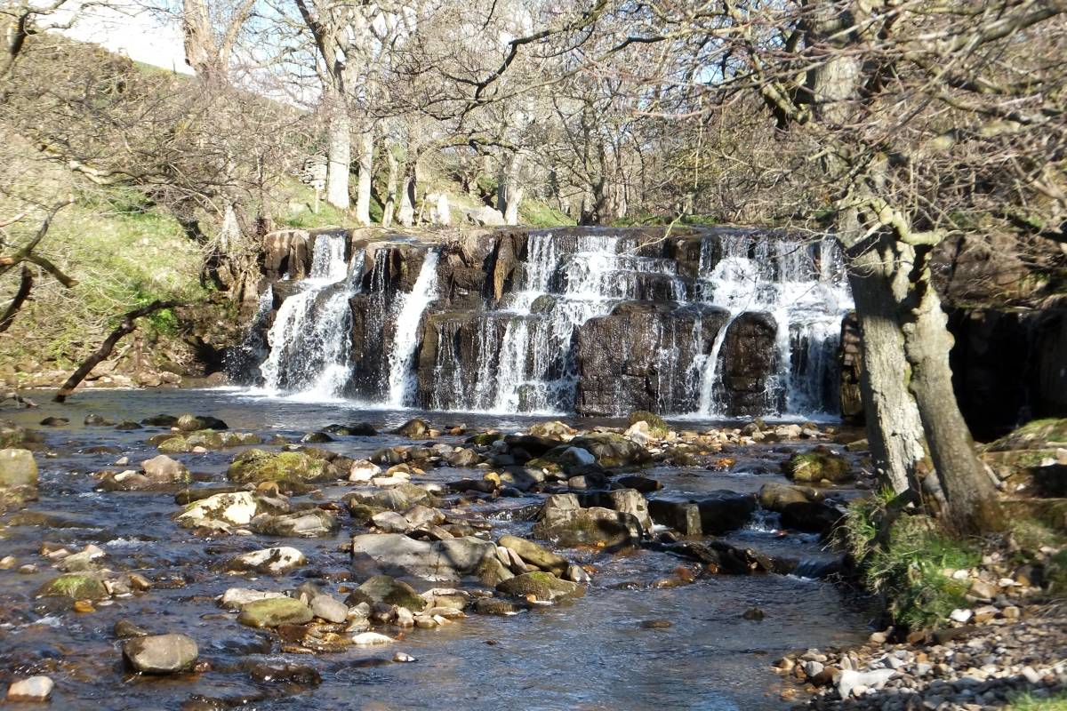
| Location | Orgate Force, Clints |
| Civil Parish | Marske |
| Brit. National Grid | NZ 09061 01860 |
| Altitude | 199M |
| Geology | |
| Record Name | Orgate Force Underground Leat |
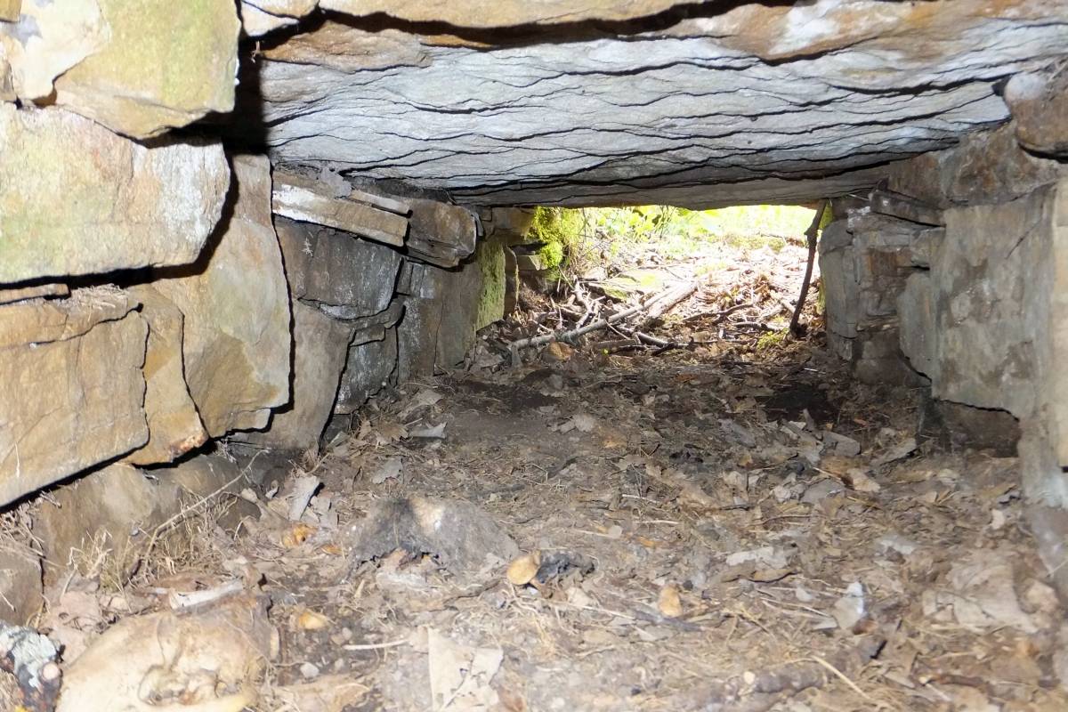
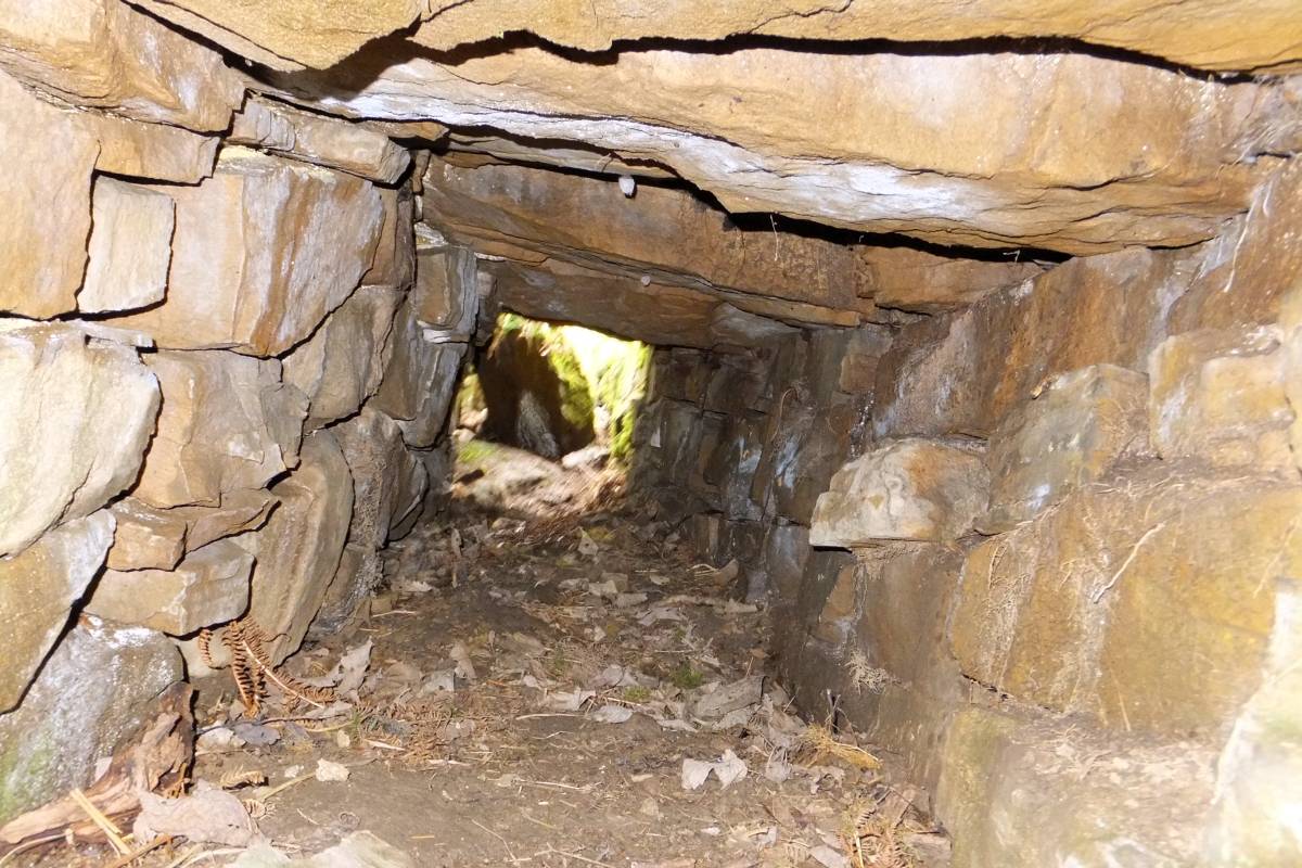
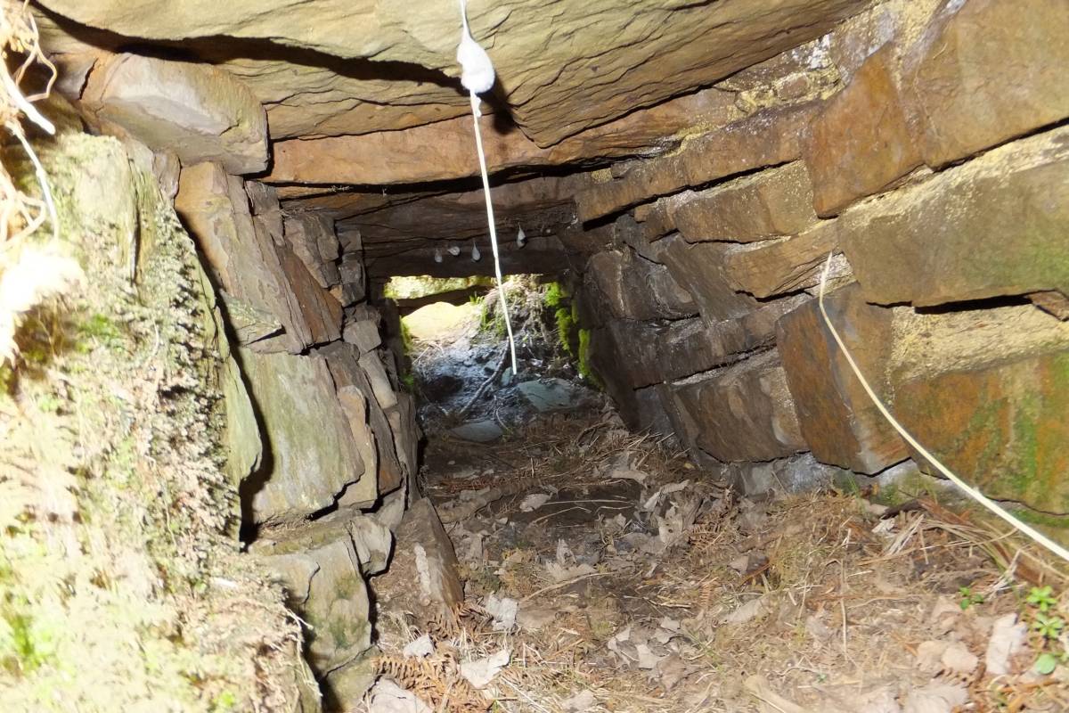
| Record Description | Approximately 20m of stone sided and stone capped leat running beside Marske Beck. The leat joins the beck well above Orgate Force and extends eastwards disappearing in thick undergrowth. Whilst the leat appears to have a gradient in the opposite direction to the beck I suspect it is an optical illusion.
It is likely that the leat extended eastwards beyond Orgate Force and eventually turning into a launder which fed water to an overshot waterwheel powering the bellows in Clints Smelt Mill 2 that is indicated on Les Tyson's map. See Image 8.
|
| Dimensions | |
| Geographical area | |
| Species | |
| Scientific Name | |
| Common / Notable Species | |
| Tree and / or Stem Girth | |
| Tree: Position / Form / Status | |
| Tree Site ID | 0 |
| Associated Site SWAAG ID | 0 |
| Additional Notes | |
| Image 1 ID | 2699 Click image to enlarge |
| Image 1 Description | Map of the area. Red flags are the locations of the 3 smelt mills. The yellow cross is the location of the leat.
©Crown copyright and database rights 2011 Ordnance Survey 1000237401, kindly supplied by the North Yorkshire Dales National Park Authority | 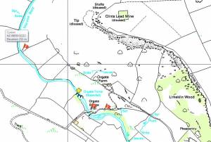 |
| Image 2 ID | 2648 Click image to enlarge |
| Image 2 Description | Orgate Force | 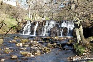 |
| Image 3 ID | 2649 Click image to enlarge |
| Image 3 Description | Leat | 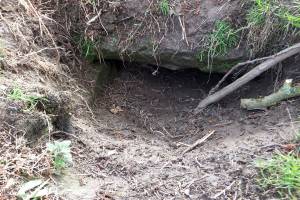 |
| Image 4 ID | 2650 Click image to enlarge |
| Image 4 Description | Leat | 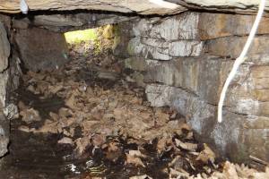 |
| Image 5 ID | 2651 Click image to enlarge |
| Image 5 Description | Leat | 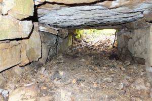 |
| Image 6 ID | 2652 Click image to enlarge |
| Image 6 Description | Leat |  |
| Image 7 ID | 2653 Click image to enlarge |
| Image 7 Description | Leat | 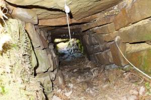 |
| Image 8 ID | 2698 Click image to enlarge |
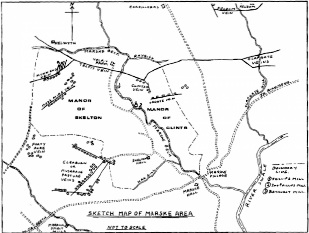
| Image 8 Description | British Mining No. 50
Mining and Smelting in the Marske Areas, Swaledale, by Leslie Owen Tyson
The leat is just to the west of smelt mill 2 indicated on the map. There are some major 'corner stones' that may be where the mill was on the grassy area to the north of the beck and the west of the concrete road. |  |