|
| *****SWAAG_ID***** | 541 |
| Date Entered | 30/05/2012 |
| Updated on | 30/05/2012 |
| Recorded by | Tim Laurie |
| Category | Rock Art |
| Record Type | Archaeology |
| SWAAG Site Name | |
| Site Type | |
| Site Name | |
| Site Description | |
| Site Access | Public Access Land |
| Record Date | 01/01/2005 |
| Location | Barningham Low Moor |
| Civil Parish | Not known |
| Brit. National Grid | NZ 060 080 |
| Altitude | 350m |
| Geology | Glacial hummocky drift with galcial erratics which include boulders of Shap Granite and prominent lateral moraine over strata between the Main and Underset Limestones. |
| Record Name | Barningham Moor. Part Two: Rock art sites on The Low Moor. |
| Record Description | This record will detail a small number of selected rock art sites on the Low Moor. See previous Record for selected rock art and other prehistoric sites on the High Moor.
Full details of all rock art sites in the light of recent surveys are available elsewhere.
This record, Part two: The Low Moor and the previous record: Part One: The High Moor will provide an overview with photographic views of Barningham Moor together with a short introductory account of a selected number of the rock art sites located on Barningham Moor. The sites and finds are illustrated with photographs taken earlier, some of these taken at or soon after their initial discovery. In addition, brief contextual notes will be provided of the stone ring above Osmonds Gill, the stone tumulus named How Tallon and the other less prominent Round Cairns of Late Neolithic/Early Bronze Age on How Tallon Ridge all of which form the focus for the Rock Art.In addition, the burnt mounds on the Low Moor and the very different lithic finds from both the High and Low Moor the Moor. All of which which can be regarded as evidence associated with human activity contemporary with the significant group of rock art sites on Barningham Moor.
Notes
1. Professor Richard Bradley in the company of Stan Beckensall and myself visited Barningham Moor during the course of data collection for his book on the interpretation of prehistoric Atlantic rock art (Bradley 1997, see references below). This monumental work includes (pp94,95 and plate 13) a summary of the discussions held during this visit which included walking on the High Moor Edge in a mighty downpour of rain. See photo below.
2. Almost all of my earlier photo images of the Barningham Moor Rock art and other sites are on slides and cannot be uploaded until scanned.
The best of these images will be uploaded as soon as they can be scanned. |
| Dimensions | |
| Geographical area | |
| Species | |
| Scientific Name | |
| Common / Notable Species | |
| Tree and / or Stem Girth | |
| Tree: Position / Form / Status | |
| Tree Site ID | 0 |
| Associated Site SWAAG ID | 0 |
| Additional Notes | References:
Stan Beckensall,1986. Rock Carvings of Northern Britain. Shire Archaeology.
Stan Beckensall and Tim Laurie,1998. Prehistoric Rock Art of County Durham, Swaledale and Wensleydale. Durham County Books.
Richard Bradley, 1992. 'Altering the Earth.' Society of Antiquaries of Scotland Monograph Series Number 8.
Richard Bradley, 1997. 'Rock Art and the Prehistory of Atlantic Europe. Signing the Land.' Routledge.
Richard Bradley, 1998. 'The Significance of Monuments on the shaping of human experience in Neolithic and Bronze Age Europe.' Routledge.
Stephen Green, Flint Arrowheads:Typology and Interpretation. Lithics No 5. 1984. ISBN0262-7817. pp19-39.
Dennis Coggins and Stephen Clews,1980. Archaeology in the Bowes Museum: The How Tallon Finds. Transactions of the Architectural and Archaeological Society of Durham. New Series. No 5.
A & A.S. Thom with archaeological notes by A. Burl, 'Megalithic Rings.' BAR British Series 81, 1980, pp72,73.
Tim Laurie, 1977. CBA 3, News Bulletin Series 2 No 3. December 1977, pp11-13. 'Prehistoric Evidence on Barningham Moor.'
Tim Laurie, 1981. CBA 3, News Bulletin Series 2 No 13. April 1981, pp8-10. 'Further Evidence for the Prehistoric (Mesolithic) Occupation of Barningham (High) Moor.'
1981.
Access to the Moor.
While access is possible as it is all CROW Access land. Barningham Moor is exceptionally important as a breeding area for ground nesting birds and access to search for these sites during the months of May -July inclusive is not encouraged. Access may be restricted during this period. |
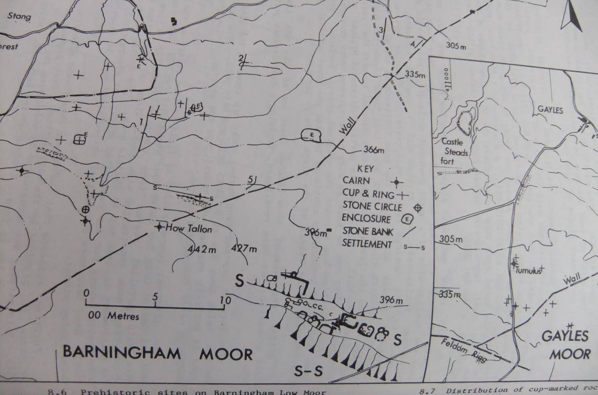
| Image 1 ID | 3033 Click image to enlarge |
| Image 1 Description | Prehistoric sites on Barningham Moor. Laurie 1985 Figure 8.6 | 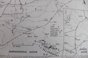 |
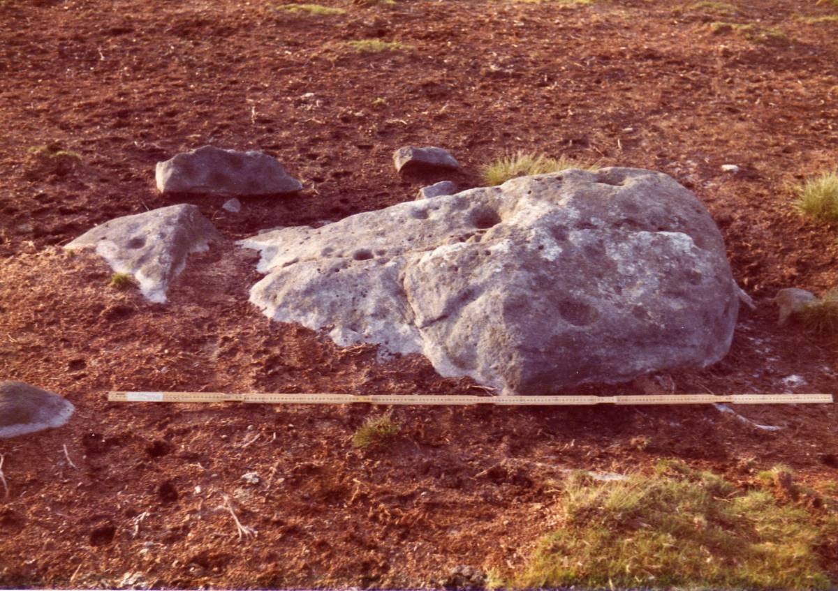
| Image 2 ID | 3054 Click image to enlarge |
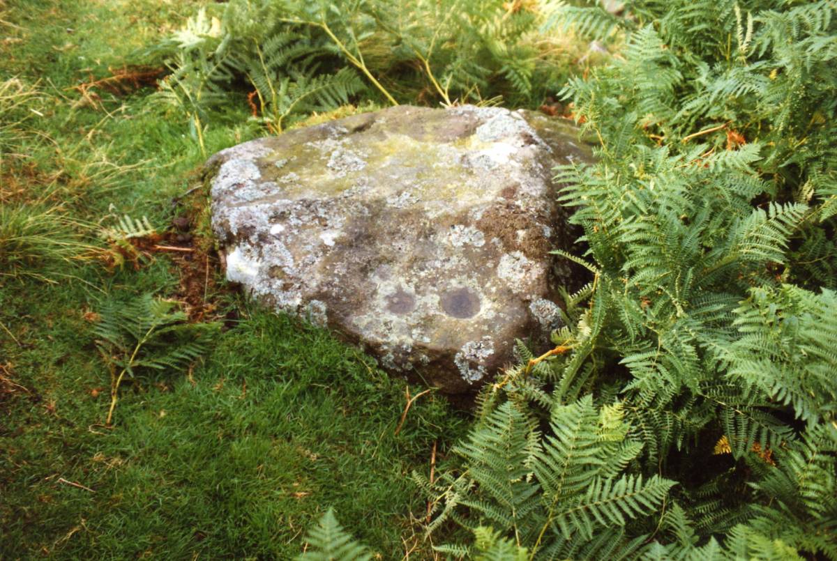
| Image 2 Description | The majority of rock art sites are simple cup marked rocks as this example. | 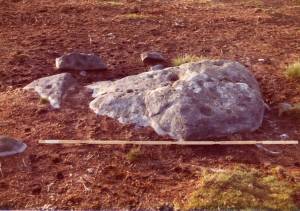 |
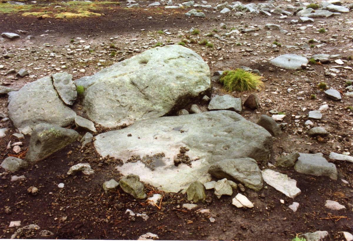
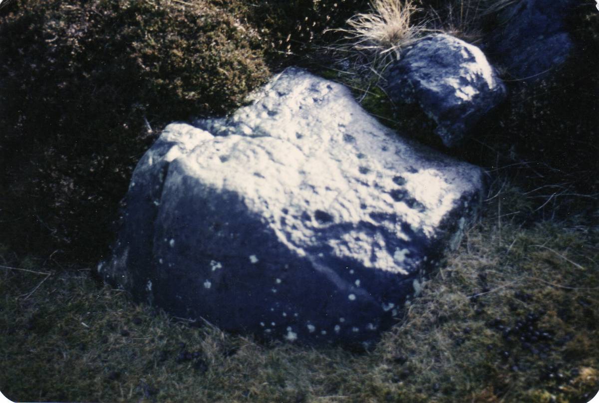
| Image 3 ID | 3044 Click image to enlarge |
| Image 3 Description | The same rocks as Image 2 but after erosion of the thin bracken peat after aerial spraying. | 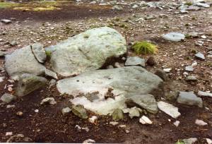 |
| Image 4 ID | 3045 Click image to enlarge |
| Image 4 Description | Site 18.Cup and ring marked slab set upright as an orthostat, stone setting and lithic finds nearby.
Photo Stan Beckensall. |  |
| Image 5 ID | 3046 Click image to enlarge |
| Image 5 Description | Site 18.Cup and ring marked slab set upright as an orthostat, stone setting and lithic finds nearby.
Photo Stan Beckensall. | 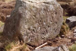 |
| Image 6 ID | 3047 Click image to enlarge |
| Image 6 Description | Site 10. Rock with cups and grooves. The carvings which once existed below the turf have been destroyed by penetration of the surface of the sandstone by fine roots of the turf. Photo Stan Beckensall. | 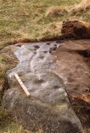 |
| Image 7 ID | 3048 Click image to enlarge |
| Image 7 Description | Small boulder with simple cup marks. |  |
| Image 8 ID | 3049 Click image to enlarge |
| Image 8 Description | Site 16. My favourite of all rock art sites! This small earthfast rock has several finely pecked concentric ring figures each with connecting grooves. | 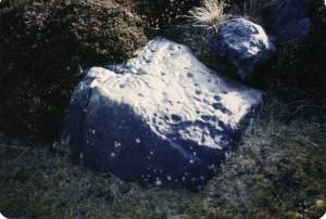 |
| Image 9 ID | 3050 Click image to enlarge |
| Image 9 Description | Site 16. My favourite of all rock art sites! This small earthfast rock has several finely pecked concentric ring figures each with connecting grooves. |  |
| Image 10 ID | 3051 Click image to enlarge |
| Image 10 Description | Site 17. This earthfast rock with a triple ring figure was completely lost when heather finally overgrew it soon after this photo was taken. It was finally rediscovered when the heather was burnt again. 10years | 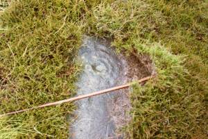 |
| Image 11 ID | 3060 |
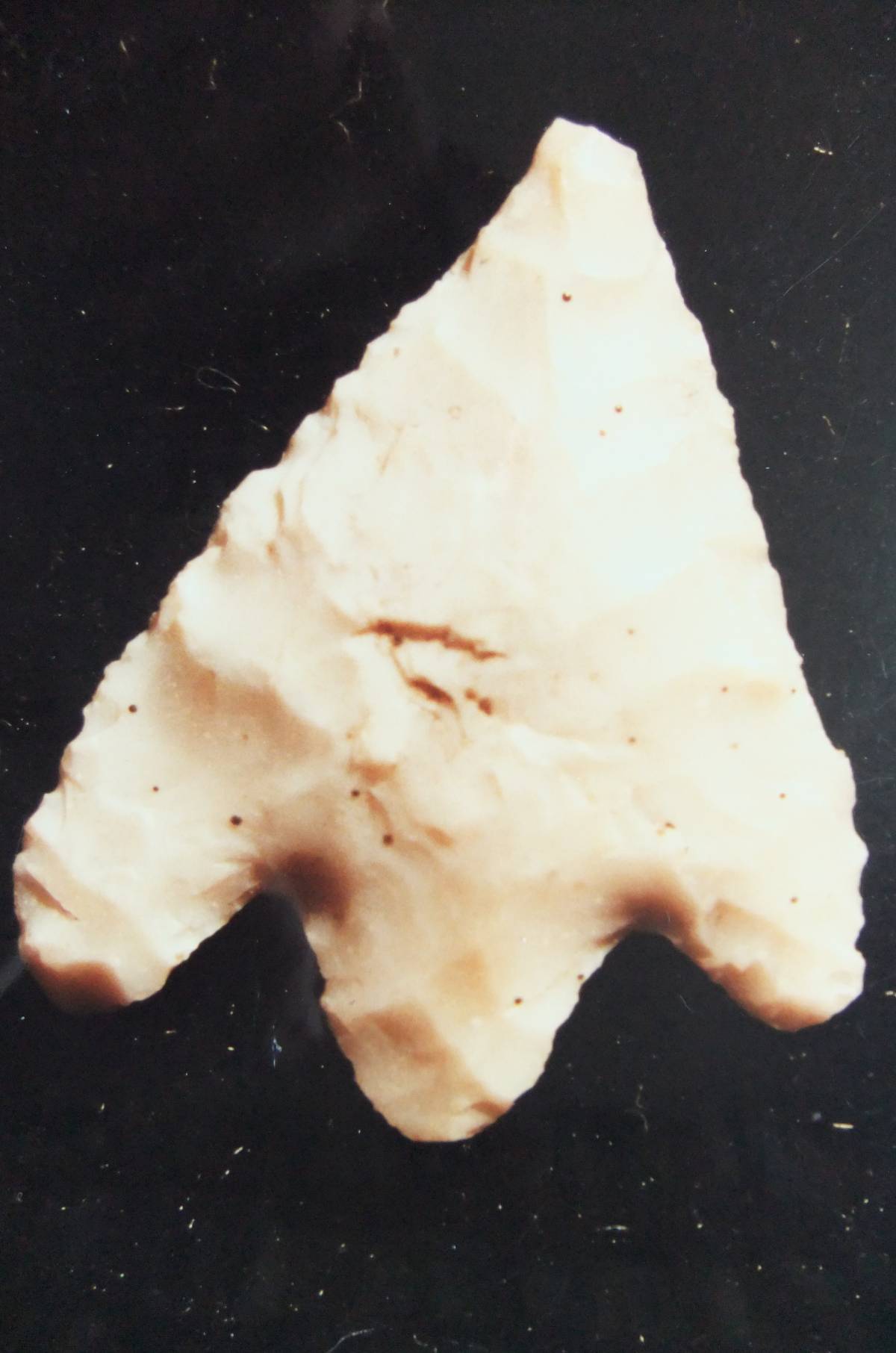
| Image 11 Description | Barb and tanged arrowhead from Barningham Low Moor. Stray find. |  |
| Image 12 ID | 3059 |
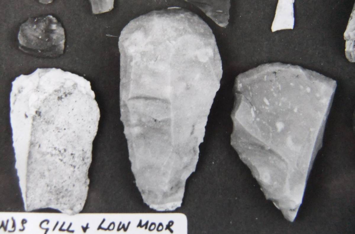
| Image 12 Description | Two end of flake scrapers from east side of Osmonds Gill and one red flint side-of-flake scraper from West Langbaugh on the Low Moor. | 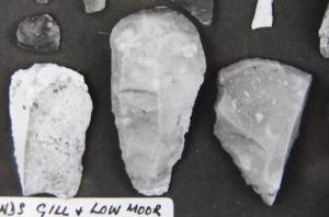 |
| Image 13 ID | 3058 |
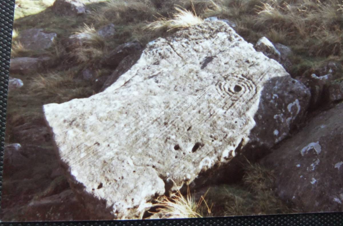
| Image 13 Description | Isolated concentric cup and ring figure on current bedded slab of sandstone, east side of Osmonds Gill. | 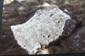 |
| Image 14 ID | 3055 |
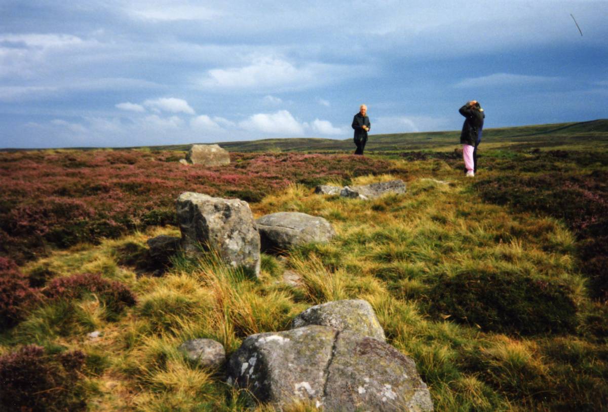
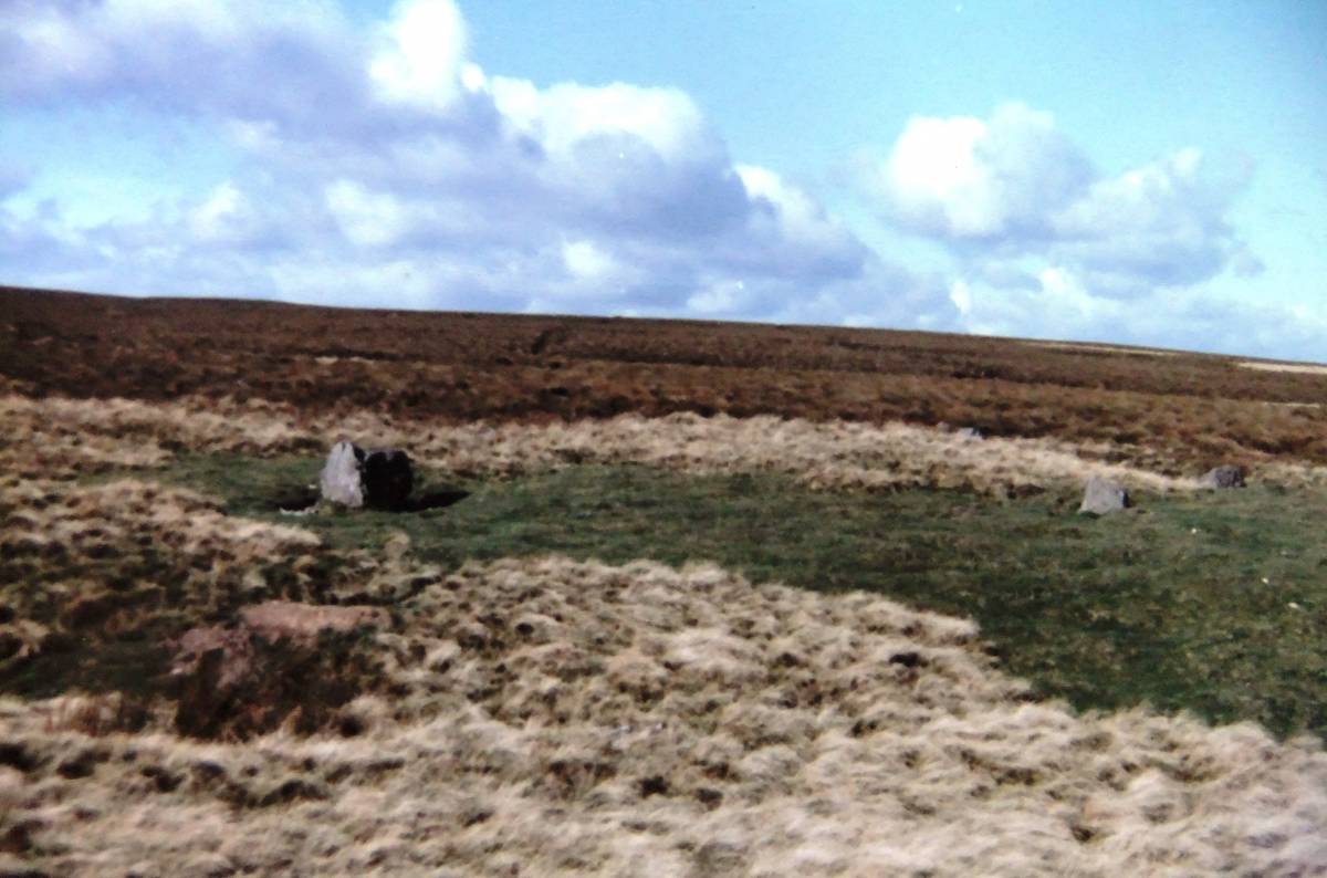
| Image 14 Description | Stone ring, seven stones, above Osmonds Gill. Low, cup marked round cairn nearby (Photos to follow). | 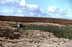 |
| Image 15 ID | 3056 |
| Image 15 Description | Stone ring, seven stones, above Osmonds Gill. |  |
| Image 16 ID | 3057 |
| Image 16 Description | Stone ring, seven stones, above Osmonds Gill. | 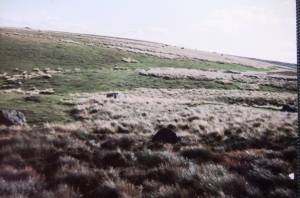 |