|
| *****SWAAG_ID***** | 542 |
| Date Entered | 04/06/2012 |
| Updated on | 04/06/2012 |
| Recorded by | Tim Laurie |
| Category | Settlement |
| Record Type | Archaeology |
| SWAAG Site Name | |
| Site Type | |
| Site Name | |
| Site Description | |
| Site Access | Private |
| Record Date | 01/01/2005 |
| Location | Arkengarthdale |
| Civil Parish | Arkengarthdale |
| Brit. National Grid | Hidden |
| Altitude | |
| Geology | Fluvio glacial deposits on lower dale side. |
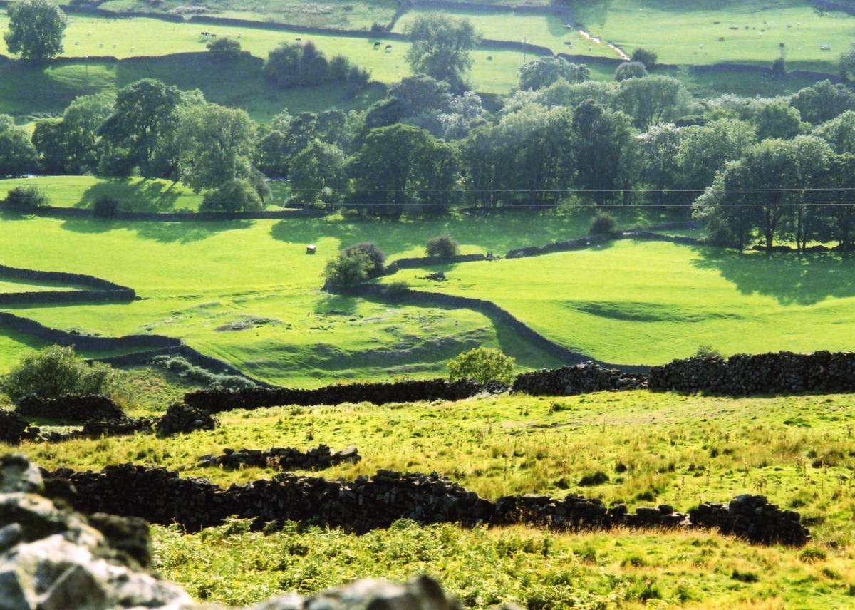
| Record Name | Curvilinear stone walled settlement above Arkle Beck. |
| Record Description | Curvilinear enclosed stone walled farmstead settlement of Late Iron Age or Native Roman character. This settlement has been much quarried for stone and is overlain by a dry stone walled field wall. Nevertheles this settlement is well preserved and the extensive remains of very many internal structures are visible. Several circular house foundations point to Romano British occupation in its final abandonment phase.
Settlements as this example have been proved elsewhere(Note 1) to be of many different episodes of occupation. The coaxial or strip field system in the adjacent pasture may be associated with this settlement.
Note 1.
This settlenent should in the first instance be compared with the two settlenents at Force Garth pasturein Upper Teesdale dated to the mid-1st and mid-2nd centuries AD (Cogggins, D. and Fairless, K. 1980. Trans. D&N5, 31-8) and to the unexcavated settlement at East Mellwaters Farm, Bowes (Laurie, T.C. 1984. Durham Arch. Journal 1, pp35-39). |
| Dimensions | See photographs |
| Geographical area | |
| Species | |
| Scientific Name | |
| Common / Notable Species | |
| Tree and / or Stem Girth | |
| Tree: Position / Form / Status | |
| Tree Site ID | 0 |
| Associated Site SWAAG ID | 0 |
| Additional Notes | This settlement was identified many years ago and photographed from higher ground and has not yet been surveyed.
The field system is crossed by a public right of way. |
| Image 1 ID | 3068 Click image to enlarge |
| Image 1 Description | Settlement viewed from the north | 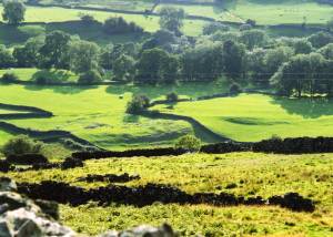 |
| Image 2 ID | 3069 Click image to enlarge |
| Image 2 Description | Settlement viewed from the north. | 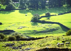 |