|
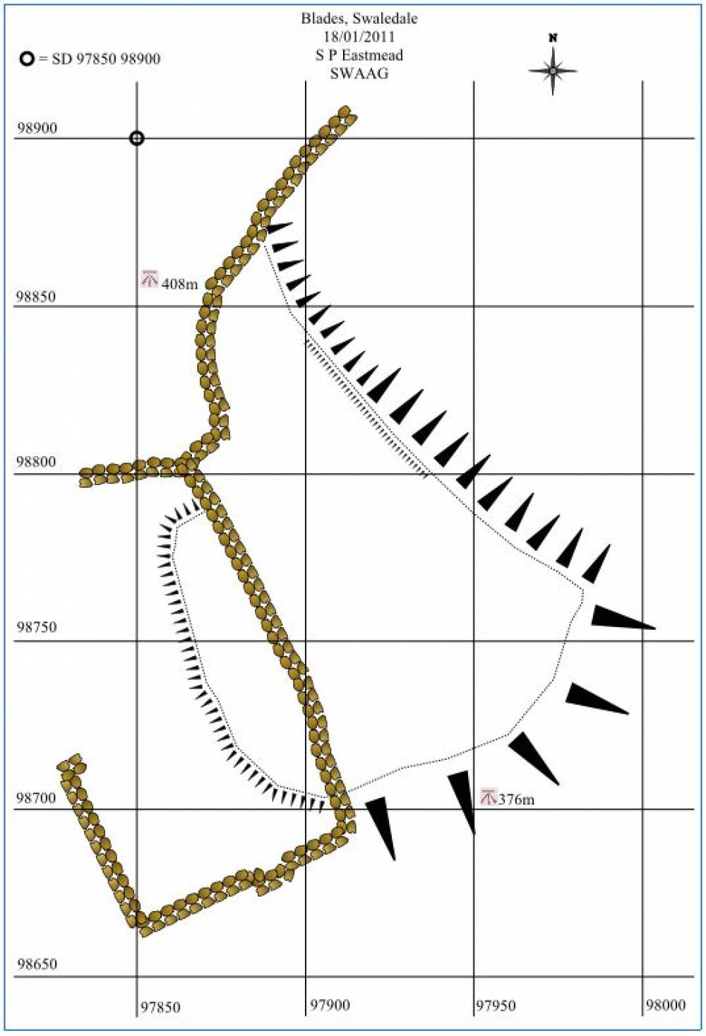
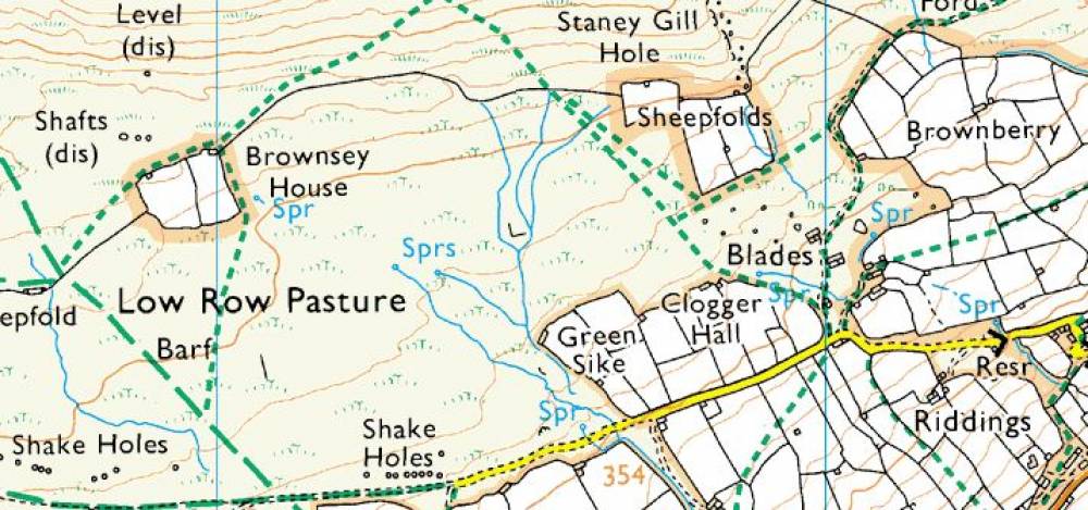
| *****SWAAG_ID***** | 112 | | Date Entered | 22/01/2011 | | Updated on | 22/01/2011 | | Recorded by | Stephen Eastmead (admin) | | Category | Earthworks | | Record Type | General HER | | SWAAG Site Name | | | Site Type | | | Site Name | | | Site Description | | | Site Access | Public Access Land | | Record Date | 18/01/2011 | | Location | Blades, Swaledale | | Civil Parish | Melbecks | | Brit. National Grid | SD 97850 98900 | | Altitude | 408m down to 376m | | Geology | At Stony (Staney) Gill Hole (See OS Map), north-east of Brownsey House, the
downthrow north is probably 300 feet or more, as it throws
out nearly all the beds between the base of the Main and the
Five-Yards Limestones. At Barf End the Main and Middle
Limestones are thrown side by side,
About 160 yards west-north-west of Brownsey House there
is an old shaft in the vein. A more recent level, 80 yards or
so north of this shaft, starts considerably on the north of the
break, in the chert above the Main Limestone. The level 100
yards north of Barf End is also on the north side of the vein.
Ref: MEMOIRS OF THE GEOLOGICAL SURVEY. ENGLAND AND WALES. THE GEOLOGY OF ' THE COUNTRY AROUND M A L L E R S T A R G , WITH PARTS OF WENSLEYDALE, SWALEDALE, AND ARKENDALE. (EXPLANATION OF QUARTER-SHEET 97 N.W. NEW SERIES, SHEET 40.) .
J. R. DAKYNS, MA., R. H. TIDDEMAN, M.A., F.G.S., R. RUSSELL, C.E., E".G.S., C. T. CLOUGH, M.A.,F.G.S., AND A. STRAHAN, M.A., F.G.S. (PARTBSY J. G. GOODCHILD, F.G.S., C. E:DE RANCE, Assoc. INST. C.E., P.G.S., G. BARROW, F.G.S., AND F. H. HATCH, PH.D., F.G.S.) | | Record Name | Blades Earthwork | | Record Description | This area has had a well defined landslip which has extended down from the upper moorland down to the more agriculturally improved grassland. Where the landslip ended towards the west, a clear difference in the ground level is in the order of 0.5 to 1.0 metre.
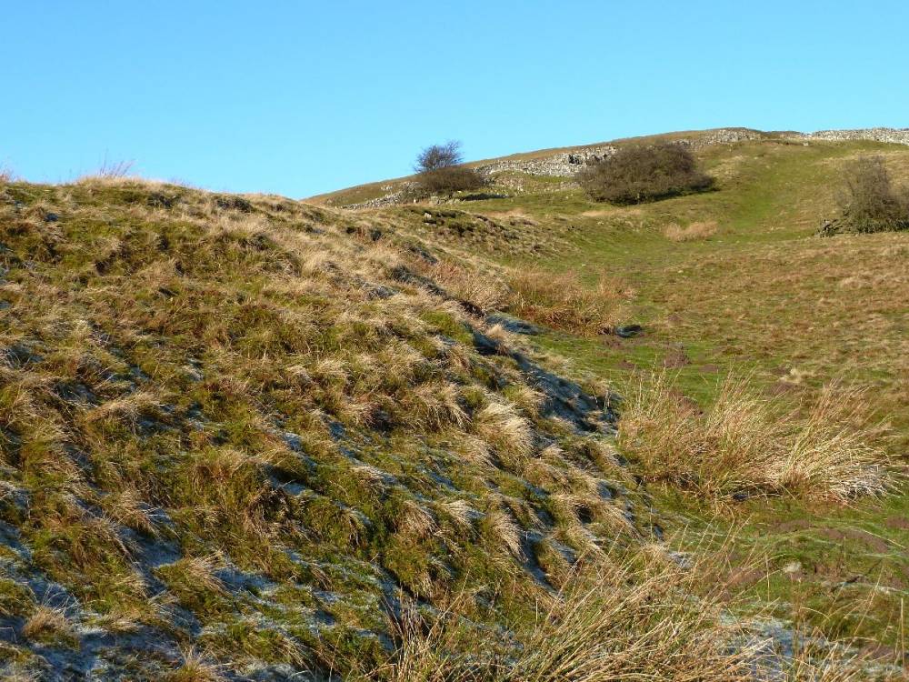
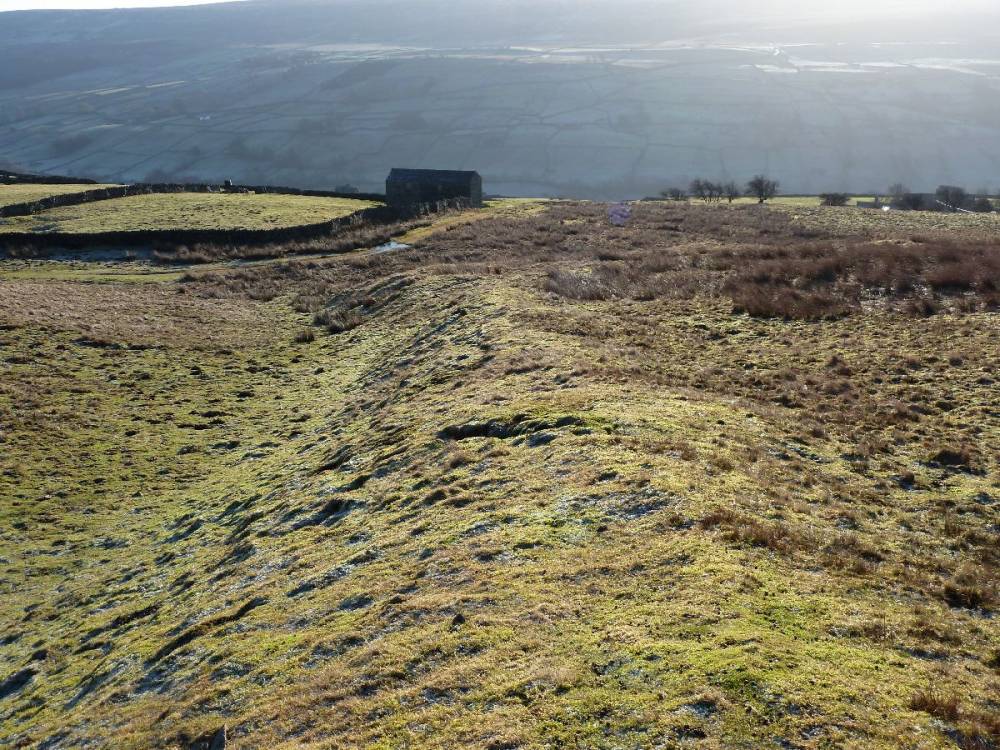
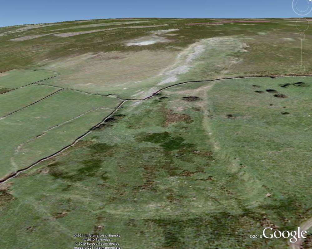
To the east it is a more complicated. The earthwork appears to be 4.0 to 5.0 metres high. When walking its length, it gives the impression that the earthwork could be a pre-existing bank which the landslip butted up to. If this is so, then the bank was constructed before the landslip, and the landslip existed prior to the dry-stone wall construction. Please look at the images below including map, Google Earth image and photographs. | | Dimensions | | | Geographical area | | | Species | | | Scientific Name | | | Common / Notable Species | | | Tree and / or Stem Girth | | | Tree: Position / Form / Status | | | Tree Site ID | 0 | | Associated Site SWAAG ID | 0 | | Additional Notes | | | Image 1 ID | 176 Click image to enlarge | | Image 1 Description | Large Bank viewed from the east. This bank looks as though it may extend beyond the drystone wall to the north (right).. | 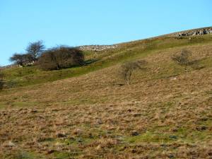 | | Image 2 ID | 177 Click image to enlarge | | Image 2 Description | Large Bank on eastern side looking north |  | | Image 3 ID | 178 Click image to enlarge | | Image 3 Description | Large Bank on eastern side looking south | 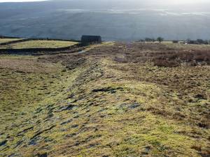 | | Image 4 ID | 179 Click image to enlarge | | Image 4 Description | Landslip termination - western end showing its height and the dry-stone wall on top. | 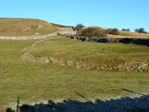 | | Image 5 ID | 180 Click image to enlarge | | Image 5 Description | Map of the area | 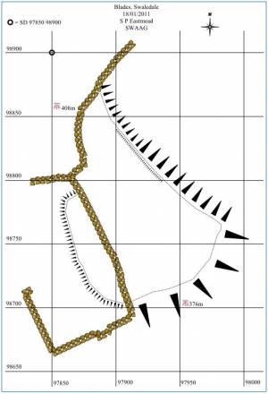 | | Image 6 ID | 181 Click image to enlarge | | Image 6 Description | Google Earth Image of the area | 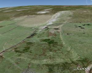 | | Image 7 ID | 182 Click image to enlarge | | Image 7 Description | OS Map of the area 1:25,000 | 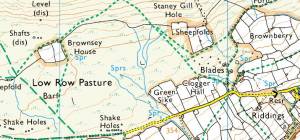 | |