|
| *****SWAAG_ID***** | 230 |
| Date Entered | 21/06/2011 |
| Updated on | 21/06/2011 |
| Recorded by | Tim Laurie |
| Category | Burnt Mound |
| Record Type | Archaeology |
| SWAAG Site Name | |
| Site Type | |
| Site Name | |
| Site Description | |
| Site Access | Public Access Land |
| Record Date | 20/06/2011 |
| Location | |
| Civil Parish | Not known |
| Brit. National Grid | SD 95605 80955 |
| Altitude | 396m |
| Geology | Spring flush. Drift above shales |
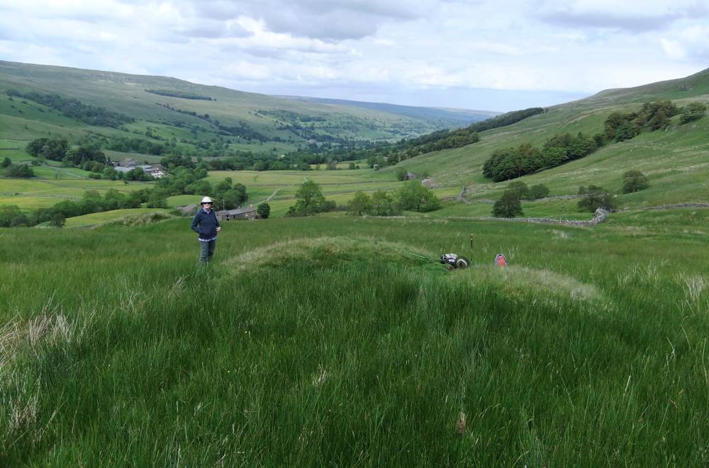
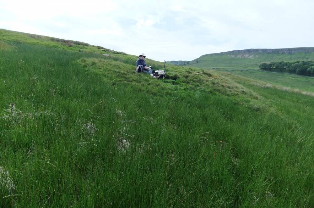
| Record Name | Two burnt mounds below Dale Head Scar. Upper Site. |
| Record Description | This large burnt mound is the Upper and smaller of two such sites space roughly 70m apart at the same spring line. The mound is of charactristic double hump shape with the position of the
central trough evident by a dense clump of rushes These two burnt mounds are additional to the body of similar sites recorded previously.
The closest known burnt mounds are the group of three burnt mounds above the village of Newbiggin, at Mill Beck Springs.
|
| Dimensions | 8m diameter and 1.5m high |
| Geographical area | |
| Species | |
| Scientific Name | |
| Common / Notable Species | |
| Tree and / or Stem Girth | |
| Tree: Position / Form / Status | |
| Tree Site ID | 0 |
| Associated Site SWAAG ID | 0 |
| Additional Notes | |
| Image 1 ID | 831 Click image to enlarge |
| Image 1 Description | Two Burnt Mounds below Dale Head Scar. The Upper Site. |  |
| Image 2 ID | 832 Click image to enlarge |
| Image 2 Description | Two Burnt Mounds below Dale Head Scar. The Upper Site. |  |