|
| *****SWAAG_ID***** | 591 |
| Date Entered | 12/08/2012 |
| Updated on | 13/08/2012 |
| Recorded by | Tim Laurie |
| Category | Earthworks |
| Record Type | Archaeology |
| SWAAG Site Name | |
| Site Type | |
| Site Name | |
| Site Description | |
| Site Access | Public Access Land |
| Record Date | 07/08/2012 |
| Location | Grinton, Harkerside Moor. High Harker Hill, Long Scar and Grove Beck |
| Civil Parish | Grinton |
| Brit. National Grid | SE 028 975 |
| Altitude | 415m |
| Geology | The Main Limestone. Long Scar appears to be a fault scar with overturned vertical limestone strata visible in scree below the cliff. (Inf. John Russell). |
| Record Name | The GrintonFremington Linear Dike System, Part One: Linear earthwork at High Harker Hill centred on Long Scar and Grove Beck Head. |
| Record Description | This record is a photographic description of the linear earthwork which has been the subject of recent excavation by SWAAG under supervision from ASDU at a storm washout section SE of Grove Beck. See excavation images.
This linear earthwork incorporates the limestone cliff of Long Scar to extend for a total distance of 750m NE from Grove Beck. Immediately north east of Grove Beck, as far as Long Scar, the earthwork comprises an infilled main ditch which may have been quarried into the limestone rock, berm and only slight traces of a stone bank. The earthwork continues from the NE end of Long Scar and here the earthwork is topped by a very substantial limestone bank with visible facing stone, see photo, which may indicate the presence of a faced rampart wall here. As with the excavated washout section this upper banks was formed from material excavated from a rear ditch.
This upper bank/rampart which was carried round the end of the ditch terminus at SE028975 some 750m NE of Grove Beck, see photos, signifying that the earthwork was indeed completed and not left incomplete as may be otherwise considered.
South east of Grove Beck, the earthwork extends only for a distance of 200m to the unnamed sike at SE . Here the Dike, as excavated, consists of a shallow round bottomed ditch,remains of a counterscarp bank , berm and an upper bank formed from material excavated from an upper ditch which has a very similar round based profile and similar fill to the main ditch.
SE of Grove Beck the Dike has been cut through by a very active storm water washout (the excavation site) and by several old inactive washouts. |
| Dimensions | Total length of this Dike, including Long Scar, is 950m |
| Geographical area | |
| Species | |
| Scientific Name | |
| Common / Notable Species | |
| Tree and / or Stem Girth | |
| Tree: Position / Form / Status | |
| Tree Site ID | 0 |
| Associated Site SWAAG ID | 0 |
| Additional Notes | It is intended to provide a similar record of each of the remaining Dike Sections which together form the Grinton-Fremington Dike System. |
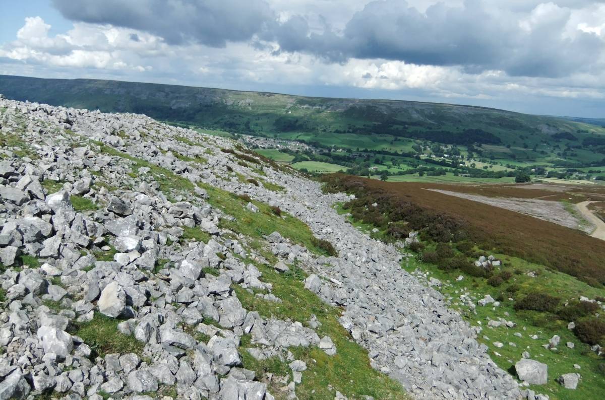
| Image 1 ID | 3244 Click image to enlarge |
| Image 1 Description | The linear earthwork north of Long Scar. View down towards Reeth. | 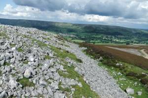 |
| Image 2 ID | 3237 Click image to enlarge |
| Image 2 Description | Long Scar with the linear earthwork visible from Grove Beck Mine. | 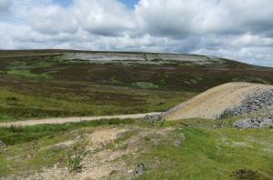 |
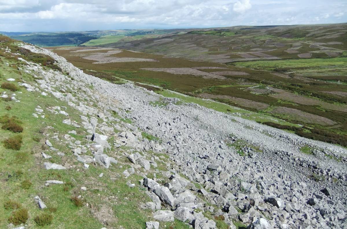
| Image 3 ID | 3238 Click image to enlarge |
| Image 3 Description | The earthwork running down towards Grove Beck from Long Scar. | 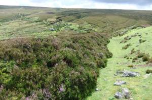 |
| Image 4 ID | 3239 Click image to enlarge |
| Image 4 Description | The linear earthwork rising towards Long Scar. NE of Grove Beck. | 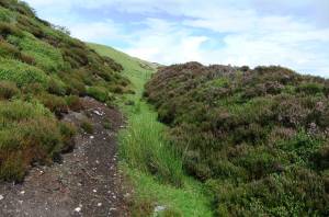 |
| Image 5 ID | 3240 Click image to enlarge |
| Image 5 Description | Long Scar, view down to Low Harker Hill | 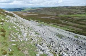 |
| Image 6 ID | 3242 Click image to enlarge |
| Image 6 Description | Common Rock-Rose. The last flowers this year. Helianthemum nummularium dominant in turf above Long Scar. | 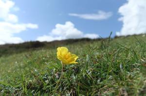 |
| Image 7 ID | 3243 Click image to enlarge |
| Image 7 Description | Prominant stone bank with visible facing course above the linear earthwork north of Long Scar | 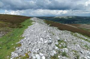 |
| Image 8 ID | 3244 Click image to enlarge |
| Image 8 Description | Prominant stone bank with visible facing course above the linear earthwork north of Long Scar | |
| Image 9 ID | 3245 Click image to enlarge |
| Image 9 Description | Stone bank above the ditch approaching the terminus on High Harker Hill | 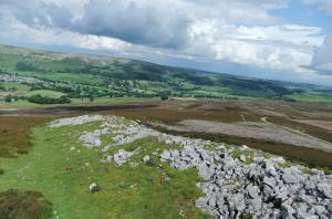 |
| Image 10 ID | 3236 Click image to enlarge |
| Image 10 Description | The road to Grove Beck Mine, Lond Scar and the earthwork visible in distance. | 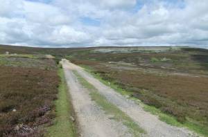 |
| Image 11 ID | 3246 |
| Image 11 Description | The earthwork approaches its terminus on High Harker Hill | 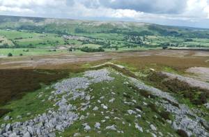 |
| Image 12 ID | 3247 |
| Image 12 Description | The terminus of the linear earthwork on High Harker Hill |  |
| Image 13 ID | 3248 |
| Image 13 Description | he substantial stone bank and ditch viewed from the terminus. | 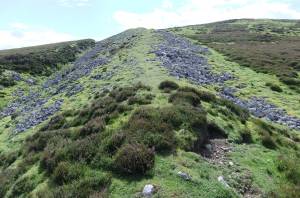 |