|
*****SWAAG_ID***** | 465 |
Date Entered | 26/02/2012 |
Updated on | 26/02/2012 |
Recorded by | Ric Carter |
Category | Burnt Mound |
Record Type | Archaeology |
SWAAG Site Name | |
Site Type | |
Site Name | |
Site Description | |
Site Access | Private |
Record Date | 25/02/2012 |
Location | Muker Side |
Civil Parish | Muker |
Brit. National Grid | SD 90451 97383 |
Altitude | 1195 feet |
Geology | |
Record Name | Burnt Mound at Muker Side |
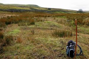
Record Description | Burnt Mound at Muker Side, on private land but visible from public footpath. A characteristic double mound of medium size and crescentic form, situated just below a spring rise, the larger mound quarried out - probably for road stone. Burnt and cracked stone visible within the mound. |
Dimensions | Approx. 9m x 6m x 0.5m |
Geographical area | |
Species | |
Scientific Name | |
Common / Notable Species | |
Tree and / or Stem Girth | |
Tree: Position / Form / Status | |
Tree Site ID | 0 |
Associated Site SWAAG ID | 0 |
Additional Notes | |
Image 1 ID | 2325 Click image to enlarge |
Image 1 Description | Burnt Mound at Muker Side |  |