Close

This site uses cookies. No personal data is stored. You can read how we use them in our cookies policy. Continuing on this site accepts their use. Thankyou.

Viewing swaag.org website implies consent to set cookies on your computer. Full details Swaledale and Arkengarthdale Archaeology Group
Registered Charitable Incorporated Organisation Number 1155775
SWAAG Honorary President:
Tim Laurie F,S,A,

Another Search

Scroll Down the Record
 *****SWAAG_ID***** 465
 Date Entered 26/02/2012
 Updated on 26/02/2012
 Recorded by Ric Carter
 Category Burnt Mound
 Record Type Archaeology
 SWAAG Site Name 
 Site Type 
 Site Name 
 Site Description 
 Site Access Private
 Record Date 25/02/2012
 Location Muker Side
 Civil Parish Muker
 Brit. National Grid SD 90451 97383
 Altitude 1195 feet
 Geology 
 Record Name Burnt Mound at Muker Side
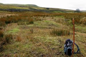
 Record Description Burnt Mound at Muker Side, on private land but visible from public footpath. A characteristic double mound of medium size and crescentic form, situated just below a spring rise, the larger mound quarried out - probably for road stone. Burnt and cracked stone visible within the mound.
 Dimensions Approx. 9m x 6m x 0.5m
 Geographical area 
 Species 
 Scientific Name 
 Common / Notable Species 
 Tree and / or Stem Girth 
 Tree: Position / Form / Status 
 Tree Site ID 0
 Associated Site SWAAG ID 0
 Additional Notes 
 Image 1 ID 2325         Click image to enlarge
 Image 1 Description Burnt Mound at Muker Side
PREV 20PREV 461 462 463 464 465 466 467 468 469 470 471 472 473 474 475 476 477 478 479 480NEXT 20
Another Search