|
| *****SWAAG_ID***** | 178 |
| Date Entered | 24/04/2011 |
| Updated on | 24/04/2011 |
| Recorded by | Tim Laurie |
| Category | Geological Record |
| Record Type | Geological HER |
| SWAAG Site Name | |
| Site Type | |
| Site Name | |
| Site Description | |
| Site Access | Public Access Land |
| Record Date | 20/04/2011 |
| Location | Birkdale Common. Little Sleddale. |
| Civil Parish | Muker |
| Brit. National Grid | NY 832 020 |
| Altitude | 410m |
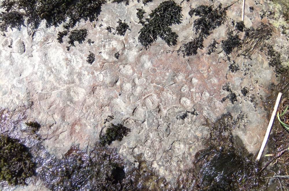
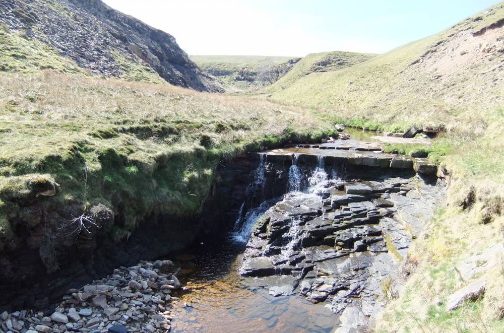
| Geology | Low waterfall formed by a thin hard limestone (Crow Limestone Series?) undercut by eroding soft mudstones.
The top surface of the limestone is highly fossiliferous, see photo. |
| Record Name | Little Sleddale. Lower Falls. Shell bed and mudstones. |
| Record Description | This fine small waterfall was photographed under drought conditions when the limestone is accessible.
Under higher water conditions this waterfall is a torrent. |
| Dimensions | |
| Geographical area | |
| Species | |
| Scientific Name | |
| Common / Notable Species | |
| Tree and / or Stem Girth | |
| Tree: Position / Form / Status | |
| Tree Site ID | 0 |
| Associated Site SWAAG ID | 0 |
| Additional Notes | |
| Image 2 ID | 590 Click image to enlarge |
| Image 2 Description | The upper surface of the limestone. Detail of shell bed.. | 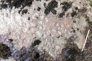 |
| Image 3 ID | 591 Click image to enlarge |
| Image 3 Description | Little Sleddale Lower Falls. Fossiliferous limestone undercut by eroding mudstones |  |