|
| *****SWAAG_ID***** | 319 |
| Date Entered | 08/11/2011 |
| Updated on | 10/11/2011 |
| Recorded by | Tim Laurie |
| Category | Rock Art |
| Record Type | Archaeology |
| SWAAG Site Name | |
| Site Type | |
| Site Name | |
| Site Description | |
| Site Access | Army Range |
| Record Date | 01/01/2005 |
| Location | Gayles Moor. Hill 99 and adjacent Allotments. |
| Civil Parish | Gayles |
| Brit. National Grid | NZ 1155 0622 |
| Altitude | 305m |
| Geology | Earthfast slabs of fell sandstone on glacial till with small exposured areas of the Underset Limestone.
|
| Record Name | Teesdale. Gayles Moor. Cluster of Rock Art Sites centred on Hill 99. |
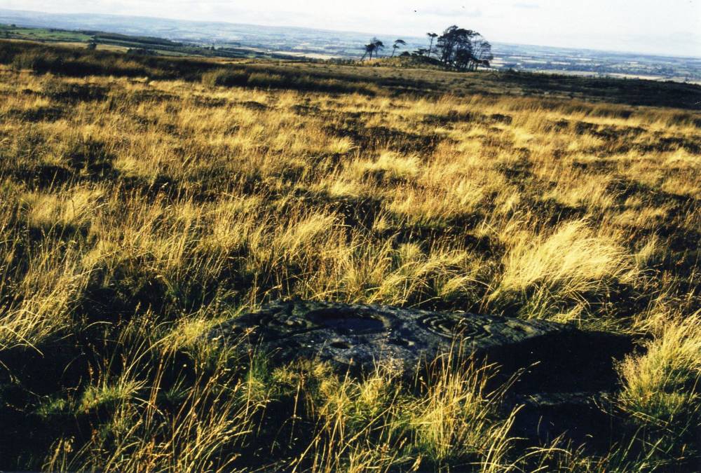
| Record Description | Hill 99 is a large regular mound and is most probably of glacial origine, a small drumlin mound,however it is very barrowlike in appearance and just might be a Neolithic or Early Bronze Age Round Barrow. Hill 99 is now shrouded within a fir plantation.
There is little doubt that Hill 99 served the purpose of a round barrow and was the focal point for the large number of earthfast rocks decorated in the cup and ring tradition on the moorland to the to the south and within the walled pastures to the north. One very fine carved rock is located at the base of Hill 99 and there is a cup marked rock near the summit This prominent mound and commands panoramic views across Teesdale and eastward to the North York Moors.
All these 'rock art' sites are well known and have been published elsewhere, but it is thought that one or two photographs (scanned from slides) taken more than thirty years ago would be of interest.
In particular one slide photograph shows Hill 99 seen from the main cup and ring marked rock- when the plantation had only just been planted and the mound was clearly visible and not as now shrouded in fir trees. (NZ 1155 0622 Centre)
ARMY LIVE FIRING RANGE.
ACCESS ONLY WITH EXPRESS WRITTEN PERMISSION FROM ARMY RANGE AUTHORITIES |
| Dimensions | See photos |
| Geographical area | |
| Species | |
| Scientific Name | |
| Common / Notable Species | |
| Tree and / or Stem Girth | |
| Tree: Position / Form / Status | |
| Tree Site ID | 0 |
| Associated Site SWAAG ID | 0 |
| Additional Notes | Rock art sites should be considered in context with the known contemporary prehistoric landscape.
The carved rocks on Gayles Moor and on the higher slopes of the southern edge of Teesdale should, perhaps and for lack of a better framework, be considered as the territorial signiture of seasonal, transhumant pastoral family groups returning to the eastern Pennine Fringe each summer with their animals to set up their tented villages near favoured springs to take advantage of the good browse and grazing on the lighter scrub hazel woodland of the limestone soils of the upper dale sides. The year round winter settlements of these groups being located on the fertile and sheltered gravel terraces of the Tees, Swale and Ure Lowlands.
This record is work in progress and further text/images will be added. |
| Image 1 ID | 1172 Click image to enlarge |
| Image 1 Description | Hill 99 seen from cup and ring marked rock on Johnon's Allotment before being shrouded within the present day plantation. | 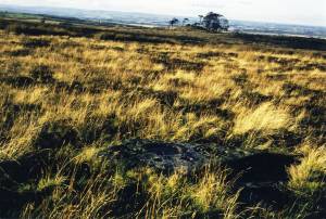 |
| Image 2 ID | 1173 Click image to enlarge |
| Image 2 Description | Cup and ring marked rock south of Hill 99. |  |
| Image 3 ID | 1174 Click image to enlarge |
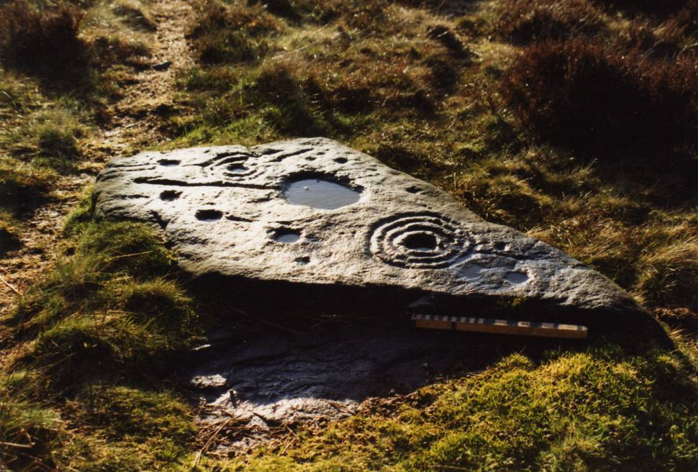
| Image 3 Description | Cup and ring marked rock immediately below Hill 99. The small fir tree in this photo was felled five years ago to allow some daylight to enable the carvings to be seen. | 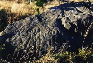 |
| Image 4 ID | 1176 Click image to enlarge |
| Image 4 Description | Complex cup marked rock.Detail. | 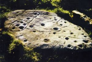 |
| Image 5 ID | 1175 Click image to enlarge |
| Image 5 Description | Twenty years on. Hill 99 hidden within plantation. Cup marked rock, possible cist cover, in foreground. | 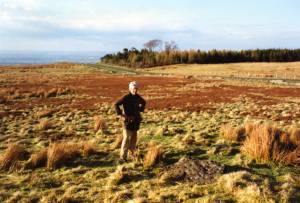 |
| Image 6 ID | 1178 Click image to enlarge |
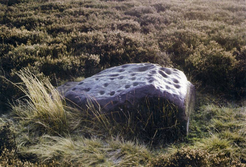
| Image 6 Description | Simple cup marks are located on the periphery of concentrations of rock art sites. Complex carvings are located at the centre of a group. | 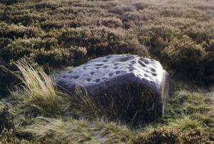 |
| Image 7 ID | 1179 Click image to enlarge |
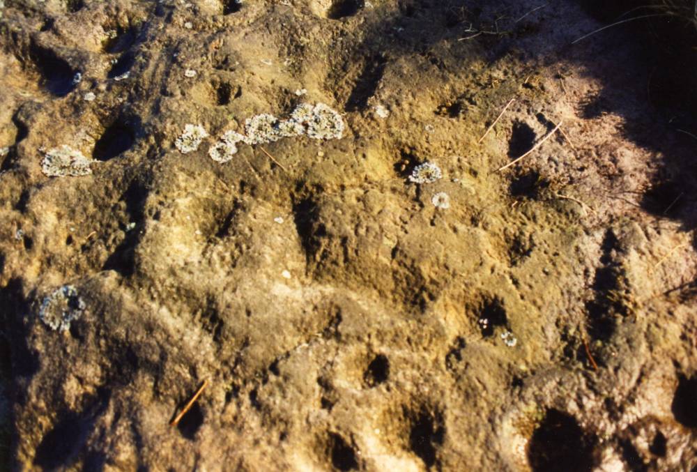
| Image 7 Description | Complex rock carving photograpphed under optimum low sun conditions. These carvings invisible on a dull day. | 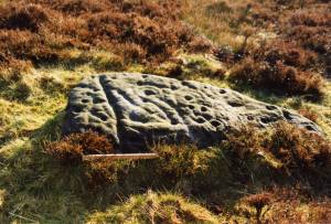 |
| Image 8 ID | 1180 Click image to enlarge |
| Image 8 Description | Very small earthfast sandstone rock with concentric ring figures. | 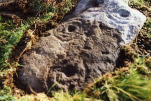 |
| Image 9 ID | 1181 Click image to enlarge |
| Image 9 Description | This highly decorated rock with fresh visible pick marks is sloping as though subsidedinto a pit or cist grave. Possibly an overturned cist cover. | 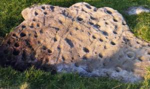 |
| Image 10 ID | 1182 Click image to enlarge |
| Image 10 Description | Detail of the same slab. | 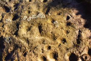 |
| Image 11 ID | 1183 |
| Image 11 Description | Ring groove enclosure or palisaded timber circle. This feature, visible as a substantial palisade groove with eastern entrance, is at the centre of the concentration of rock art. |  |
| Image 12 ID | 1186 |
| Image 12 Description | Prehistoric Sites in the NE Pennines (Laurie 2003). There are now many more recorded burnt mounds than shown. | 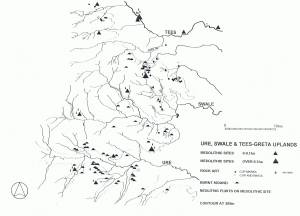 |
| Image 13 ID | 1187 |
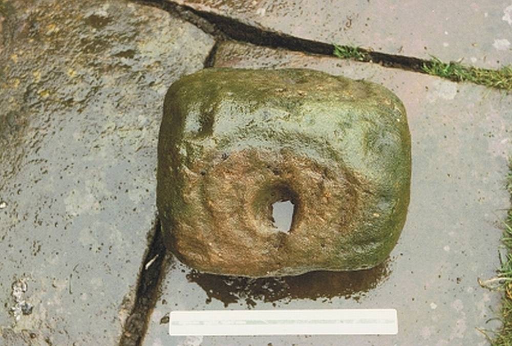
| Image 13 Description | Small portable cup and ring marked rock in Cottage Garden. Dalton. All faces decorated. | 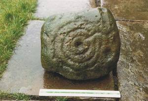 |
| Image 14 ID | 1190 |
| Image 14 Description | Small portable cup and ring marked rock in Cottage Garden. Dalton. All faces decorated. |  |