|
| *****SWAAG_ID***** | 324 |
| Date Entered | 11/11/2011 |
| Updated on | 05/12/2011 |
| Recorded by | Tim Laurie |
| Category | Tree Site Record |
| Record Type | Botanical HER |
| SWAAG Site Name | |
| Site Type | |
| Site Name | |
| Site Description | |
| Site Access | Public Access Land |
| Location | Little Sleddale, Ravine below Lower Falls |
| Civil Parish | Muker |
| Brit. National Grid | NY 832 020 |
| Altitude | 420m |
| Geology | Namurian sandstones. |
| Record Name | MUK108 Birkdale Common. Little Sleddale, Ravine below Lower FallsType A Locality with Aspen clones. |
| Record Description | Type A* Acidic vegetation on sandstone outcrop, top of ravine. East facing.
Aspen (stunted clones), Rowan.
See LR Species List (To follow). |
| Dimensions | |
| Geographical area | Upper Swaledale |
| Species | Aspen |
| Scientific Name | Populus tremula |
| Common / Notable Species | Juniper, Aspen. |
| Tree and / or Stem Girth | |
| Tree: Position / Form / Status | |
| Tree Site ID | 0 |
| Associated Site SWAAG ID | 0 |
| Additional Notes | This site is typical of the restricted tree species present on sandstone. |
| Image 1 ID | 1200 Click image to enlarge |
| Image 1 Description | Little Sleddale. Lower ravine. | 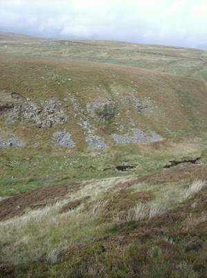 |
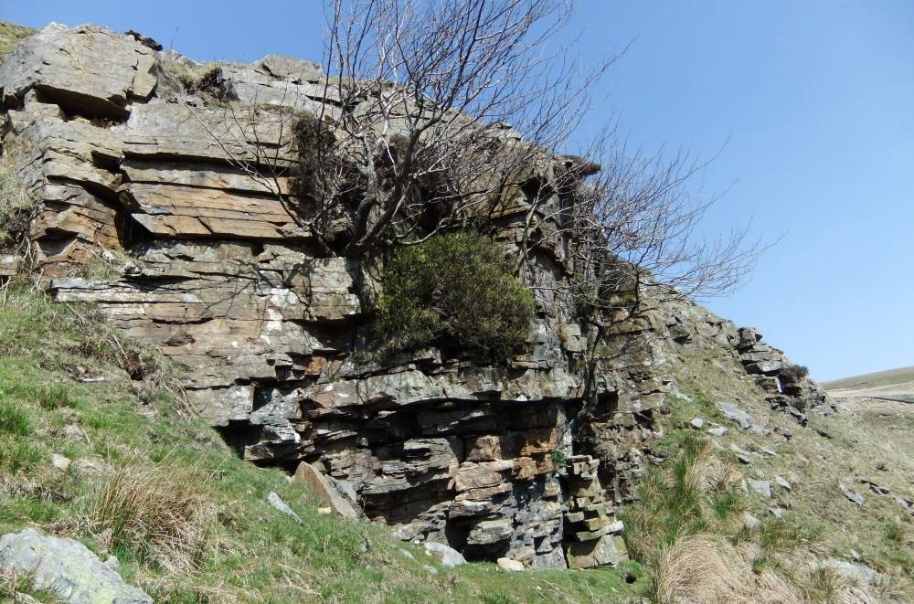
| Image 2 ID | 1201 Click image to enlarge |
| Image 2 Description | The sandstone cliff with stunted aspens. |  |
| Image 3 ID | 1202 Click image to enlarge |
| Image 3 Description | Detail of aspen. | 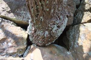 |
| Image 4 ID | 1203 Click image to enlarge |
| Image 4 Description | Little Sleddale. Lower falls. Thin fossiferous limestone with undercut shales. | 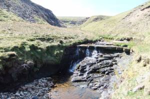 |