|
| *****SWAAG_ID***** | 531 |
| Date Entered | 21/05/2012 |
| Updated on | 21/05/2012 |
| Recorded by | Tim Laurie |
| Category | Settlement |
| Record Type | Archaeology |
| SWAAG Site Name | |
| Site Type | |
| Site Name | |
| Site Description | |
| Site Access | Public Access Land |
| Record Date | 21/05/2012 |
| Location | Great Rowleth Wood |
| Civil Parish | Melbecks |
| Brit. National Grid | SD 9638 9805 |
| Altitude | |
| Geology | Talus slope below the Middle Limestone. |
| Record Name | Great Rowleth Wood. Platform Settlement, associated enclosures, trackway and coaxial field system. |
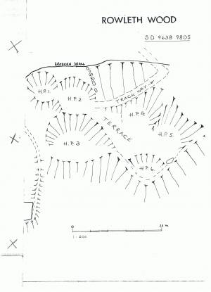
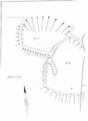
| Record Description | See TCL Plane Table Survey Plan, Part One: East Section, The Settlement and Part Two: West Section, The Two Conjoined Enclosures.
Well preserved platform settlement with two conjoined stone banked enclosures all of Prehistoric Iron Age or Bronze Age Character with associated trackway leading upwards to the coaxial field system (unsurveyed) on Low Row Pasture.
The extensive coaxial field system has not yet been susrveyed and this should be a suitable Future Project for SWAAG. |
| Dimensions | See Survey Plans |
| Geographical area | |
| Species | |
| Scientific Name | |
| Common / Notable Species | |
| Tree and / or Stem Girth | |
| Tree: Position / Form / Status | |
| Tree Site ID | 0 |
| Associated Site SWAAG ID | 0 |
| Additional Notes | The platforms at Great Rowleth are similar to those above Healaugh, one of which was excavated and dated to the late Iron Age/Roman Occupation. |
| Image 1 ID | 2933 Click image to enlarge |
| Image 1 Description | TCL Plane Table Survey Plan 1:200 Part One: The Eastern Section. The Platform Settlement. |  |
| Image 2 ID | 2936 Click image to enlarge |
| Image 2 Description | TCL Plane Table Survey Plan 1:200 Part Two: The Western Section. The conjoined enclosures. |  |
| Image 3 ID | 2937 Click image to enlarge |
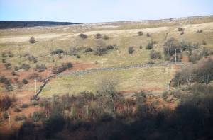
| Image 3 Description | Great Rowleth Wood. Settlement at top right of the intake. |  |
| Image 4 ID | 2938 Click image to enlarge |
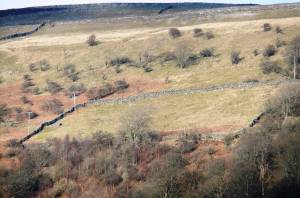
| Image 4 Description | Great Rowleth Wood. Settlement at top right of the intake. |  |


