|
| *****SWAAG_ID***** | 532 | | Date Entered | 24/05/2012 | | Updated on | 20/08/2012 | | Recorded by | Tim Laurie | | Category | Earthworks | | Record Type | Northern Britain | | SWAAG Site Name | | | Site Type | | | Site Name | | | Site Description | | | Site Access | Public Footpath | | Record Date | 27/04/2012 | | Location | Roman Forts on the line of the A66 | | Civil Parish | Not known | | Brit. National Grid | | | Altitude | Various | | Geology | Various | | Record Name | SWAAG in Eden Part Nine. Roman Forts at Greta Bridge, Bowes and Brough and the Marching Camp at Stainmore Summit | | Record Description | As Peter Dennison-Edson's Notes and Bibliography:
SWAAG and the Romans on Stainmore.
Introduction.
Tim Laurie and others have stressed the importance from the Mesolithic onwards of the Stainmore route between the relatively populous and fertile lowlands of the Vale of Mowbray and the Solway Firth . The Romans were not traversing unkown trackless wastes when they came this way.
Until the late 60s the Roman frontier in Britain lay roughly along the Trent/Mersey/Humber line with legionary bases at Wroxeter and Lincoln. North of this was a large territory stretching to the north of the later line of Hadrian’s Wall occupied by tribes which the Romans referred to collectively as the Brigantes, possibly a grouping owing broad allegiance to a single ruler. The Brigantes had been led since the Conquest by the female ruler Cartimandua and her husband Venutius who both adopted a pro-Roman stance. Caratacus was handed over to the Romans when he fled north in 51 and the Brigantes took no formal part in the Boudican revolt. This relationship with Rome, whatever its formal or informal nature, broke down c69 when Cartimandua and Venutius divorced. She had to be rescued by Roman troops and he “rebelledâ€. Without an ally guarding their northern borders, the Romans moved to subdue opposition and bring the north under control. In 71, a military campaign (doubtless facilitated by pro-Roman groups among the Brigantes) led by the Governor Petilius Cerealis marching from Lincoln via Scotch Corner and across Stainmore to Carlisle to meet the XX Legion moving up the west coast from Wroxeter, began this process, which was followed by fort and road building throughout Brigantia. Parts of this network, including the forts at Bowes and Brough were garrisoned and maintained through to the end of the Roman Occupation in Britain.
Greta Bridge Roman Fort (Roman name unknown)
The fort platform, originally c3.6 acres, is accessed by a gate from the gardens of The Morritt Arms Hotel, which overlies the northern third of the site. The line of the ramparts is clear on the east (ditchless because the site utilizes a natural scarp) and south (where there is a double ditch and a clearly visible entrance) but has been destroyed on the west by the road to Brignall which may have developed along the ditch line. No internal features are visible.
Greta Bridge was a late addition to the line of forts along the route from Scotch Corner to Penrith, probably replacing an earler, smaller fort to the east at Carkin Moor after the building of Hadrian’s Wall.
There are no inscriptions naming army units serving at the fort. One building inscription records work under the Governor L. Alfenus Senecio (c205-7) when many forts across the North were renovated. Rescue excavations in 1972-4 before the realignment of the A66 back to the old line of the Roman road found buildings of the vicus (civilian settlement) stretching for over half a kilometre east and west of a river crossing with evidence of occupation from the mid 2nd to the early 4th century (late for North Britain).
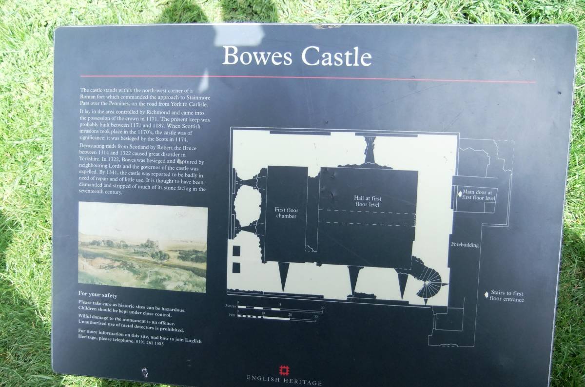
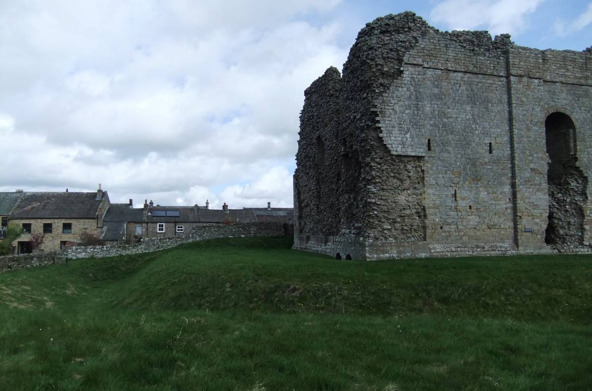
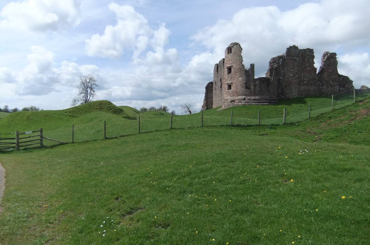
Bowes Roman Fort (Lavatris)
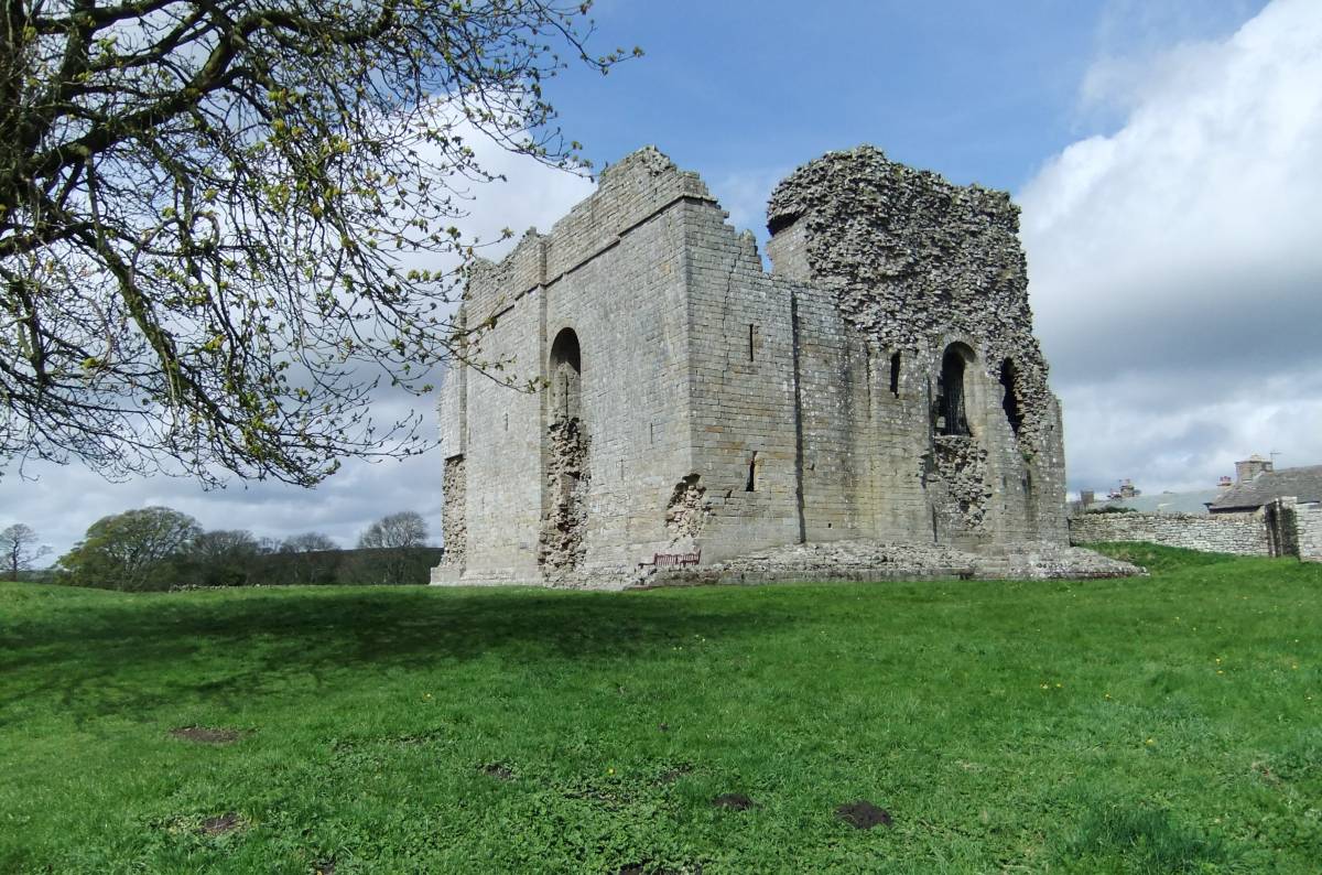
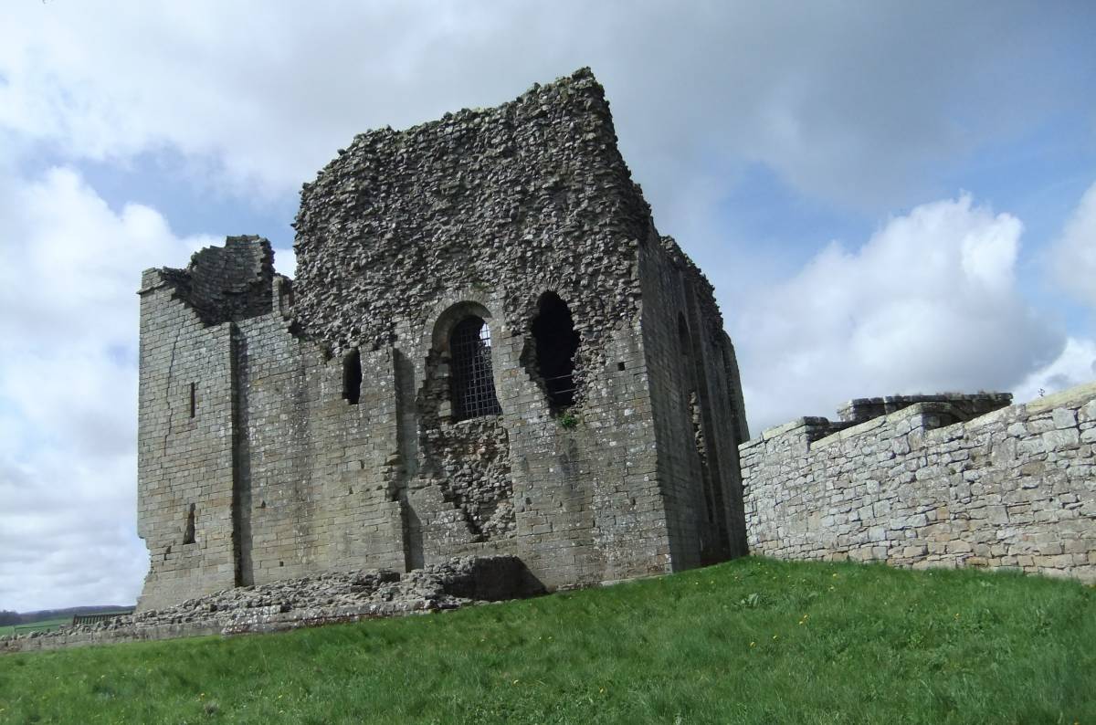
The fort platform, originally c4.2 acres, is accessed from the Castle which overlies the northern part of the site (as do the vicarage and church). The line of the ramparts and ditch is clear on the south and west.
Units attested by inscription include Cohors IV Breucorum (c131-3), Cohors I Thracum (attested late 2nd/early 3rd century) whose prefects dedicated altars at shrines on Scargill Moor, 2 miles south, and a Numerus Exploratorum (undated).
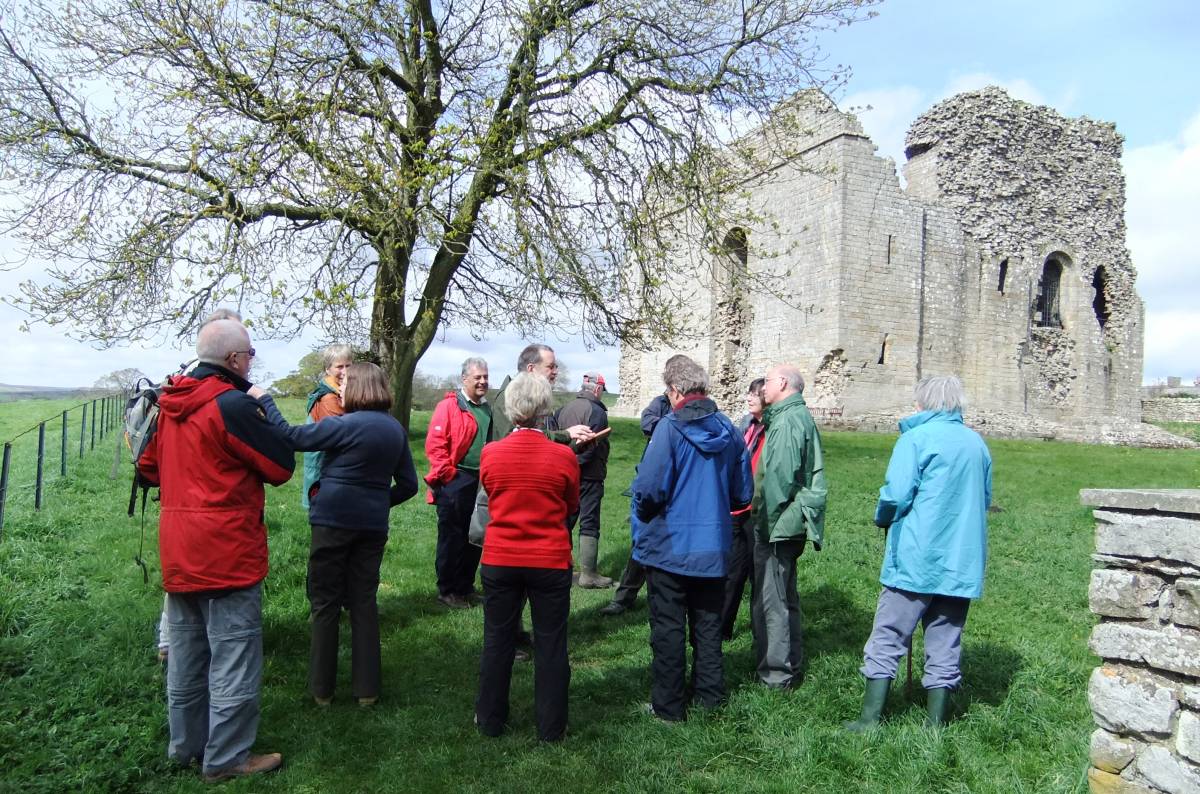
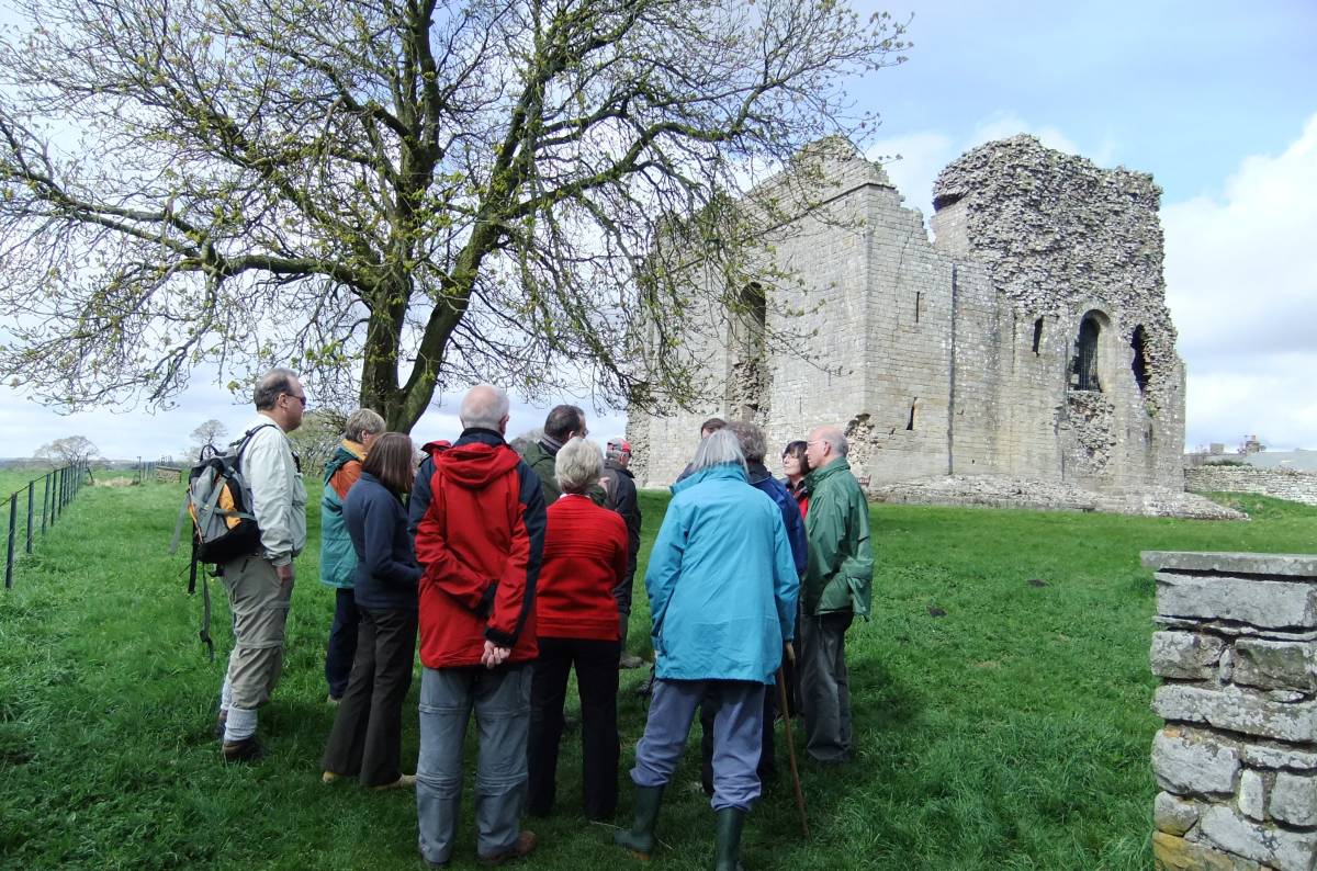
As the strategic eastern entrance to the Stainmore Pass, Bowes appears to have been occupied almost continuously from construction in the early AD70s (wooden ramparts), through a rebuilding of the walls in stone in the 130s, to at least the late 4th century (dated wall repairs). The intervallum road (running inside the ramparts) was remetalled at least 12 times. An annex to the north was superceded by a vicus which from pottery remains may also have been inhabited into the late 4th century. A bathhouse is visible in the fields to the south east.
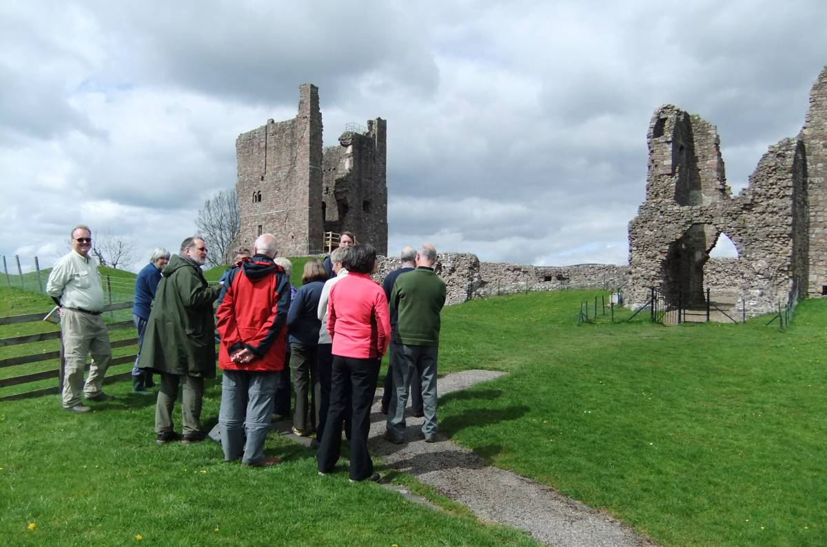
Rey Cross “Marching Camp†(Roman name unknown)
The site, of c20 acres, which is split by the A66 can be accessed from laybys on both north and south carriageways of the main road. The line of the earth ramparts, mostly un-ditched, is clear throughout the site, as are the tituli (outlying banks defending entrances) which are, unusually, circular or oval.
Marching camps, being temporary structures built on campaign and occupied for short periods of time, are notoriously hard to date. The definitive report (see references) refers throughout to the “putative†definition of the site. That said, it seems likely that Rey Cross is the best preserved of a series of campaign camps (others have been identified at Crackenthorpe, Plumpton Head, Cow Close and Kirby Thore) related to the initial campaign to subjugate the Brigantes after the fall of Cartimandua, carried out by the Governor Petilius Cerialis (71-73/4) marching north from the then legionary base at Lincoln and crossing to Carlisle over Stainmore.
Rey Cross is comparable in area to a legionary fortress and could well have held a force of more than 5000, probably a part of the IX Hispana legion (Cerialis’s old command when he was legionary legate at the time of the Boudiccan revolt) based at Lincoln plus auxiliary cohorts.
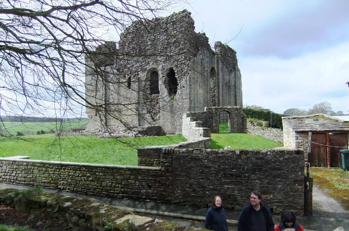
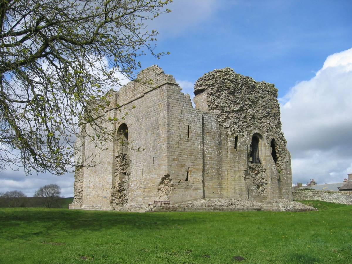
Brough Roman Fort (Verteris)
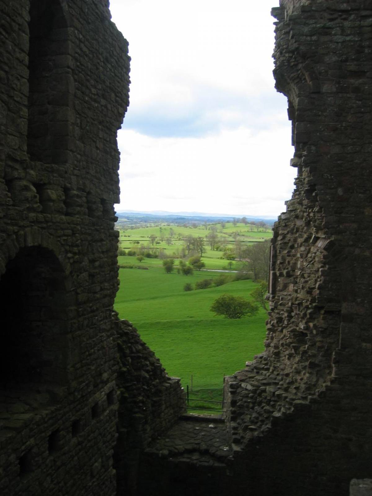
The site, of c2.8 acres, is accessed from the Castle which overlies the northern half. The line of the ramparts can be traced in the fields to the south and west.
Units attested are the Cohors VII Thracum, and the Numerus Directorum.
The fort site has yielded pottery from the Flavian period (70s-90s) through to the late 4th century. A timber and stone vicus east of the fort has revealed no pottery either as early or as late as those dates. There was a bathhouse to the south where a piece of Tan Hill coal was found, unfortunately insufficiently secure stratigraphically to suggest that such coal was used for firing the furnace. Excavations in the cemetery east of the fort revealed cremation burials as late as the 4th century (possibly indicating military conservatism when elsewhere inhumation had become more common). Inscriptions include one in Greek to Hermes of Commagene who died aged 16. A haul of 187 lead seals, possibly used to address consignments of goods or for stock control, was found in the beck to the north of the fort. Named destinations include Brough itself (the most numerous), Whitley castle, Lancaster and Ilkley, and seals of the legion II Augusta (long based at Caerleon). Authorities differ on whether these indicate that Brough was a transit post for military supplies, or whether this was a scrap-dealers stock.
References
Bidwell, Paul, and Hodgson, Nick, The Roman Army in Northern England, The Arbeia Society 2009
Frere S. S. and Fitts R. L., Excavations at Bowes and Lease Rigg Roman Forts, Yorkshire Archaeological Report No.6, Yorkshire Archaeological Society 2009
Vyner, Blaise et al, Stainmore – The Archaeology of a North Pennine Pass, Tees Archaeology Monograph Series vol.1, Tees Archaeology and English Heritage 2001
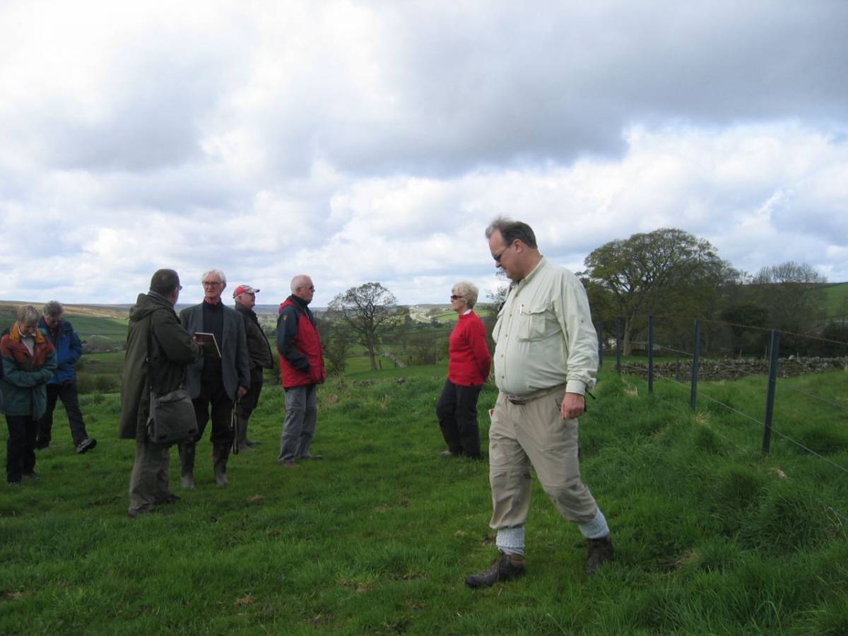
| | Dimensions | | | Geographical area | | | Species | | | Scientific Name | | | Common / Notable Species | | | Tree and / or Stem Girth | | | Tree: Position / Form / Status | | | Tree Site ID | 0 | | Associated Site SWAAG ID | 0 | | Additional Notes | The photographs attached show SWAAG Members enjoying a fine April Day at the Roman Forts detailed above of which those at Bowes and Brough were reoccupied and strengthened as Norman and Medieval Castles on what was then the effective boundary with Scotland, under the expert guidance of Peter on their way across the A66 to visit Prehistoric Sites in the Vale of Eden.
Due to lack of time,we were unable to arrange to see the fine roman inscriptions inside Bowes Church. A further visit is indicated. | | Image 1 ID | 2940 Click image to enlarge | | Image 1 Description | Bowes | 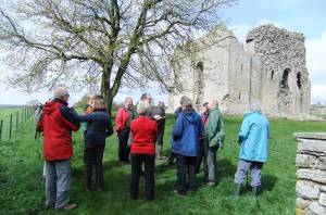 | | Image 2 ID | 2941 Click image to enlarge | | Image 2 Description | Bowes | 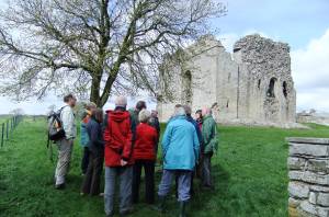 | | Image 3 ID | 2942 Click image to enlarge | | Image 3 Description | Bowes. The Norman Castle. | 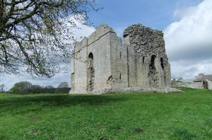 | | Image 4 ID | 2943 Click image to enlarge | | Image 4 Description | Bowes. | 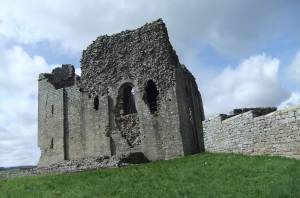 | | Image 5 ID | 2944 Click image to enlarge | | Image 5 Description | Bowes |  | | Image 6 ID | 2945 Click image to enlarge | | Image 6 Description | Bowes | 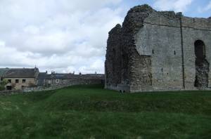 | | Image 7 ID | 2946 Click image to enlarge | | Image 7 Description | Bowes |  | | Image 8 ID | 2947 Click image to enlarge | | Image 8 Description | Bowes. Except for the poor suffering Boarded School Children, all Bowes residents seem to be long lived | 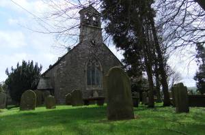 | | Image 9 ID | 2948 Click image to enlarge | | Image 9 Description | | 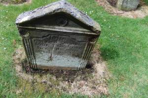 | | Image 10 ID | 2949 Click image to enlarge | | Image 10 Description | Brough. The introduction. | 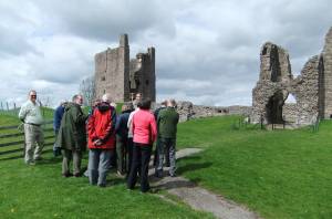 | | Image 11 ID | 2950 | | Image 11 Description | Brough. |  | | Image 12 ID | 3063 | | Image 12 Description | The Norman Castle at Bowes. Image Jocelyn Campbell. | 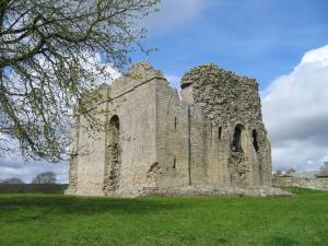 | | Image 13 ID | 3064 | | Image 13 Description | SWAAG in discussion. Bowes Roman Fort. Image Jocelyn Campbell. | 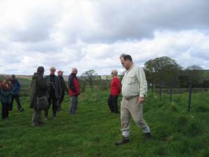 | | Image 14 ID | 3065 | | Image 14 Description | The Medieval Castle at Brough. SE Corner. Image Jocelyn Campbell | 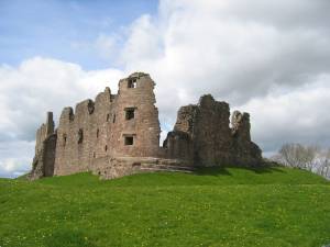 | | Image 15 ID | 3066 | | Image 15 Description | The Medieval Castle at Brough. View westward, ancient Ash Pollard (remains of). | 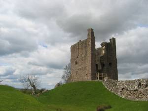 | | Image 16 ID | 3067 | | Image 16 Description | The Medieval Castle at Brough. What a nice view you have! Image Jocelyn Campbell. | 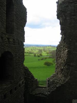 | | Image 17 ID | 3251 | | Image 17 Description | Samian sherd from Bowes Churchyard.Reference to Oswald and Pryce, T Davies, 1920 An Introduction to the study of Terra Sigillata suggests that this sherd was from near the footring of a small Form 30 cup manufactured at HEILIGENBERG, close to Lake Constance. The wall of the sherd is only 3mm thick and Rouletted externally. It is likely to be Hadrianic in date (117 – 138 AD)
It is a surface find from the top NE corner of the new burial ground at Bowes.
Submitted by Mrs Jocelyn Campbell with the contextual note from Mr Giles Cooper. | 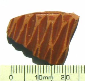 | |