Reeth
Museum's Digital Image Archive has beeen
transfered to the Resource Centre in
Keld.
|
| Dr Arthur Raistrick - polymath |
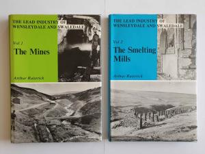
Although most members were aware of Dr Arthur Raistrick’s books on the mines and smelting mills of Wensleydale and Swaledale, few of us knew what a prolific writer he was until we heard Dr Richard Smith’s talk. Richard is editor of the Northern Mine Research Society’s journal and co-author of four books on tin analysis, bulk sampling and lead mining in the West Pennines and Cornwall. He has published over 40 research papers on a variety of topics. He is particularly interested in medieval smelting and took part in the SWAAG/NMRS excavation of a lead smelting site, at Fremington, in 2013. His talk examined Raistrick’s contribution to mining history.
Raistrick could be described as a polymath – he was a geologist, palynologist, archaeologist, academic and writer. Born in 1896, he graduated in civil engineering and later obtained a doctorate in geology. His pacifist views led to his imprisonment as a conscientious objector in the First World War. He became a Quaker and during the Second World War kept his earnings below the income tax threshold to avoid any contribution to the war effort. His employment prospects and academic career suffered.
Raistrick was a pioneer of industrial archaeology, making a significant contribution to the understanding of the development of lead mining in the Pennines. He was particularly interested in the role of the London Lead Company, based in Middleton-in Teesdale, which was sometimes known as ‘The Quaker Company’ because of its origins. The company took a wide interest in their employees’ welfare, building houses, schools and libraries. In return they expected temperance and a high moral standard from their workers. Raistrick wrote several papers and books on the company’s contribution to industrial welfare.
During his lifetime, until his death in 1991, Raistrick wrote over 300 books and research papers. He also played an important role in preserving mining archives for future generations. Many of his works are still relevant to study of mining history today and his accuracy has only occasionally been challenged.
J. H. |
 |
|
|
|
| Click an image to enlarge in a new tab |
| |
|
|
|
|
| News Record: 191 Updated: 20-09-2024 15:40:09 |
|
|
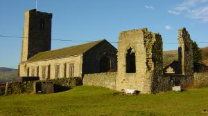
| In the Footsteps of Nuns |
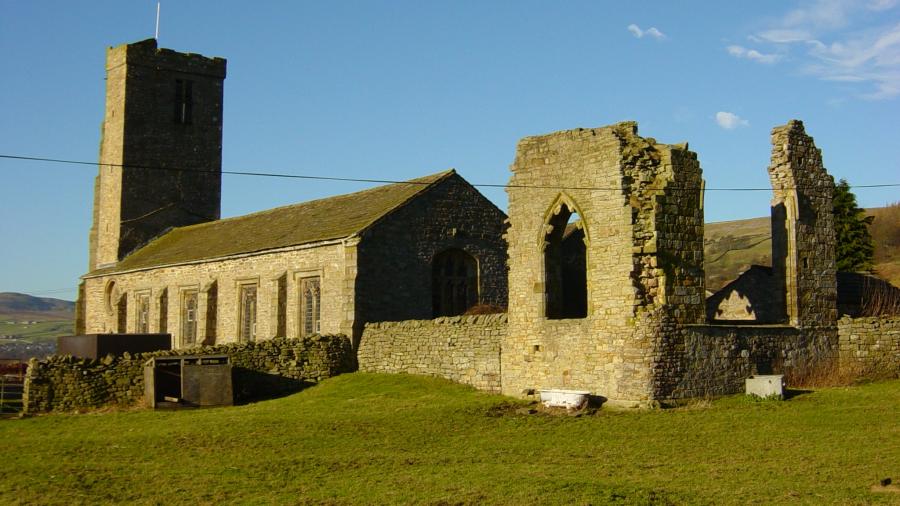
Sandy Carter, who is the Development Officer at Marrick Priory, was our speaker in July. The priory is an outdoor education and residential centre, but its history goes back to the 12th century when it was founded as a Benedictine nunnery.
Unlike Ellerton Priory just to the south, it escaped destruction during the marauding raids of the Scots in the 14th century but was closed two hundred years later during Henry VIII’s dissolution of the monasteries. The prioress, Christabel Cowper, and sixteen nuns were evicted in 1540. The leasehold and then the ownership passed to Sir John Woodall.
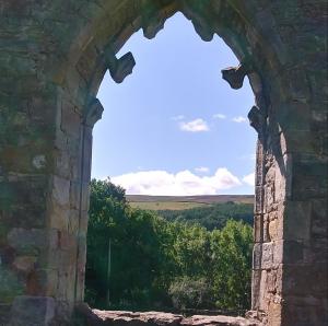
The church continued to be used as a place of worship down the centuries, although it was rebuilt in 1811, incorporating some of the earlier structures. It is all that remains of the original priory, apart from some enigmatic pieces of stonework in the grounds. The last services were held there in the 1940s.
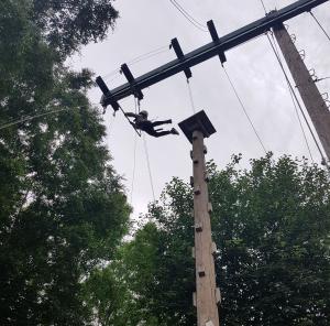
The priory was opened as an outdoor education centre in the 1970s. It offers the opportunity for young people to spend time together in a rural setting with a rich historical past. They can try a wide-range of exciting activities, such as canoeing, archery, abseiling and high ropes and most leave with unforgettable memories of their time there.
J. H. |
 |
 |
| Marrick Priory |
|
| Click an image to enlarge in a new tab |
| |
 |
|
| The high ropes |
|
| News Record: 190 Updated: 11-08-2024 14:03:21 |
|
|
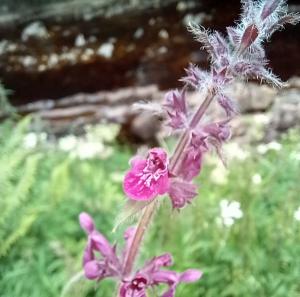
| SWAAG Wildflower walk – July 2024 |
A group of 9 met at Rukin’s car park in Keld for a short walk led by Sue Knight and Janet Bethune. The walk was about a mile in total to allow for the slow pace needed for adequate discussion of the flowers and grasses which were encountered. The group were provided with hand-lenses and a list of about 70 plants they were likely to see. The aim of the walk was to point out distinguishing features that would help people remember the plants.
We started with the common buttercup and how to separate Meadow and Creeping Buttercups and then focused on a range of grasses. The commonest was the soft, downy Yorkshire Fog. One member wondered if references to putting cows out into the “fog” and producing “fog cheese” from their milk could be a reference to this . A special plant for the northern dales was Melancholy Thistle, which put on a superb show. In spite of being a thistle, it has no spines. We also tackled a couple of ferns, with lenses out so the shape of the fronds could be checked.
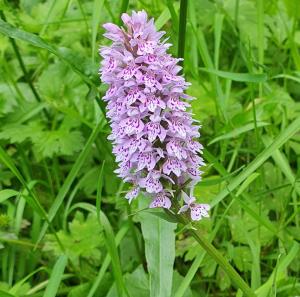
Everyone managed to see the subtle differences between Male Fern and Lady Fern, the latter having a more delicate appearance! Colour was provided by the Monkey Flower, Meadowsweet and Common Spotted orchid. The sense of smell can also be used to help name a flower and the horrid smell of Woundwort and Herb Robert is not easily forgotten. We ended by testing the sense of smell on a more pleasant note by comparing Garden Mint and Water Mint, the latter having a fresher, spearminty smell.
We returned to the car park as the heavens opened and pleased that the walk had been dry. |
 |
 |
| Common Spotted Orchid |
Hedge Wound Wort |
| Click an image to enlarge in a new tab |
| |
 |
|
| Small Copper on a Melancholy Thistle |
|
| News Record: 189 Updated: 18-07-2024 11:21:36 |
|
|
|