|
| *****SWAAG_ID***** | 98 |
| Date Entered | 12/01/2011 |
| Updated on | 03/11/2012 |
| Recorded by | Tim Laurie |
| Category | Burnt Mound |
| Record Type | Archaeology |
| SWAAG Site Name | |
| Site Type | |
| Site Name | |
| Site Description | |
| Site Access | Not known |
| Record Date | 01/01/2005 |
| Location | Upper Teesdale. Beside small sike on floodplain, south of the River Tees. Below Cronkley Scar. |
| Civil Parish | Forest and Frith |
| Brit. National Grid | NY 8426 2968 |
| Altitude | 380m |
| Geology | On gravel floodplain some 250m south of the River Tees. |
| Record Name | Burnt Mound surveyed by Tim Laurie |
| Record Description | Close to the Tees but not on the river bank itself . This site is large and located on the bank of an abandoned spring stream. This site is a penannular bank of fire cracked stone with a flat circular interior. One orthostat indicates a structure within the penannular bank. The most westerly burnt mound located in Teesdale to date.
Non diagnostic lithic finds reported by The Late Dennis Coggins from erosion patch by at base of the River Bank.
Reference:
Laurie, T.C. 2003. �Researching the Prehistory of Wensleydale, Swaledale and Teesdale�. Gazetteer of Burnt Mound Sites. In: T.G. Manby, Patrick Ottaway and Stephen Moorhouse. Eds. �The Archaeology of Yorkshire. An assessment at the end of the 21st century�. pp223-253 |
| Dimensions | Large, high |
| Geographical area | |
| Species | |
| Scientific Name | |
| Common / Notable Species | |
| Tree and / or Stem Girth | |
| Tree: Position / Form / Status | |
| Tree Site ID | 0 |
| Associated Site SWAAG ID | 0 |
| Additional Notes | Dimensions.
Size: Small <6m, Medium 6m-9m, Large 10m-15m, Extra large >15m.
Height: Low <0.5m, Average 0.5-1.0m, High >1.0m.
Revisited 01.11.2012, see photos. Erosion surfaces caused since previous visit show the highly compacted burnt stone core of the mound, previously not visible. |
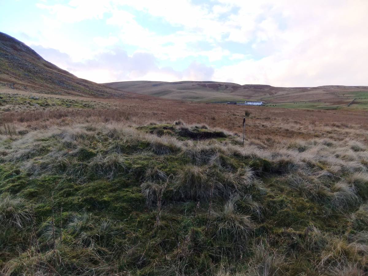
| Image 1 ID | 3589 Click image to enlarge |
| Image 1 Description | The burnt mound view westward. Cronkley Scar in background. | 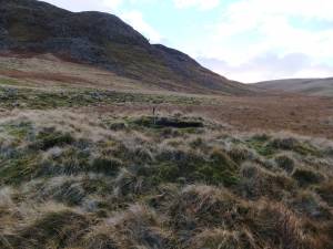 |
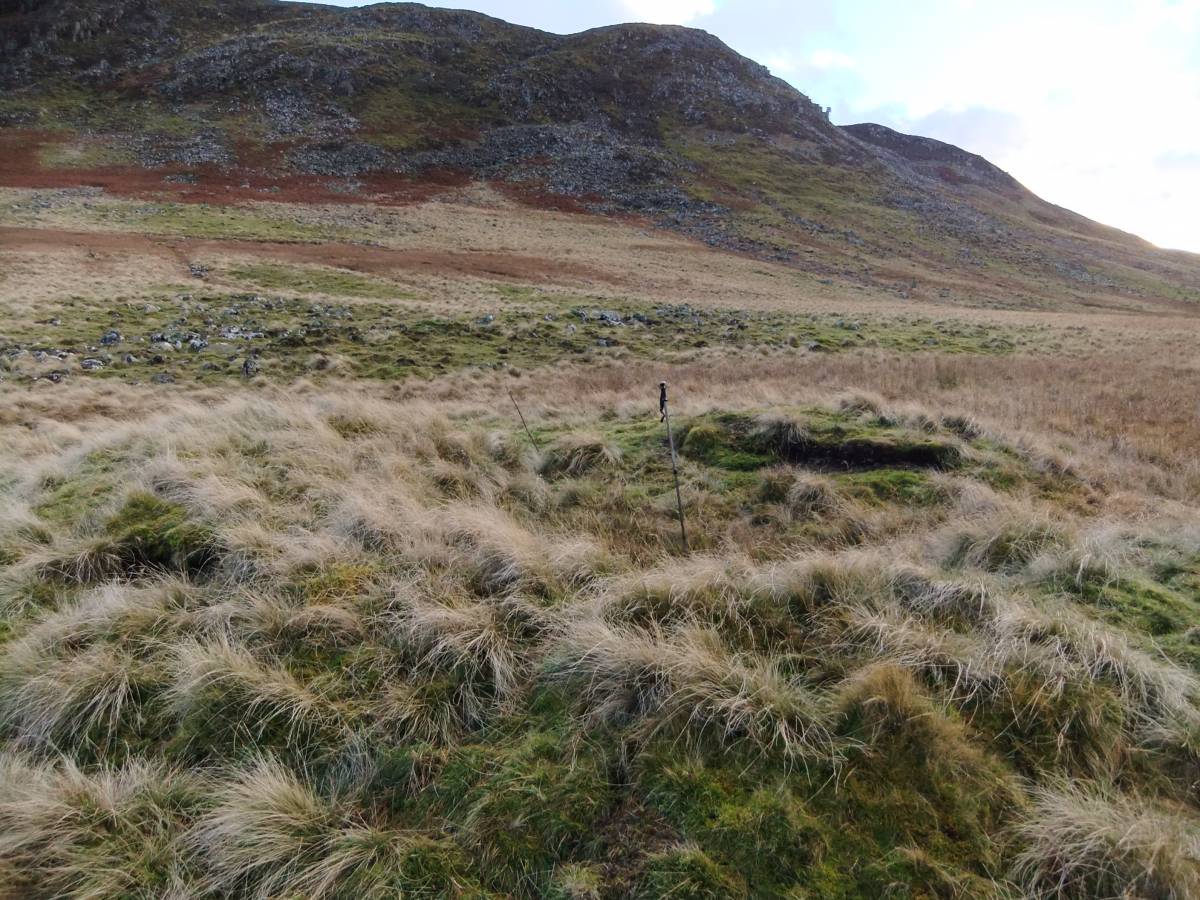
| Image 2 ID | 3590 Click image to enlarge |
| Image 2 Description | View towards Widdibank Farm 1km upstream. | 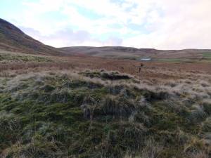 |
| Image 3 ID | 3591 Click image to enlarge |
| Image 3 Description | | 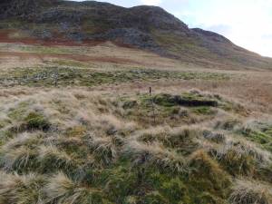 |
| Image 4 ID | 3592 Click image to enlarge |
| Image 4 Description | Burnt stone core of the mound revealed by recent erosion. | 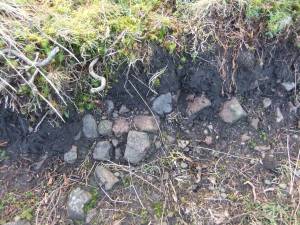 |
| Image 5 ID | 3593 Click image to enlarge |
| Image 5 Description | | 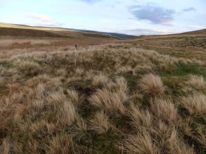 |
| Image 6 ID | 3594 Click image to enlarge |
| Image 6 Description | Circular area at centre of the mound, trough and possible timber framed shelter. | 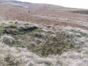 |