|
| *****SWAAG_ID***** | 819 |
| Date Entered | 27/07/2014 |
| Updated on | 15/09/2014 |
| Recorded by | Doug Waugh |
| Category | Geological Record |
| Record Type | Miscellaneous |
| SWAAG Site | Grinton Moor |
| Site Access | Public Access Land |
| Record Date | 24/07/2014 |
| Location | Grinton Moor above Grovebeck Gill oppposite the end of the Earthworks. |
| Civil Parish | Grinton |
| Brit. National Grid | SE 04136 97352 |
| Altitude | 321mtrs |
| Record Name | Fossil remains on rock. |
| Record Description | Fossilised marks on stone. The fossil has not been identifed and remains a mystery. Can anyone throw any light on this?
To find the stone leave the Grinton to Redmire road at SE 044974 on the track to Grovebeck Gill and High Harker Hill and proceed on the track for approx 400 strides (280 metres). At this point to the North of the track, about 7.5 metres away, is a large (80cm x 80cm) stone, number 1 of 4 in a rough line (3mtrs, 1mtr and 2.5mtrs apart). |
| Dimensions | 21.8cms x 43cms maximum. |
| Image 1 ID | 5620 Click image to enlarge |
| Image 1 Description | Photograph of complete image. The length of the main portion is 218mm while the breadth towards the rounded end is 30mm and 43mm before the bend, the diffrence being due to a shallow, triangular area. | 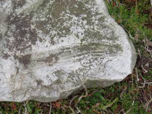 |
| Image 2 ID | 5621 Click image to enlarge |
| Image 2 Description | Photograph of the point where the fossil bends. | 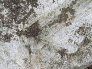 |
| Image 3 ID | 5622 Click image to enlarge |
| Image 3 Description | Photograph showing the rounded end of the fossil | 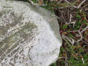 |
| Image 4 ID | 5552 Click image to enlarge |
| Image 4 Description | Photograph to illustrate the cellular structure of the fossil. | 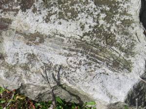 |
| Image 5 ID | 5818 Click image to enlarge |
| Image 5 Description | This picture shows the view from the track of the complex area of stones to the North and the stone with the fossil is on the right, the medium sized stone just before the large one, about half-way up the picture. | 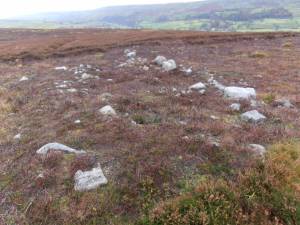 |


