|
| *****SWAAG_ID***** | 771 |
| Date Entered | 30/12/2013 |
| Updated on | 02/01/2014 |
| Recorded by | Stephen Eastmead |
| Category | Geophysical Record |
| Record Type | Archaeology |
| SWAAG Site | Hagg Farm |
| Site Access | Private |
| Record Date | 29/12/2013 |
| Location | Hagg Farm Field 3884 Rectangular Bank / Platform |
| Civil Parish | Reeth |
| Brit. National Grid | SE 05365 98844 |
| Altitude | 206m |
| Record Name | Gradiometer Survey |
| Record Description | Magnetic survey using a Bartington 601-2 Gradiometer. 20x20m grid. Images show the location on the 1:10,000 OS map and Google Earth, the precise GPS data and minimum processed survey data. |
| Additional Notes | Survey by Mike Walton and Stephen Eastmead. |
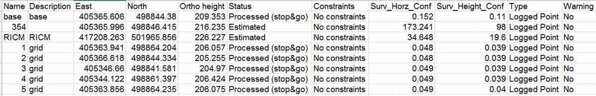
| Image 1 ID | 4934 Click image to enlarge |
| Image 1 Description | GPS corrected data Confidence 4-5cm horizontally and vertically | 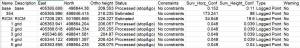 |
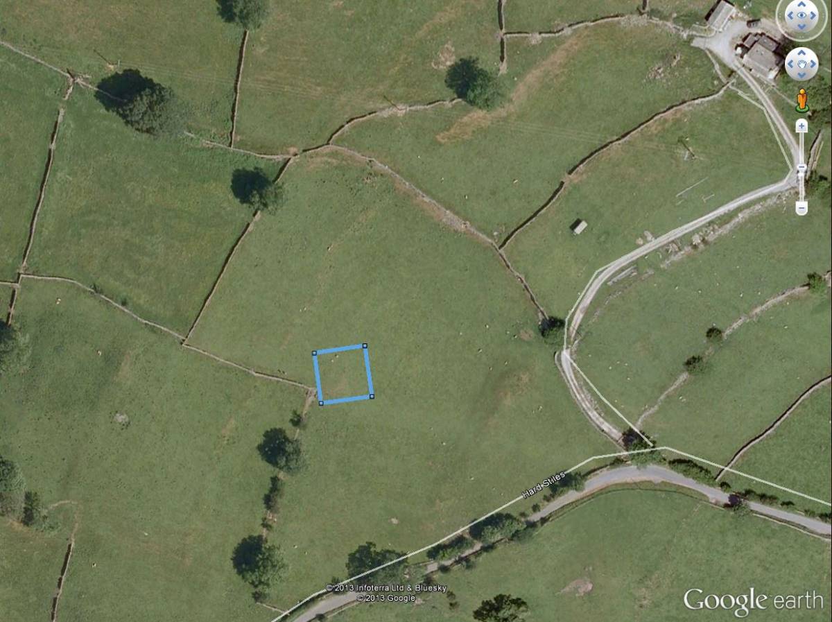
| Image 2 ID | 4931 Click image to enlarge |
| Image 2 Description | Grid location on Google Earth | 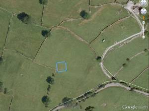 |
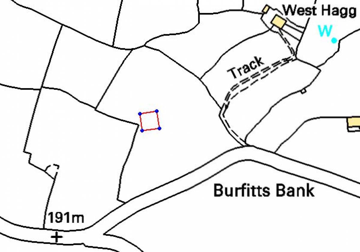
| Image 3 ID | 4933 Click image to enlarge |
| Image 3 Description | Grid Location on OS 1:10,000 map. ©Crown copyright and database rights 2011 Ordnance Survey 1000237401, kindly supplied by the North Yorkshire Dales National Park Authority. | 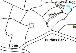 |
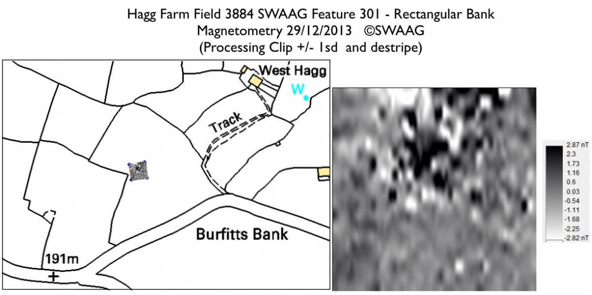
| Image 4 ID | 4938 Click image to enlarge |
| Image 4 Description | Gradiometer data ©SWAAG Map: ©Crown copyright and database rights 2011 Ordnance Survey 1000237401, kindly supplied by the North Yorkshire Dales National Park Authority. | 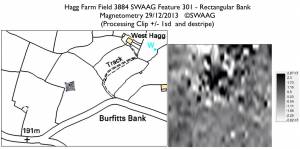 |
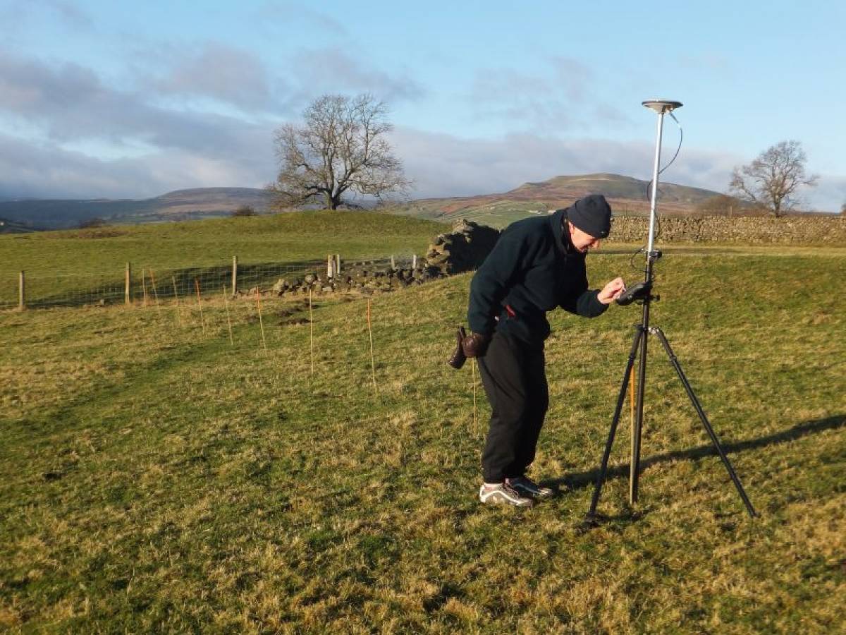
| Image 5 ID | 4935 Click image to enlarge |
| Image 5 Description | Collecting the grid GPS data with the bank in the background. | 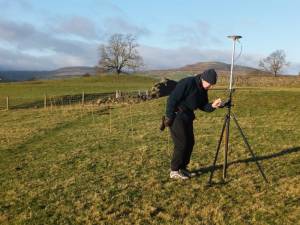 |