|
| *****SWAAG_ID***** | 638 | | Date Entered | 07/11/2012 | | Updated on | 07/11/2012 | | Recorded by | Tim Laurie | | Category | Geographical Record | | Record Type | General HER | | Record Date | 07/11/2012 | | Location | Grinton | | Civil Parish | Grinton | | Brit. National Grid | | | Altitude | 186m | | Geology | River Swale | | Record Name | Grinton Church and Bridge from The Hagg, Fremington. Autumn colour. | | Record Description | Telephoto images of Grinton,Grinton Pastures and Harkerside Moor from The River Swale to High Harker Hill, on a fine day from the excavations at The Hagg, Fremington. | | Image 1 ID | 3650 Click image to enlarge | | Image 1 Description | Grinton, the Church and Bridge in autumn colour | 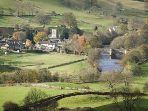 | | Image 2 ID | 3651 Click image to enlarge | | Image 2 Description | Grinton, from the Swale to High Harker Hill | 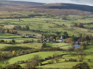 |
 |
|

