|
| *****SWAAG_ID***** | 552 |
| Date Entered | 25/06/2012 |
| Updated on | 25/06/2012 |
| Recorded by | Tim Laurie |
| Category | Geological Record |
| Record Type | Geological HER |
| Site Access | Public Footpath |
| Record Date | 24/06/2012 |
| Location | |
| Civil Parish | Not known |
| Brit. National Grid | NZ 133 152 |
| Altitude | 95m |
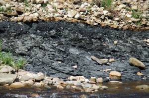
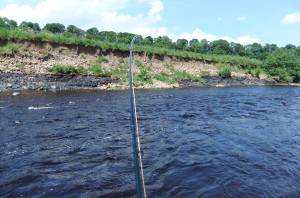
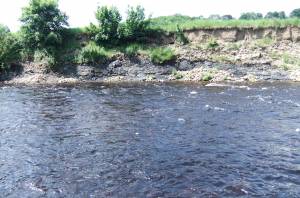
| Geology | Black shales in the Millstone Grit Series of Namurian Age exposed in the North Bank of the Tees below Ovington. A thin layer of ironstone nodules caps the layer, then a bed of gravel topped by river born silt and turf.
A colony of sand martins have made their nest burrows in the silt of the river bank. |
| Record Name | Ovington. River Tees, North Bank. Black shales and overlying gravels and silt. |
| Record Description | This bed of black shale or mudstone is unfossiliferous. |
| Additional Notes | These shales are usually unfossiliferous however the crowded remains of brachiopods, trilobites, bryophytes (Fenestrella sp.) and other fossils are occasionally found in thin calcareous marine bed bands and at at the base of thick beds of these shales.
Where marine shale bands outcrop in Upper Swaledale, sepages of calcium rich groundwater form tufa deposits with rich flora of high botanical interest.
Reference: British Geological Survey: The Geology of the countrey around Barnard Castle. |
| Image 1 ID | 3109 Click image to enlarge |
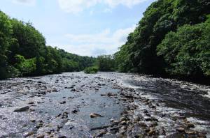
| Image 1 Description | River Tees below the Islands at Ovinton. Just a reminder that the banks of the River Tees between Barnard Castle and Darlington are accessible and of great beauty and interest to walkers and anglers alike. |  |
| Image 2 ID | 3108 Click image to enlarge |
| Image 2 Description | |  |
| Image 3 ID | 3110 Click image to enlarge |
| Image 3 Description | |  |
| Image 4 ID | 3111 Click image to enlarge |
| Image 4 Description | |  |


