|
| *****SWAAG_ID***** | 4 |
| Date Entered | 09/01/2011 |
| Updated on | 02/02/2012 |
| Recorded by | Tim Laurie |
| Category | Burnt Mound |
| Record Type | Archaeology |
| SWAAG Site | Stainton Moor |
| Site Access | Army Range |
| Record Date | 01/01/2005 |
| Location | Stainton Moor Springs 400m SE of The Ship Plantation. |
| Civil Parish | Stainton |
| Brit. National Grid | SE 0908 9668 |
| Altitude | 300m |
| Geology | Spring line on Richmond Cherts. |
| Record Name | Stainton CP. Stainton Springs. Group of four burnt mounds. |
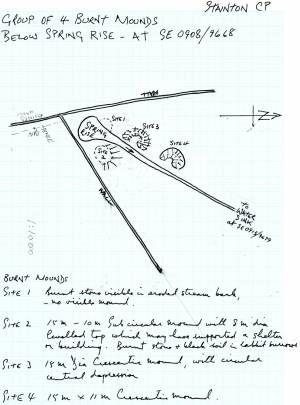
| Record Description | See Location Map and Site Sketch Plan, Figure 3 (STA07.01)
Site 1. Uppermost of four burnt mounds in enclosed pasture on western bank of small stream at springrise, See Figure 3 (STA07.01)Visible only as deposit of burnt stone in eroding bank of the stream.
Site 2. Located on eastern bank of the stream immediately below the spring rise.Very large burnt mound with flattened top indicating the presence of a sheltering structure.
Site 3. Located on western bank of the same spring stream but some 10m below Site 1 and the spring rise. Large site of characteristic crescentic form, entirely turf covered.
Site 4. Also located on the western bank of the same stream but some 10m below Site 3.
|
| Dimensions | Site 1: Small, low. Site 2 Very large, high. Site 3 Large, medium. Site 4 Large, medium.* |
| Additional Notes | *Indicative Dimensions:
Size: Small <6m, Medium 6m-9m, Large 10m-15m, Extra large >15m.
Height: Low <0.5m, Average 0.5-1.0m, High >1.0m.
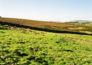
Site 2. Uppermost (east bank) of four burnt mounds at the same spring stream. This mound is a large oval low mound 15m*10m with a visibly levelled top 8m diameter (See photo STA07.02), probably the stance for a timber hut structure.
Site 3. On west bank, 10m below site 1 in pasture at the same spring. See Figure 3 (STA07.01.This mound is a large circular 15m diameter mound of characteristic crescent plan. Located on the west bank of the stream below site 1 at the spring head.
Site 4.See plan, Figure 3 (STA07.01)
This mound is a large oval mound 15m*11m on plan of characteristic crescent plan. Located on the west bank of the stream 10m below site 3.
These burnt mounds may relate to the unenclosed settlement to be recorded seperately south of the Ship Plantation, some 300m to the west. |
| Image 1 ID | 416 Click image to enlarge |
| Image 1 Description | Stainton CP. Stainton Springs. Group of four burnt mounds at the same spring rise. Location Plan. |  |
| Image 2 ID | 417 Click image to enlarge |
| Image 2 Description | Stainton Cp. Stainton Springs. Burnt mound Site 2. Note flattened platform, stance for timber structure. |  |
| Image 3 ID | 418 Click image to enlarge |
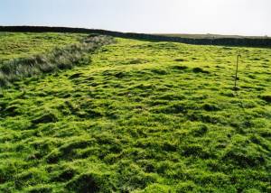
| Image 3 Description | Stainton CP. Stainton Springs. View towards spring rise from below Site 4. Sites 3 an 2 also visible. |  |
| Image 4 ID | 1642 Click image to enlarge |
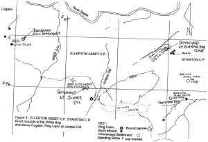
| Image 4 Description | Location Map. Ellerton and Stainton Moors. Prehistoric Sites. |  |


