|
| *****SWAAG_ID***** | 318 |
| Date Entered | 07/11/2011 |
| Updated on | 05/01/2012 |
| Recorded by | Tim Laurie |
| Category | Settlement |
| Record Type | Archaeology |
| Record Date | 15/03/2006 |
| Location | Hurst Moor. Moresdale Ridge. |
| Civil Parish | Marrick |
| Brit. National Grid | Hidden |
| Altitude | 400m |
| Geology | Richmond cherts. |
| Record Name | Marrick CP. Moresdale Ridge. Cairnfield settlement and Cup marked cairn |
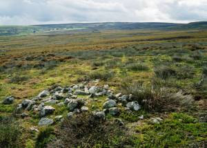
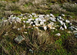
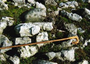
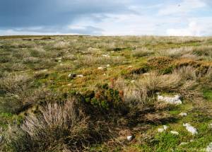
| Record Description | Curving Stone bank which may be a large 70m diameter enclosure with several small cairns one of which is cupmarked, see photograph. On south facing heather moorland. Now masked below heather. |
| Dimensions | See photographs |
| Additional Notes | This stone banked enclosure and the group of small stone cairns nearby are characteristic of bronze age cairnfield type settlements throughout the Uplands of Northern Britain.
They are especially frequent on the high moorland above the Swale and its north bank tributary streams
The placing of the cup marked rock on one of the cairns could be fortuitous, but is more probably a deliberate deposition in recognition of a burial below the cairn.
Undisturbed and long may it so remain.
Very few undisturbed cairns with cup marks survive.
Several rock art sites known to exist below Holgate How 1.5km to the east, see Beckensall and Laurie 1998. |
| Image 1 ID | 1170 Click image to enlarge |
| Image 1 Description | Small cup marked cairn, Moresdale Ridge. |  |
| Image 2 ID | 1168 Click image to enlarge |
| Image 2 Description | Cup marked cairn. |  |
| Image 3 ID | 1169 Click image to enlarge |
| Image 3 Description | Cup marked cairn, detail. |  |
| Image 4 ID | 1171 Click image to enlarge |
| Image 4 Description | Possible curvilinear enclosure defined by a very low but substantial spread stone bank. |  |


