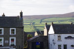
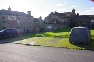
25 Members and guests joined Alan and Judith Mills on Saturday 7th September, to explore the local history of Reeth and its surrounding area.
Starting on Reeth green Alan discussed the development of the village and its appearance as incomplete planned village. Reeth got is Market Charter in 1695. Buildings dating from medieval, through Georgian to more modern alterations in late 19C and early 20C periods were discussed.
From the bandstand the western part of the Grinton – Fremington Dykes and the Romano- British settlement. Following along the line of Harkerside the southern dykes can be observed.
Further investigation of the green area the Porters Lodge for the Reeth Poor Law Union Workhouse was pointed out. In operation from 1840 to 1930 the workhouse housed up to 80 paupers.
Leaving the Green we passed down towards Reeth bridge (built 1772/3) passing Stonegate (many of which were shops in earlier times). Arriving at Fremington Corn Mill it is possible to see the water wheel still in situ in the building. The first record of the mill was in 1288, the current building dates from 1751 and closed around 1900.
As we approached Draycott Hall a ditch and bank can be observed running up to High Fremington. A little further along the road to the right an eroded bank can be seen – is this part of the dyke system or not?
We then progressed towards Grinton. The bridge was constructed 1797, looking underneath you can see where the medieval bridge was widened to accommodate more traffic.
Passing through the church yard in Grinton we moved along the Corpse Way. You can now see more parts of the “dyke” system. Here the ditch and bank are clear. There are 7 sections of the dyke in the area – possible Bronze Age / Iron Age / Viking? – but probably multi period, extended and reused as required over the ages.
Swale Hall Farm is one of the oldest houses in the area. This is a possible site of a corn mill, usually every manor house had a corn mill (this is the manor of West Grinton). Moving on we passed a Bronze age burial mound, the Romano British settlement we had seen from Reeth Green, a Burnt Mound and a Tufa Quarry (white calcium carbonate – limestone – used as a fertiliser).
At the Swing Bridge you can see How Hill to your left (a worked mound with a possible settlement on top. Across the river you can see the strip lynchets (terraces) dating from 14th C.
|

