| Viewing swaag.org website implies consent to set cookies on your computer. Full details | Swaledale and
Arkengarthdale Archaeology Group Registered Charitable Incorporated Organisation Number 1155775 |
SWAAG Honorary President:
Tim Laurie F,S,A, |
| SWAAG News Archive | |
| News Archive | |
| Addlebrough June 2024 | |
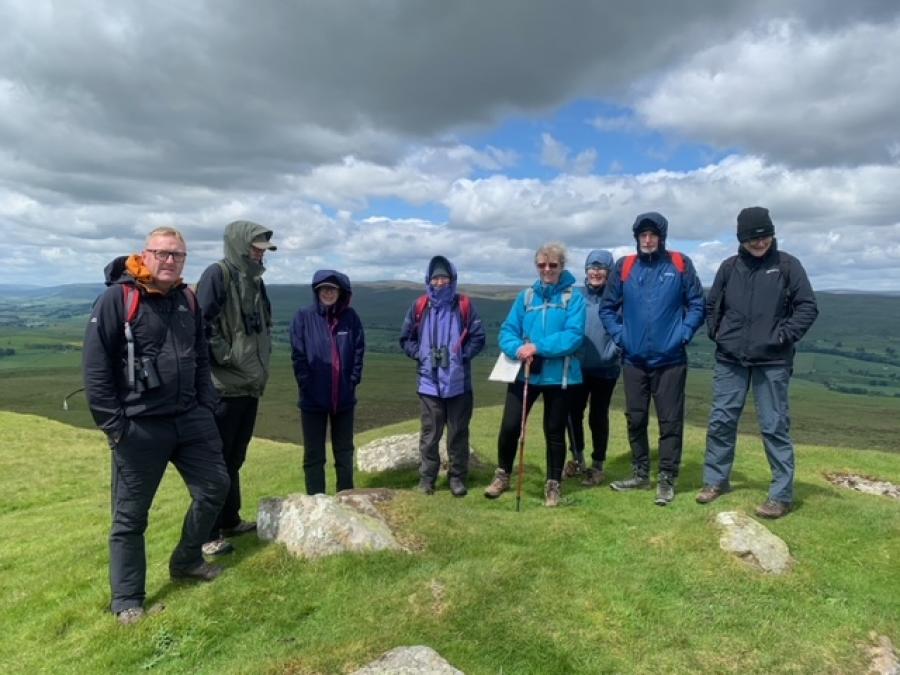
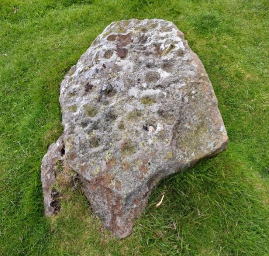
| The aim of the walk was to start from the village of Thornton Rust in Wensleydale to the summit of Addlebrough and to view the bronze age burial mound and cup marked stones on the summit. The nine of us met in the small car park in Thornton Rust, a small village on the south side of Wensleydale. After reading the information board about the sheep dip in the stream next to the car park we set off at 10.30am. After a few hundred metres along a walled track, we reached the fields heading to the heathland below Addlebrough. Eventually after a few ladder stiles we reached what could possibly be a large standing stone that had toppled over and from here we got our first view of the bronze age / iron age settlement that was visible on Greenber Edge to the south. We then set off on the steady climb up Addlebrough. Once on the top we were greeted with stunning views of Wensleydale. We could see across to Carperby and the bronze age burial mounds above the village, bronze age settlement at Pen Hill and the henge above Aysgarth which was at the centre of these settlements. We made our way to the south side of the summit where we could view the settlement on Greenber Edge including Stoney Raise cairn which is the largest stone cairn in the northern Pennines measuring 30 metres across and 2 meters high. The settlement is almost one kilometre in length and very visible in the landscape. It had been used many times over the centuries including iron age / Roman and possibly in medieval times. After lunch we headed around to the north side of the summit looking at various features on the way until we reached the burial mound with some beautiful cup-marked stones on top. This burial has stunning views of the full length of Wensleydale. We then walked around to the west side of the summit in strong winds to view the remains of some medieval house and field plots of stone which are still visible. From here we could see Semer Water and the huge boulder named the Devil’s Stone that lay below. The wind was now really strong so we decided to return to Thornton Rust off the front of Addlebrough. On the way we observed lots of natural springs and looked for the many possible burnt mounds that are around Addlebrough and Thornton Moor. Burnt mounds are mounds containing a large pile of burnt stones and a trough that would have contained water from the spring. The hot stones would have been added to the water, these are believed to be bronze age and found all over northern Europe. It is not known whether these are prehistoric saunas, for industrial use such as leather working or of a ritual purpose. Once we had crossed a few more fields we were on the road that led us back to Thornton Rust and the car park. The four-hour round journey took in stunning views of Wensleydale and the rich archaeology in this bronze age landscape. |
|
 |
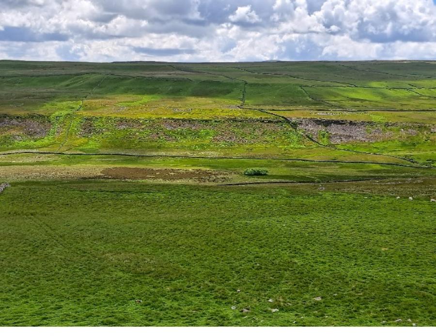 |
| SWAAG Members on the summit of Addlebrough at the bronze-age burial mound with cupped stones | Greenber Edge Settlement and Stoney Raise Cairn |
| Click Images to Enlarge | |
 |
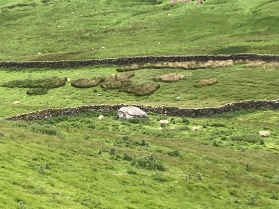 |
| One of the cupped marked stones on the burial mound, Addlebrough | Devil’s Stone |
| News Record: 187 Updated: 21-06-2024 11:47:50 | |