| Viewing swaag.org website implies consent to set cookies on your computer. Full details | Swaledale and
Arkengarthdale Archaeology Group Registered Charitable Incorporated Organisation Number 1155775 |
SWAAG Honorary President:
Tim Laurie F,S,A, |
| SWAAG News Archive | |
| News Archive | |
| Walk to a Romano-British settlement near Applegarth | |
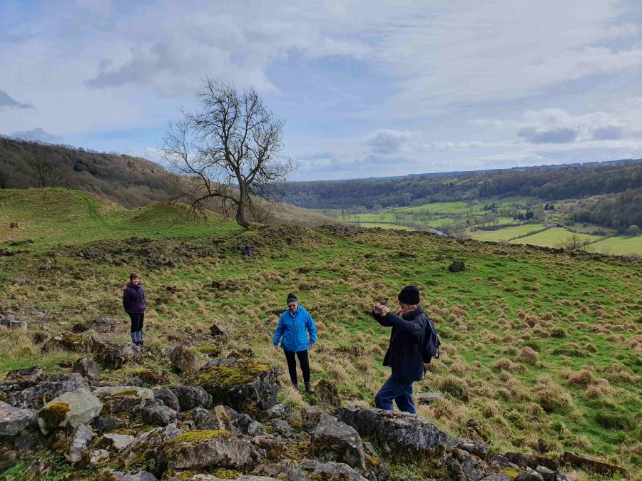
| The postponed walk to the enclosed Romano-British settlement below Whitcliffe Scar finally took place in mid-March. Six SWAAG members met leaders Rod Flint and Jane Harrison at Marske. The original plan to follow the Coast-to-Coast footpath across the fields was abandoned in favour of picking up the ancient trackway further along the tarmac road. As a result of the detour we avoided getting very wet feet, spotted an old sunken trackway running parallel to the modern road and discovered several newts in a trough! Jane explained how Swaledale owes its distinctive character to the underlying Yoredale rocks and subsequent erosion by ice and water. The more resistant limestones and the overlying cherts form the higher ground and scars on the north side of the valley. On the southern side of the valley these are overlain by younger rocks which were mostly deposited in terrestrial rather than marine environments. Thin coal seams were able to form and were mined for a limited time on Downholme Moor. The settlers at Applegarth probably made use of natural features when building their settlement below Whitcliffe Scar. There are several springs in the vicinity and the steep rampart overlooking the approaching sunken way may be a modified fluvial or glacial deposit. We explored the site after lunch. There are two main enclosures separated by a sunken track. Both contain the remains of buildings. The most interesting features are the unusual beehive structures in the east wall of the eastern enclosure. Further exploration revealed there were probably others which have either collapsed or have been buried below rock fall. Further information is available on SWAAG database record 228 or on Historic England’s website. List entry: 1018335. Of the rumoured lead mine, we could see no evidence! Although it was cold and drizzly when we met, the day stayed dry, and we were rewarded with some beautiful views along Swaledale when the sun came out. There were good views of the cultivation terraces when we walked back down to Marske. These are thought to pre-date the medieval ridge and furrow. J.H. |
|
 |
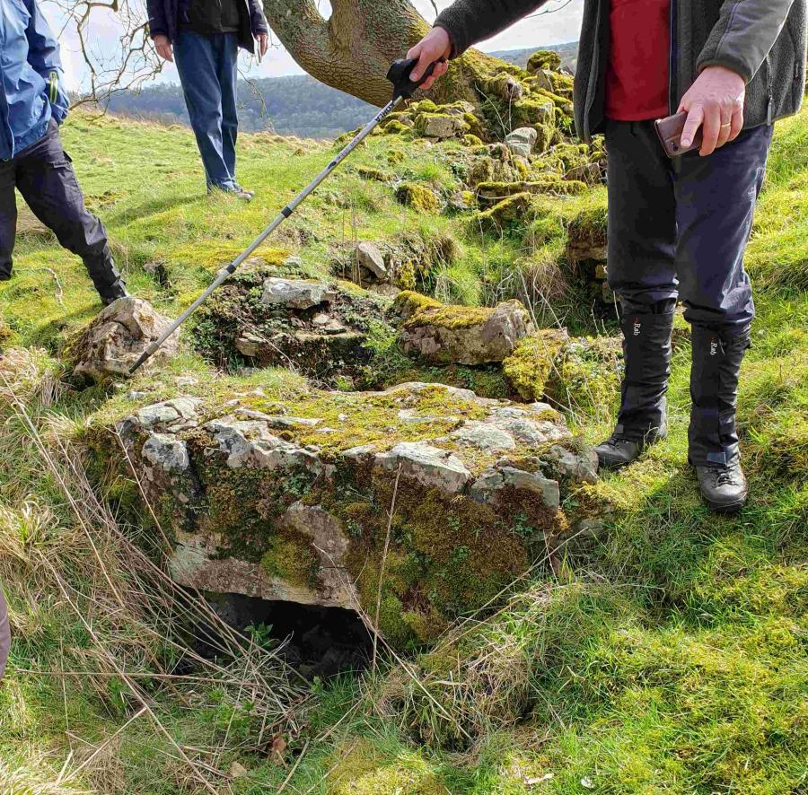 |
| Beehive feature in eastern enclosure | Close-up of beehive feature |
| Click Images to Enlarge | |
 |
 |
| View eastwards across eastern enclosure | Cultivation terraces at Marske |
| News Record: 183 Updated: 09-05-2024 11:42:28 | |