| Viewing swaag.org website implies consent to set cookies on your computer. Full details | Swaledale and
Arkengarthdale Archaeology Group Registered Charitable Incorporated Organisation Number 1155775 |
SWAAG Honorary President:
Tim Laurie F,S,A, |
| SWAAG News Archive | |
| News Archive | |
| Scots Dyke - A talk and two walks | |
| Following her talk in March, Jane Harrison led two walks to look at sections of the Scots Dyke. The dyke is a linear earthwork which today stretches 14 kilometres, from near Stanwick St. John in the north, to just south of the river Swale in Richmond. Over time the embankment has become lower and wider, and the ditch has filled with debris. In places it has been ploughed out completely. Some better-preserved sections remain in the grounds of St. Nicholas and near Whitefields Farm, where a deliberate gap appears to exist. These were visited on the walks. The purpose of the dyke is unknown, but it probably served as a boundary, rather than as a defensive barrier. It still forms the eastern boundary of Richmond today. Who built it is conjecture, but the occupants of the oppidum at Stanwick might have had the necessary manpower and resources to complete this huge undertaking. There has only been limited excavation of the earthwork and one dating of the ditch suggests that it might have started to infill during the first century B.C. J. H. |
|
 |
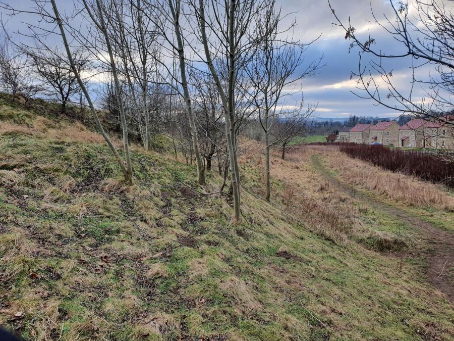 |
| Below Rimington Avenue | Near St. Nicholas Drive |
| Click Images to Enlarge | |
| News Record: 155 Updated: 26-05-2022 14:30:16 | |