 |
Swaledale and Arkengarthdale Archaeology Group The Swaledale Project 7000 Years of a Landscape and its People Registered Charitable Incorporated Organisation Number 1155775 |
|
| Grinton Archive: documents,
maps and images Some documents will take time to load. |
|
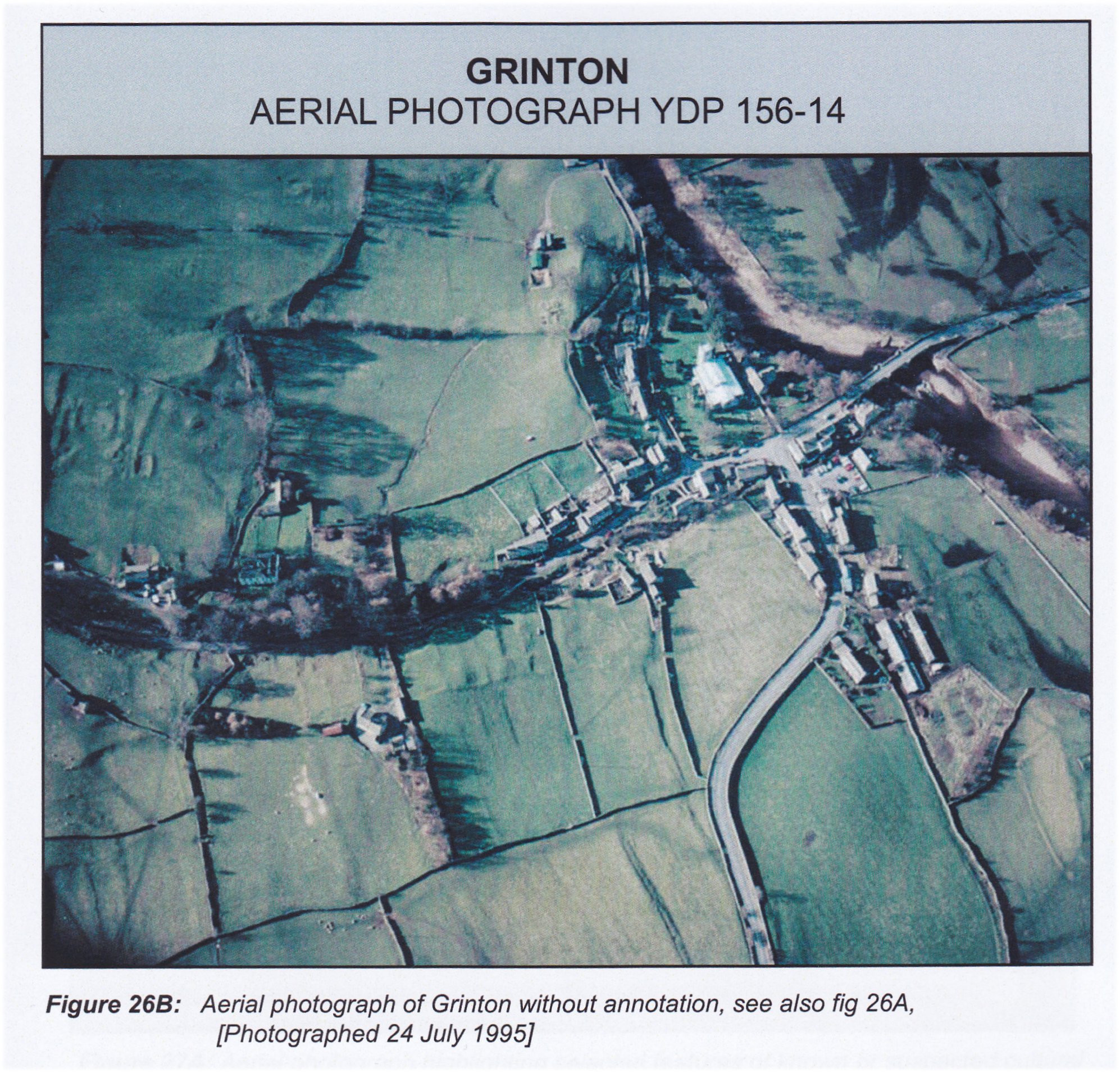 Aerial photograph of Grinton taken in 1995. ©R. White/YDNPA YDP156-14 illustrating the archaeological features. |
|
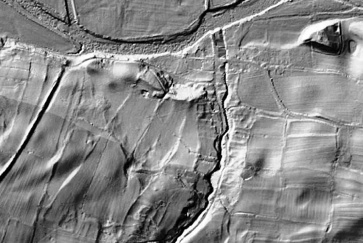 Lidar Image of Grinton © Environment Agency copyright 2013. All rights reserved. Showing the housing and garden plots of land on either side of Grinton Gill as it wends its way to join the R Swale at the top of the image. The surrounding fields show the ridge and furrow ploughing. At the top right is the western defended settlement sited on a glacial mound beside the swale and it associated pond. The eastern mound is just off this image. |
|
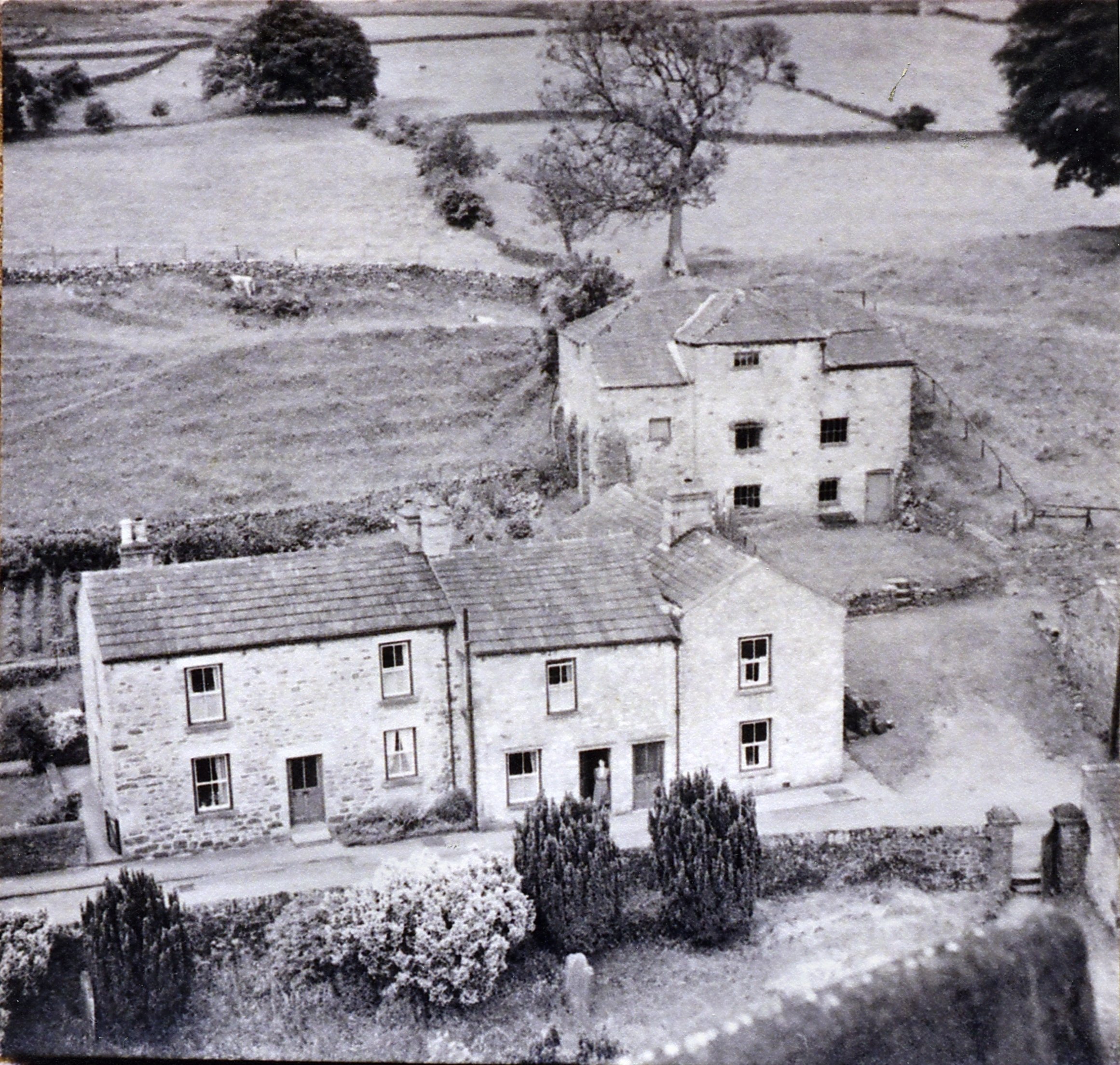 Grinton Mill around 1950, shortly before it was demolished although the house still stands. © Tim Mason |
|
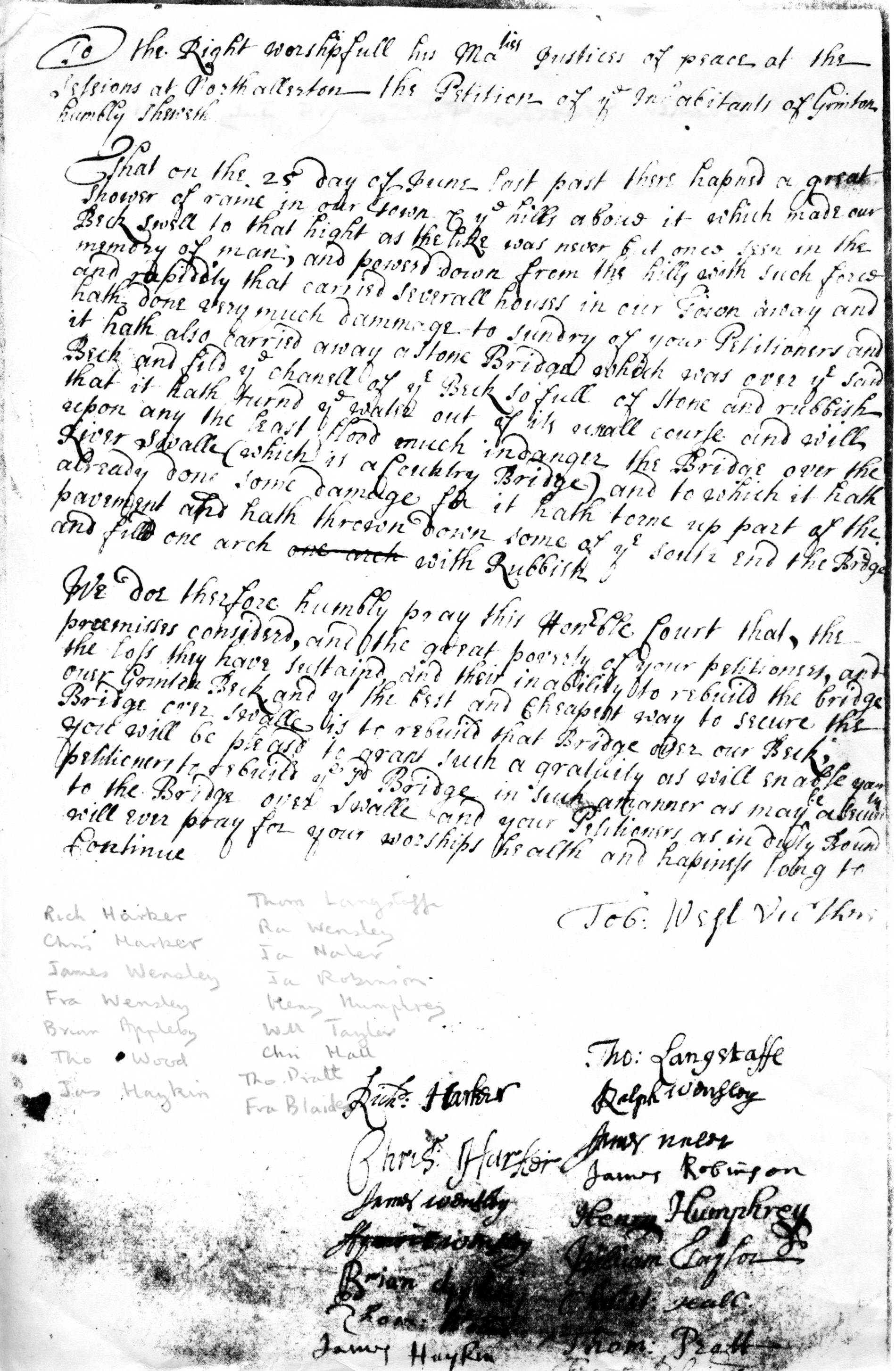 Grinton bridge floods quarter sessions petition 15 July 1701. © NYCRO Why was the medieval settlement abandoned? This petition might be a clue. It states that “on the 25th day of June last past [1701] there happened a great shower of rain in our town and the hills above which made our beck swell to that height as the like was never but once seen in the memory of man and poured down from the hills with such force and rapidity that carried several houses in our town away and hath done very much damage to sundry of your petitioners and it hath also carried away a stone bridge which was over the said beck…” © Alan Mills. |
|
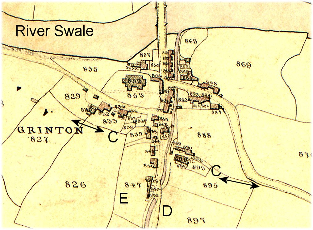 An extract from the Tithe Map of 1841
showing the probable line of the old route [C] in and out
of the village together with the probable location of the
medieval core of the village [E, D]. Also note the houses in
what is now the graveyard. Tithe map copyright R White / YDNPA |
|
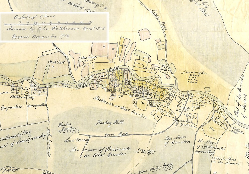 Manor of Grinton 1708. This map was drawn in 1712 from a copy of the original made in 1708 to help settle a court case against the Wharton family initiated by Reginald Marriott and others in 1705. This was about the ownership of lead mining rights on Grinton How in Swaledale. Mining rights were valuable things and disputes could be quite violent; it was like the Wild West here at that time. In the run up to the case miners dammed waterways, flooded mines, shot at someone serving an injunction and said "they care not a fig for the injunctions"! Attempts were made to bribe the foreman of the jury and when the case was settled in favour of Reginald Marriott against Lord Wharton, Marriott took out the jurors for a slap-up meal and gave each of them 20 guineas - a tidy sum in those days. This map is an important piece of that history and our local heritage. This particular map is copyright The J L Barker Collection / NYCRO. |
|
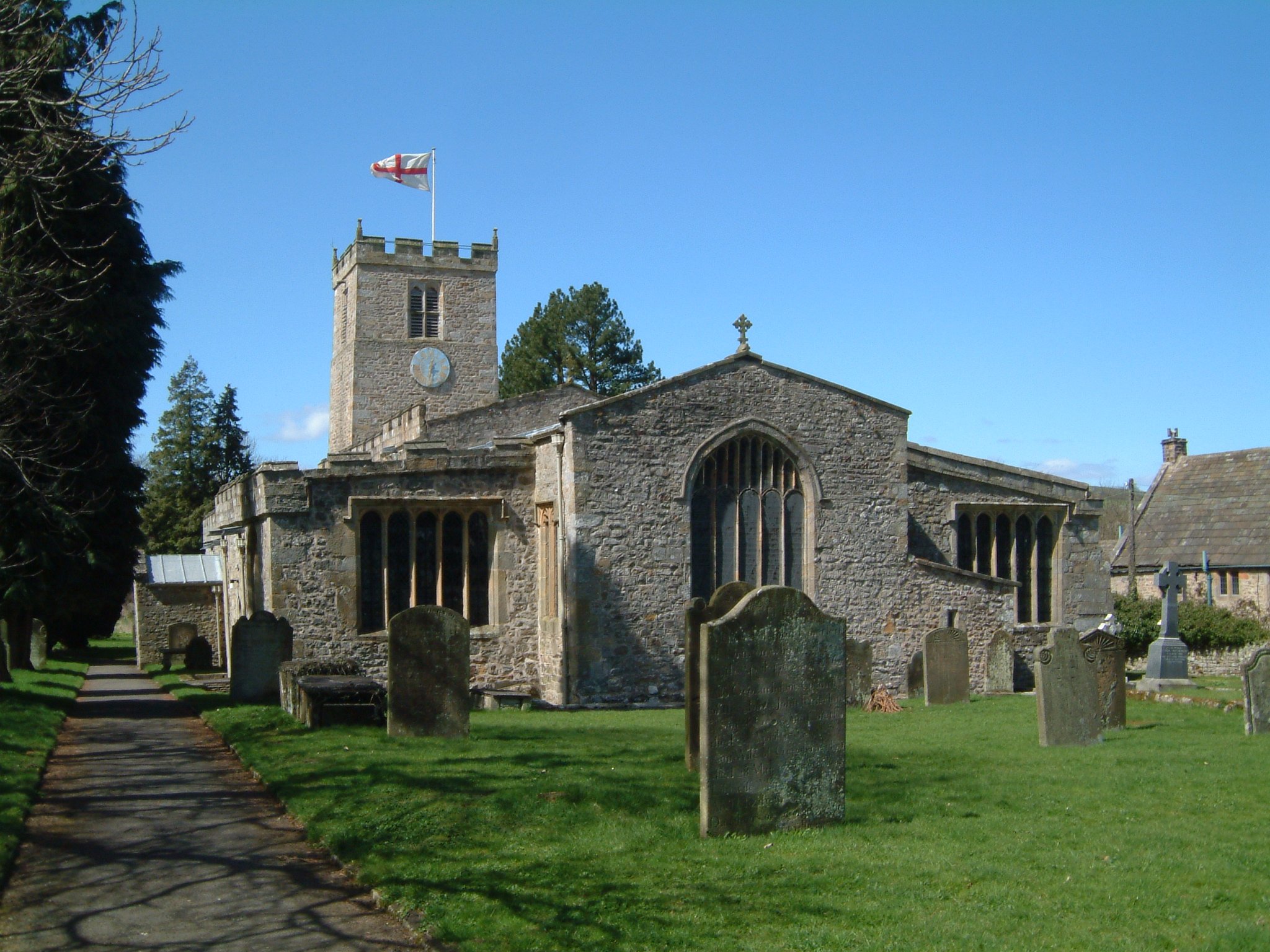 Saint Andrews Parish Church Grinton ©Jonathan Dawson The first known mention of the Grinton church is the grant by Maude, wife of Walter de Gaunt, of “the Church of St. Andrew of Swaledale” to the Augustinian Priory at Bridlington which her husband, Lord of the Manor of Healaugh, had founded c1113. The oldest part of the church is still Norman, consistent with the founding in the early 12th century. |
|