|
| *****SWAAG_ID***** | 2 |
| Date Entered | 08/01/2011 |
| Updated on | 24/07/2016 |
| Recorded by | Stephen Eastmead (admin) |
| Category | SWAAG Site |
| Record Type | Archaeology |
| SWAAG Site Name | |
| Site Type | |
| Site Name | |
| Site Description | |
| Site Access | Public Access Land |
| Record Date | 06/01/2011 |
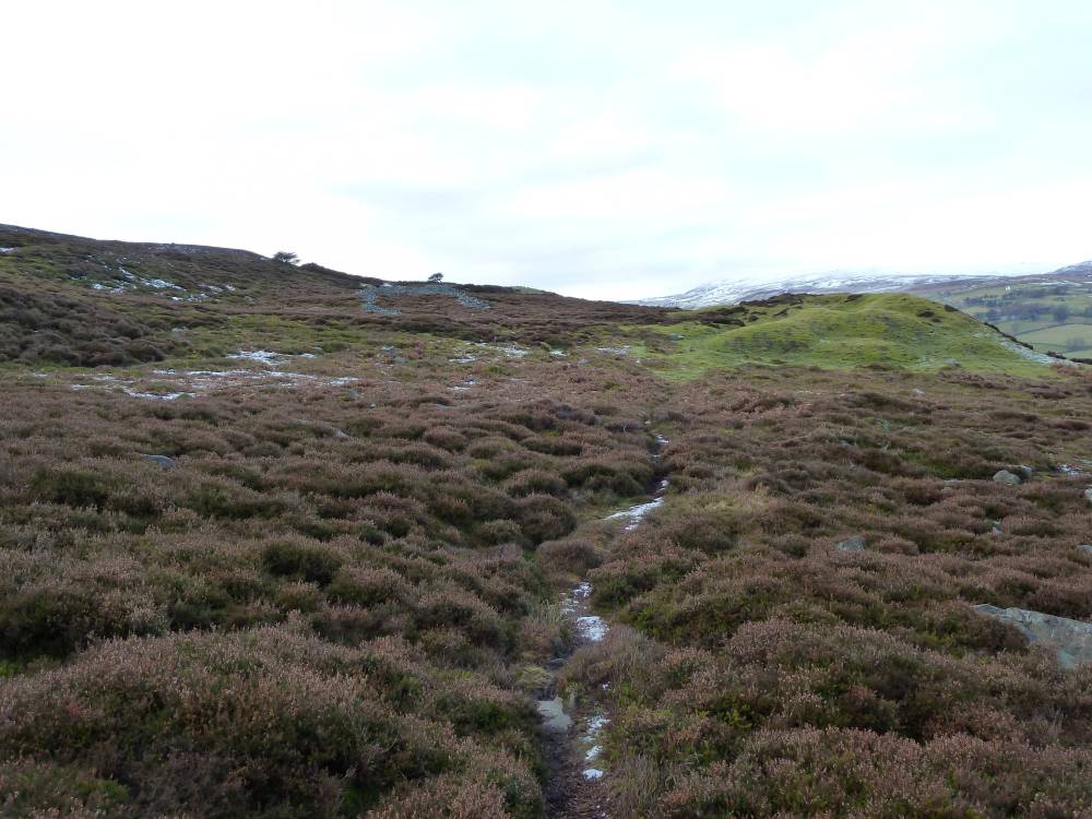
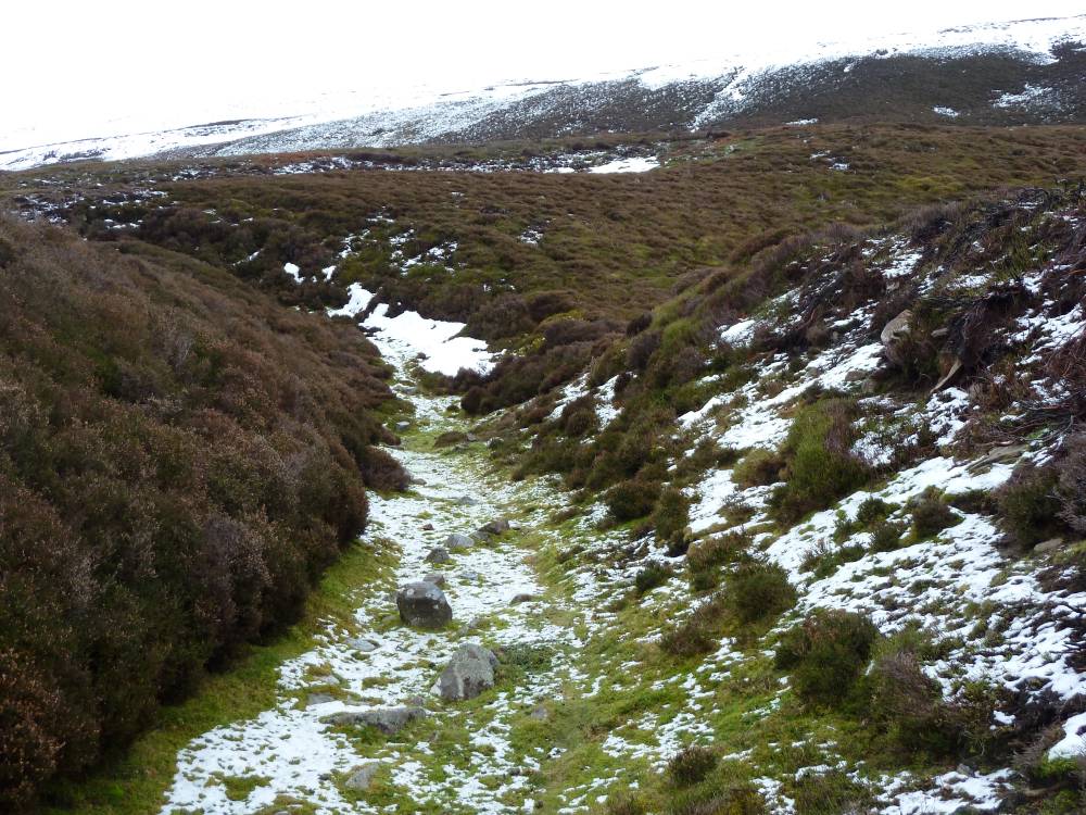
| Location | Maiden Castle on northerly side of Harkerside Moor 2Km SW of Reeth in Swaledale. |
| Civil Parish | Grinton |
| Brit. National Grid | SE 02189 98100 |
| Altitude | 310M |
| Geology | |
| Record Name | Maiden Castle |
| Record Description | English Heritage classify Maiden Castle as a pre-historic iron age defended settlement with adjacent round barrow. A full description by EH can be read in Additional Notes.
A basic site map has been drawn by SWAAG prior to a geophysical survey to be conducted later in 2011. Further information is available on swaag.org on the reports page. |
| Dimensions | East - West 108m x North - South 88m. |
| Geographical area | |
| Species | |
| Scientific Name | |
| Common / Notable Species | |
| Tree and / or Stem Girth | |
| Tree: Position / Form / Status | |
| Tree Site ID | 0 |
| Associated Site SWAAG ID | 0 |
| Additional Notes | The monument is situated on a north facing slope on the lower flanks of
High Harker Hill overlooking the confluence of two major valleys. The site
would appear to have been chosen to utilize the spread of a natural stream
gulley which has created a hollow in the hillside and which has been
subsequently levelled. The monument is oval in shape and measures 108m east to
west by 88m north to south. The area has been enclosed by a substantial
surrounding ditch and an inner rampart upon which are the footings of a stone
wall. On the south side the ditch has been cut across the natural steep slope
giving the exaggerated appearance of a massive inner rampart and in the south
west the natural gulley has been truncated by the enclosing work. There are no
traces of an external bank or wall although a predominantly earthen bank
emanates from the west side of the ditch and runs along the crest of the
gulley, terminating at its head. This bank would appear to be contemporary
with the enclosure.
Access to the enclosure is in the east, where limited excavation has
revealed large corner and facing stones forming an entrance 5m wide. A length
of banking and short stretch of wall on the internal south side of the
entrance may be the remains of some form of enclosure for gateway protection.
This entrance is approached by a probably contemporary stone walled avenue,
now tumbled, 114m long and averaging 6m wide between inner faces.
Within the interior of the enclosure and slightly scarped into the inner
rampart, are the remains of a stone founded hut circle with a diameter of 11m
and 0.4m high with no definite traces of an entrance. An amorphous stony
platform 20m to the south west, also slightly scarped into the inner rampart
may also be a hut foundation.
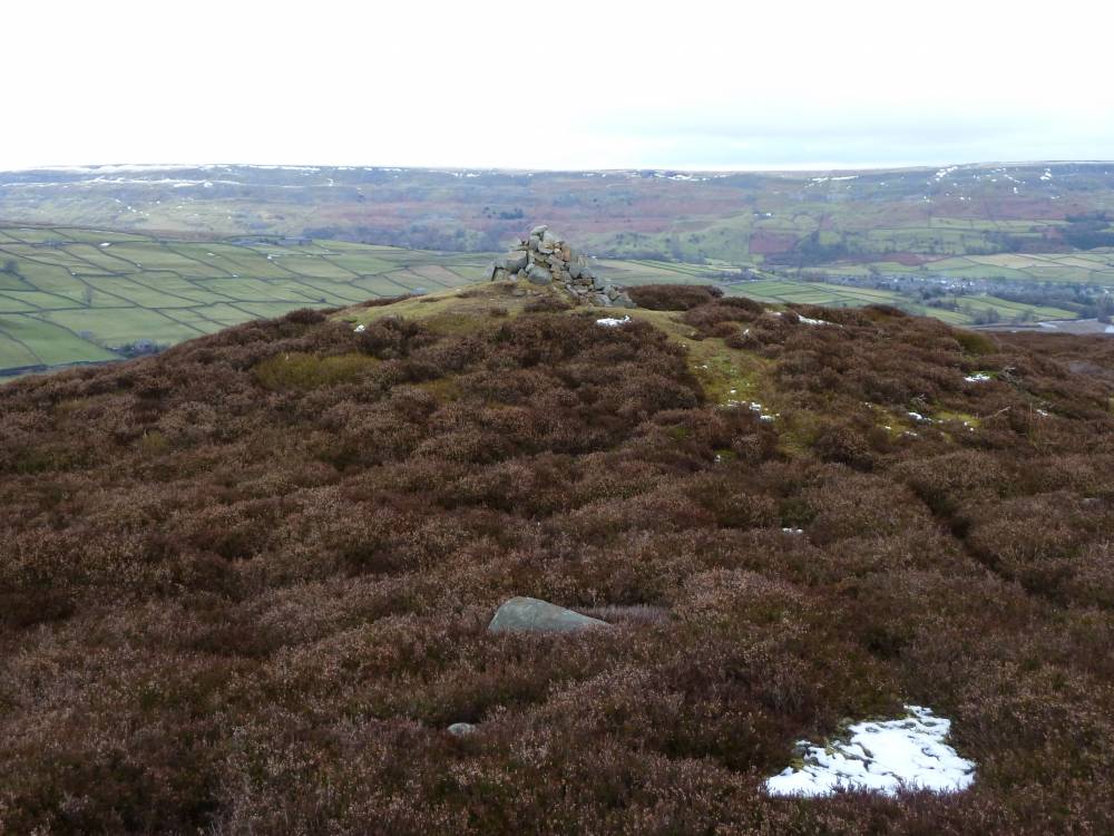
At the eastern extent of the avenue is a large and somewhat mutilated
round barrow built of earth and gravel 1.7m high with dimensions of 35m east
to west by 28m north to south.
ASSESSMENT OF IMPORTANCE
During the mid-prehistoric period (seventh to fifth centuries BC) a variety of
different types of defensive settlements began to be constructed and occupied
in the northern uplands of England. The most obvious sites were hillforts
built in prominent locations. In addition to these a range of smaller sites,
sometimes with an enclosed area of less than 1ha and defined as defended
settlements, were also constructed. Some of these were located on hilltops,
others are found in less prominent positions. The enclosing defences were of
earthen construction, some sites having a single bank and ditch (univallate),
others having more than one (multivallate). At some sites these earthen
ramparts represent a second phase of defence, the first having been a timber
fence or palisade. Within the enclosure a number of stone or timber-built
round houses were occupied by the inhabitants. Stock may also have been kept
in these houses, especially during the cold winter months, or in enclosed
yards outside them. The communities occupying these sites were probably single
family groups, the defended settlements being used as farmsteads. Construction
and use of this type of site extended over several centuries, possibly through
to the early Romano-British period (mid to late first century AD).
Defended settlements are a rare monument type. They were an important element
of the later prehistoric settlement pattern of the northern uplands and are
important for any study of the developing use of fortified settlements during
this period. All well-preserved examples are believed to be of national
importance.
Bowl barrows are funerary monuments dating from the Late Neolithic period to
the Late Bronze Age, with most examples dating to the period 2400-1500BC. They
were constructed as earthen or rubble mounds, sometimes ditched, which covered
single or multiple burials. There are over 10000 surviving bowl barrows
recorded nationally. Often occupying prominent locations, they are a major
historic element in the modern landscape and their considerable variation in
form, and longevity as a monument type provides important information on the
diversity of beliefs and social organisation amongst early prehistoric
communities. A substantial proportion of surviving examples are considered
worthy of protection.
The earthwork is an impressive and well preserved example of this monument
type.
SCHEDULING HISTORY
Records show that the monument was included
in the Schedule on 26th June 1924 as:
COUNTY/NUMBER: Yorkshire 46
NAME: Maiden Castle, Grinton
Scheduling confirmed on 9th October 1981 as:
COUNTY/NUMBER: North Yorkshire 46
NAME: Maiden Castle, Grinton
The reference of this monument is now:
NATIONAL MONUMENT NUMBER: 24535
NAME: Maiden Castle prehistoric defended settlement and adjacent round barrow
SCHEDULING REVISED ON 04th July 1995.
The scheduling document can be read here.
|
| Image 1 ID | 50 Click image to enlarge |
| Image 1 Description | Survey Map | 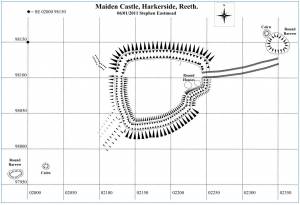 |
| Image 2 ID | 51 Click image to enlarge |
| Image 2 Description | Survey Map Altitudes | 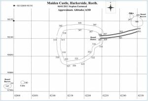 |
| Image 4 ID | 11 Click image to enlarge |
| Image 4 Description | Google Earth Image from July 2009. | 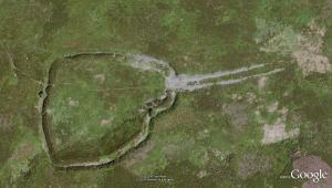 |
| Image 5 ID | 12 Click image to enlarge |
| Image 5 Description | View looking west of the entrance and eastern round barrow. |  |
| Image 6 ID | 13 Click image to enlarge |
| Image 6 Description | View looking towards the west showing the tumbled down walls of the entrance. |  |
| Image 7 ID | 14 Click image to enlarge |
| Image 7 Description | Ditch between outer and inner banks on the western side. Looking towards the River Swale | 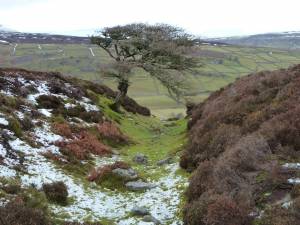 |
| Image 8 ID | 15 Click image to enlarge |
| Image 8 Description | Western ditch looking towards Harkerside Moor. |  |
| Image 9 ID | 16 Click image to enlarge |
| Image 9 Description | Looking towards the River Swale showing the western round barrow. |  |