|
| *****SWAAG_ID***** | 84 |
| Date Entered | 12/01/2011 |
| Updated on | 10/03/2020 |
| Recorded by | Tim Laurie |
| Category | Burnt Mound |
| Record Type | Archaeology |
| SWAAG Site Name | |
| Site Type | |
| Site Name | |
| Site Description | |
| Site Access | Public Access Land |
| Location | Barningham. The Low Moor. Settlement and Burnt mound below How Tallon |
| Civil Parish | Barningham |
| Brit. National Grid | NZ 057 078 |
| Altitude | 390m |
| Geology | Burnt mound at spring rise below kame terrace (settlements) below North Facing quarried cliff scarp formed by sandstone strata below the Main Limestone ridge of How Tallon. |
| Record Name | Barningham. The Low Moor. Settlement and Burnt mound below How Tallon |
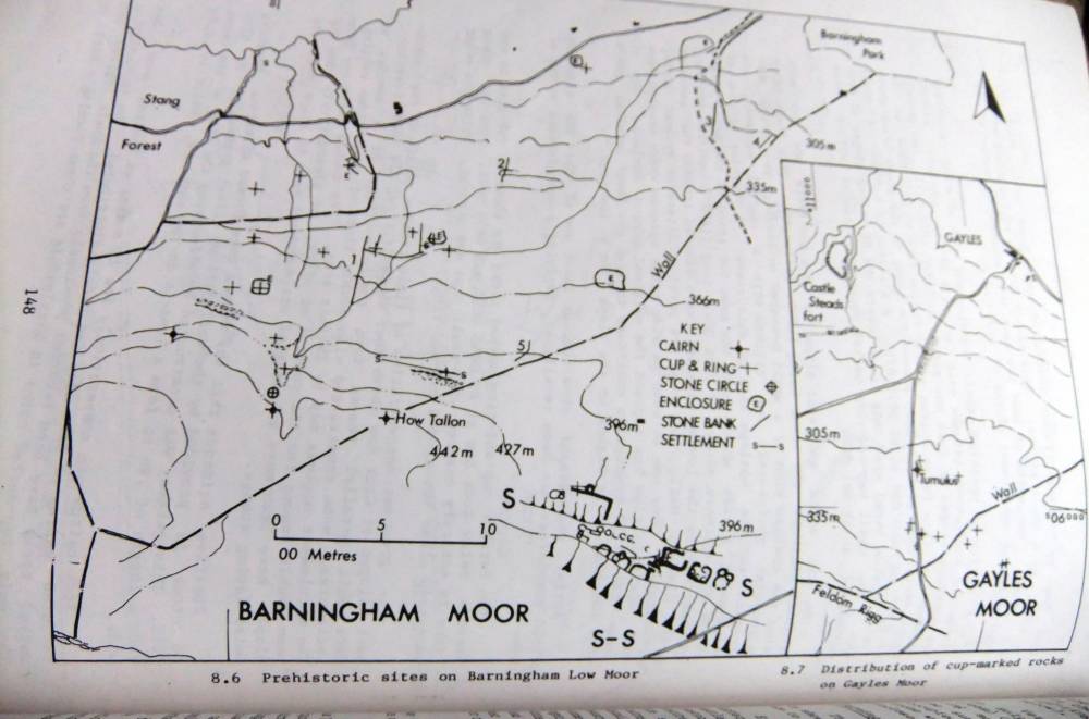
| Record Description | Burnt mound at spring rise below kame terrace (the settlement terrace). This small burnt mound is of characteristic crescent plan and is located at the springrise. This burnt mound was the first to be recognised by T.C. Laurie during the initial fieldwork on Barningham Moor
See Laurie, T.C. 1985. BAR Upland Settlement in Britain. The Second Millenium BC and after. Chapter 12, Figure 8.6 and Tom Gledhill and Ros Nicholls' subsequent theodolite Survey Plans attached.
This burnt Mound is one of four burnt mounds recognised on Barningham Moor.
The association between burnt mounds and round cairns, rock art, scraper dominated late prehistoric lithic concentrations and unenclosed settlements is well illustrated by the complex of Prehistoric sites on Barningham Moor.
The stone walled settlements on the terrace above the burnt mound are probably much later in date (of Late Prehistoric or Native Roman age), however there are indications of earlier occupations on this north facing terrace and also on the Low Moor. |
| Dimensions | Medium, average |
| Geographical area | |
| Species | |
| Scientific Name | |
| Common / Notable Species | |
| Tree and / or Stem Girth | |
| Tree: Position / Form / Status | |
| Tree Site ID | 0 |
| Associated Site SWAAG ID | 0 |
| Additional Notes | Indicative Dimensions for Burnt Mounds adopted here:
Size: Small <6m, Medium 6m-9m, Large 10m-15m, Extra large >15m.
Height: Low <0.5m, Average 0.5-1.0m, High >1.0m.
|
| Image 1 ID | 1789 Click image to enlarge |
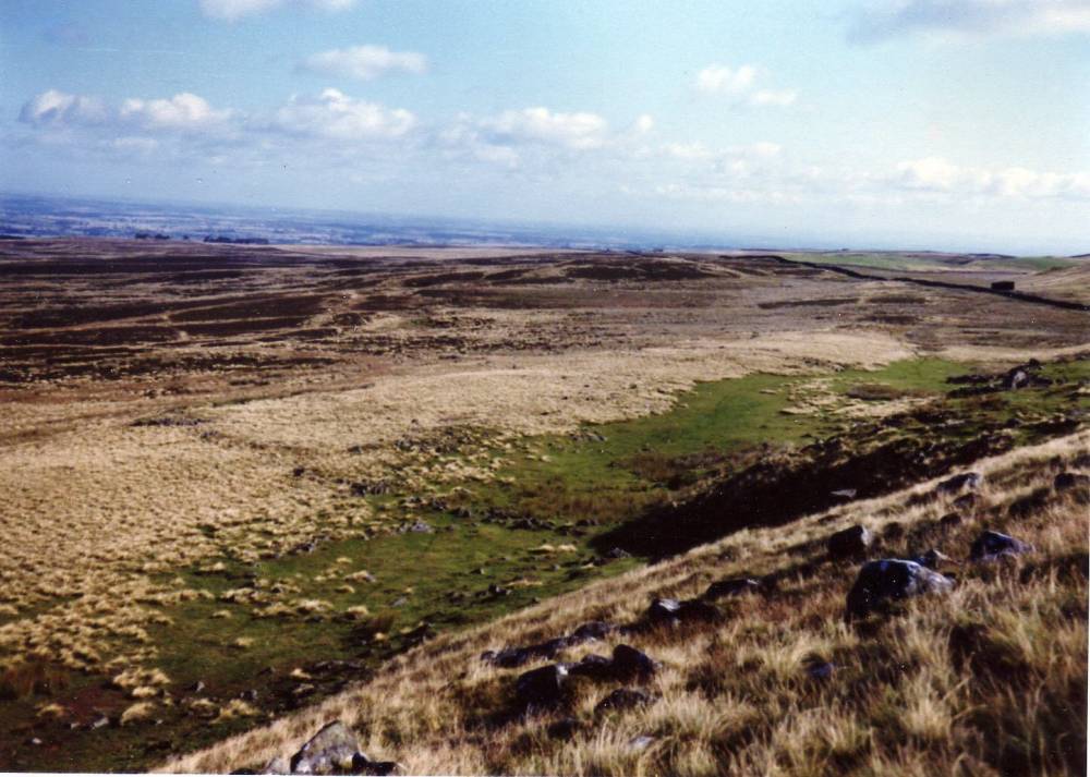
| Image 1 Description | Barningham Low Moor. The settlement terrace below How Tallon. | 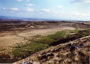 |
| Image 2 ID | 1792 Click image to enlarge |
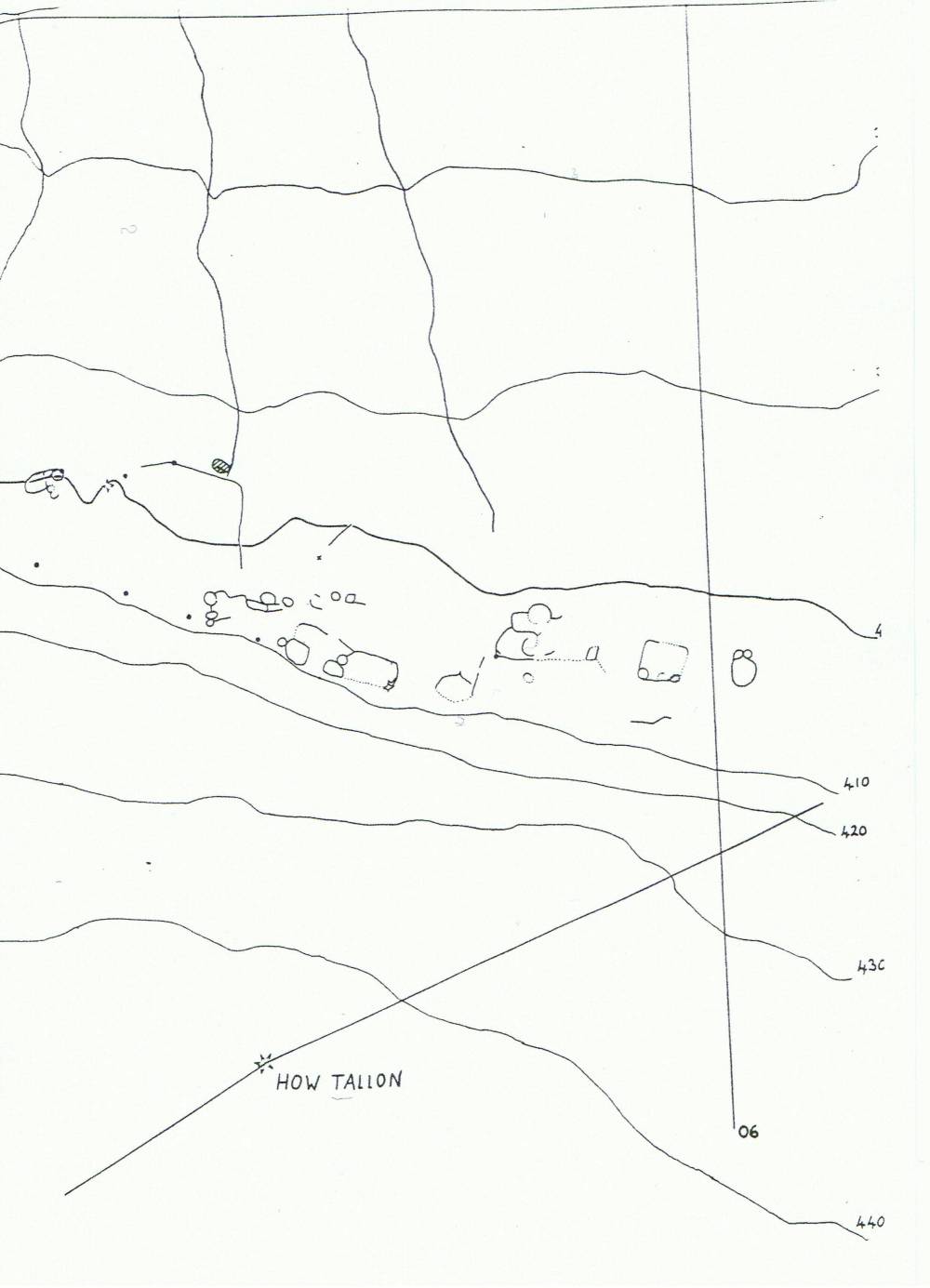
| Image 2 Description | Barningham Low Moor. The settlement terrace and burnt mound. Tom Gledhill and Ros Nichol Survey. | 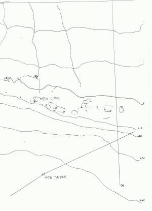 |
| Image 3 ID | 1791 Click image to enlarge |
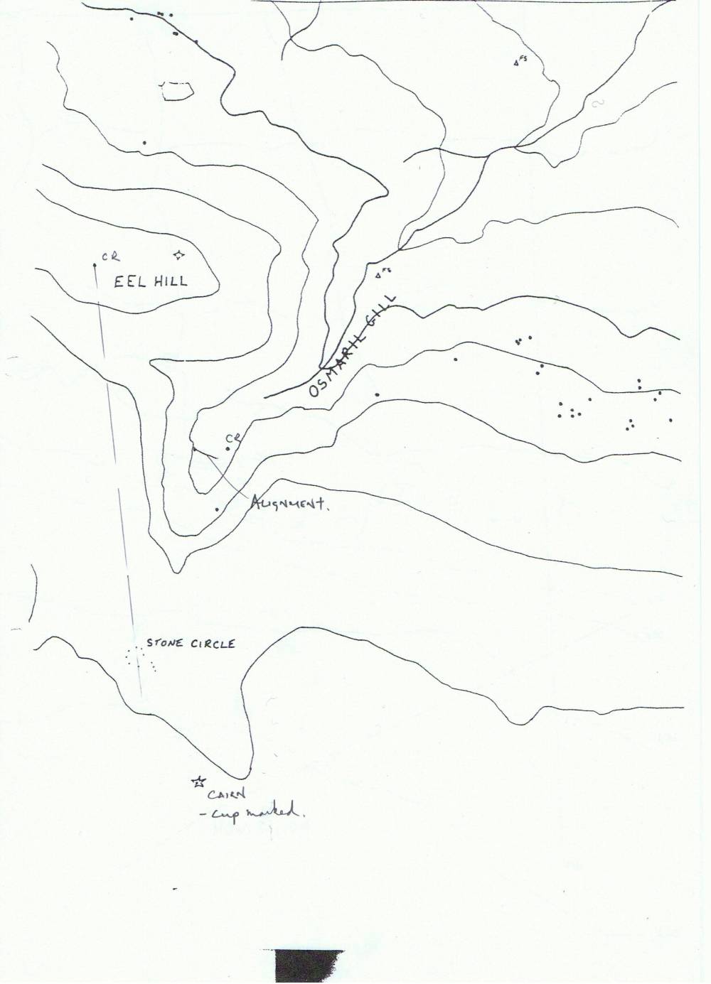
| Image 3 Description | Barningham Low Moor. Osmond's Gill. Prehistoric Sites. Tom Gledhill and Ros Nichol Survey. | 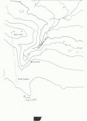 |
| Image 4 ID | 1794 Click image to enlarge |
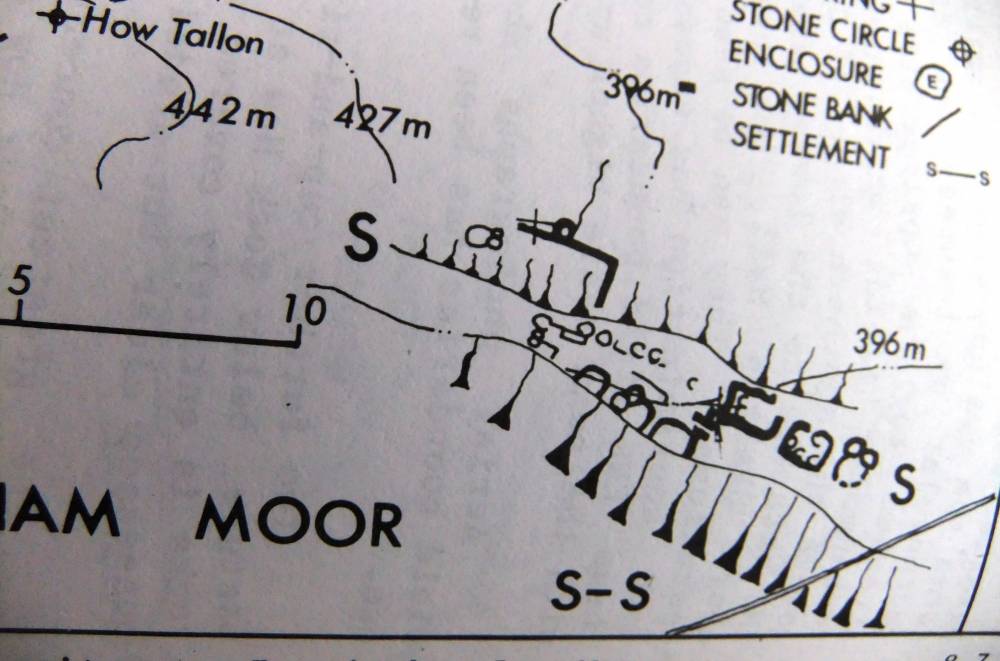
| Image 4 Description | Prehistoric sites on Barningham Moor, Laurie 1985 Fig.8.6 | 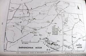 |
| Image 5 ID | 1795 Click image to enlarge |
| Image 5 Description | Detail. The burnt mound is the circular feature adjacent to the spring and later field bank below the settlement terrace. |  |
| Image 6 ID | 1797 Click image to enlarge |
| Image 6 Description | Barningham Low Moor. Prehistoric Sites. Tom Gledhill and Ros Nichol Survey. | 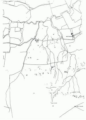 |