|
| *****SWAAG_ID***** | 392 |
| Date Entered | 10/12/2011 |
| Updated on | 10/12/2011 |
| Recorded by | Tim Laurie |
| Category | Ring Cairns |
| Record Type | Archaeology |
| SWAAG Site Name | |
| Site Type | |
| Site Name | |
| Site Description | |
| Site Access | Army Range |
| Record Date | 01/01/2005 |
| Location | Ellerton Moor |
| Civil Parish | Ellerton Abbey |
| Brit. National Grid | SE 075 959 |
| Altitude | 362m |
| Geology | Strata above the Main Limestone. |
| Record Name | ELL06 Army Ranges, Ellerton Moor. Ring cairn at head of Juniper Gill |
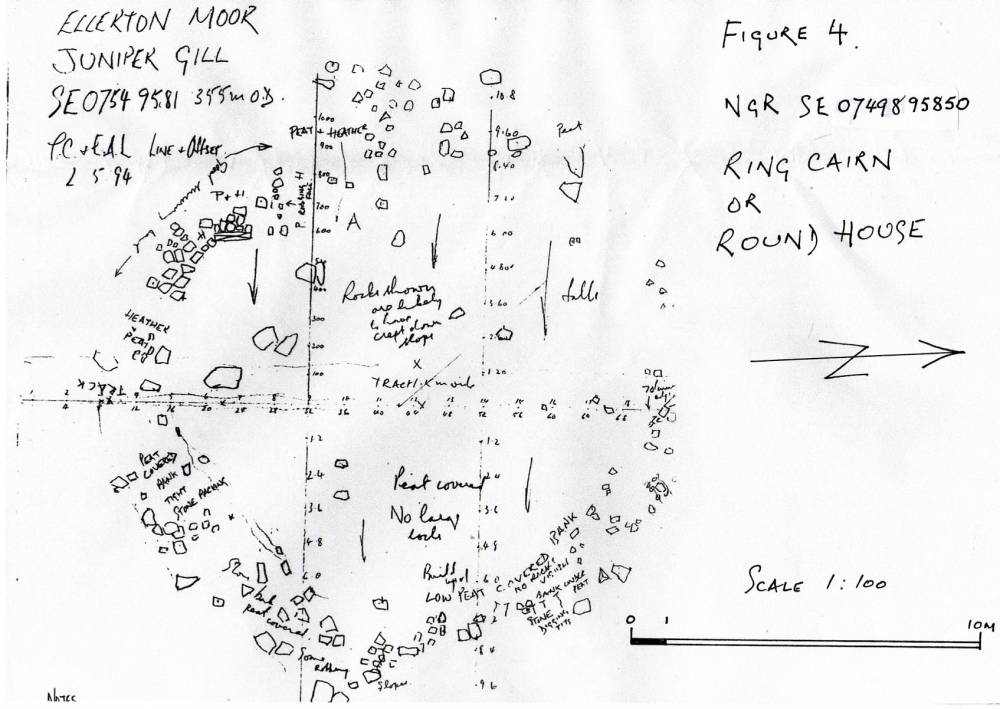
| Record Description | See Line and offset survey sketch plan, Figure 1.
Low stone dump ringwork with some facing stones 13m internal diameter, 17m external diameter. Crossed by track and slighted by some stone robbing. Difficult to see in thick heather.
Vulnerable to moor road surface improvement works!
NOTE! ARMY RANGE DANGER AREA!
This site is on an active Army Firing Range.
Access is NOT ALLOWED without express written permission from the Army Range Authorities. |
| Dimensions | |
| Geographical area | |
| Species | |
| Scientific Name | |
| Common / Notable Species | |
| Tree and / or Stem Girth | |
| Tree: Position / Form / Status | |
| Tree Site ID | 0 |
| Associated Site SWAAG ID | 0 |
| Additional Notes | This ringwork has been scheduled as a Ring Cairn, and Ring Cairn it may be. However there is the equal possiblity that this ring work is an unenclosed round house associated with the field system and cairnfield located some 300m to the north west, see Figures 1 and 4 attached. In support of the interpretation as a ring cairn, this ringwork could be considered, together with the large (for this area)isolated round cairn (Ell04) and Standing Stone (ELL07) as marking the importance of this location as the point where the high escarpment above the Eden Valley first becomes visible through Arkengarthdale and across Stainmore. THe Moor Edge above Juniper Gill is on the line of the lowest and easiest approach through Arkengarthdale to the Stainmore Pass. The braided trackways and paths followed by the Galloway Cattle Drovers from Alston through Teeddale and named the Badger Way after the itinerent tinkers who also used it(See Raistrick 'Green Tracks across the Pennines') may well also have been a prehistoric routeway from the South and East (from the Vale of Mowbray) to the North and west (To the Eden Valley and northward to Galloway) The stone circle at Mudbeck (Thom 19XX)is at the point where the A66 at Rey Cross(and ring cairn within the Rey Cross Roman Marching Camp,see Vyner et al 2003) first becomes visible across Stainmore. However, these romantic thoughts must nor preclude an equal interpretation that the Juniper Gil Ringwork may be an unenclosed round house of Middle Bronze Age date associated with the cairnfield and coaxial field system located west of Juniper Gill. (ELL05)
|
| Image 1 ID | 1642 Click image to enlarge |
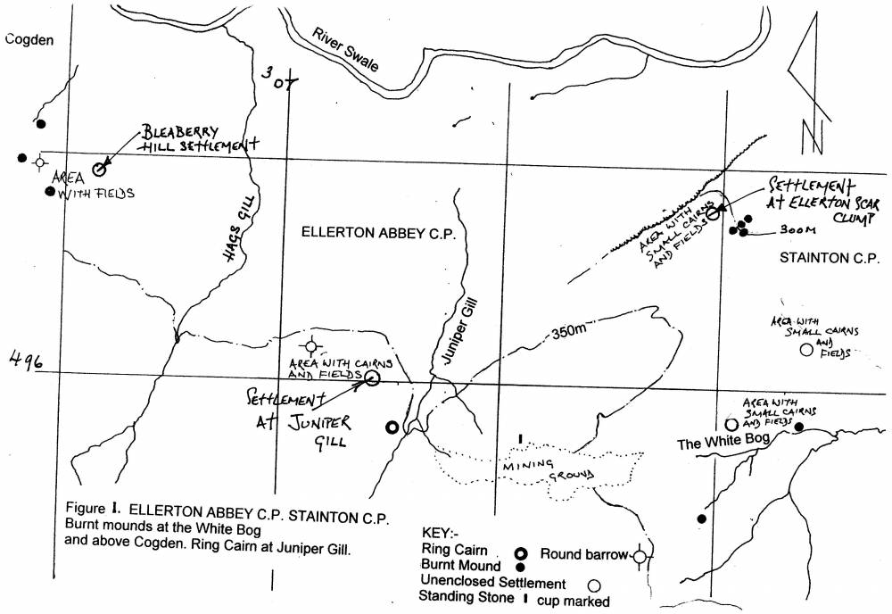
| Image 1 Description | Prehistoric sites on Ellerton Moor. | 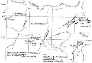 |
| Image 2 ID | 1643 Click image to enlarge |
| Image 2 Description | Sketch Plan of the ringwork. 1:100. | 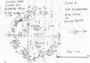 |
| Image 3 ID | 1644 Click image to enlarge |
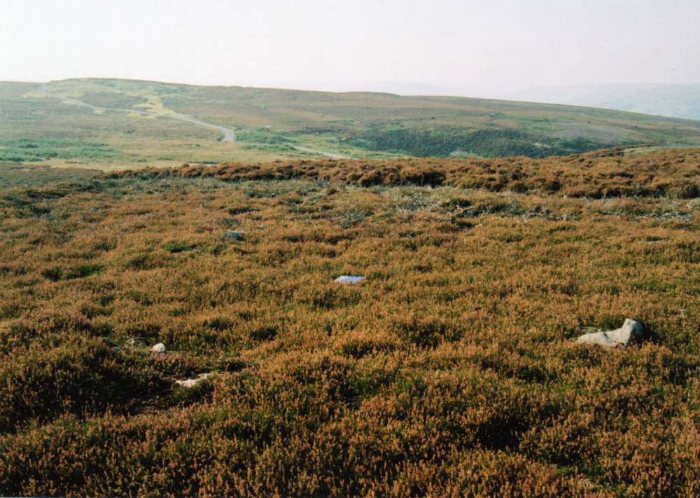
| Image 3 Description | The head of Juniper Gill from new access road to the east. Ringwork is on the rising ground mid distance. | 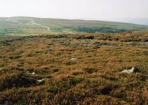 |
| Image 4 ID | 1645 Click image to enlarge |
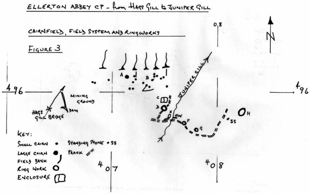
| Image 4 Description | Location Plan. Prehistoric Sites from Hags Gill to Ellerton Scar. Ringwork is Site D | 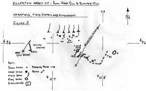 |