|
| *****SWAAG_ID***** | 434 |
| Date Entered | 23/01/2012 |
| Updated on | 23/01/2012 |
| Recorded by | Tim Laurie |
| Category | Flower / Plant Record |
| Record Type | Botanical HER |
| SWAAG Site Name | |
| Site Type | |
| Site Name | |
| Site Description | |
| Site Access | Army Range |
| Location | Oncolite rich spring flushes and streams with rich flora. SE089 936. Close to eastern edge of New Range Footprint. ! |
| Civil Parish | Preston Under Scar |
| Brit. National Grid | SE 08924 93602 |
| Altitude | 310m |
| Geology | Highly calcareous oncoid rich springs rising from Namurian Strata below morainic hills. |
| Record Name | Bellerby Moor. Oncolite rich spring flushes south of Black Beck Gill, at interfluve between Swale and Ure |
| Record Description | Very large calcareous flush and braided streams whose beds are formed by massed oncoids, with Primula farinosa, see photos. Oncolite rich flushes similar to this on Thornton Rust Moor (SSSI) are associated with abundant Birds-eye primrose (Primula farinosa). Least club moss, (Seliginella selaginoides). A similar rich flush flora is also likely also to be present here.
Vegetation not yet recorded. |
| Dimensions | See photographs |
| Geographical area | Wensleydale |
| Species | Birds-eye primrose. (Primula farinosa). |
| Scientific Name | |
| Common / Notable Species | |
| Tree and / or Stem Girth | |
| Tree: Position / Form / Status | |
| Tree Site ID | 0 |
| Associated Site SWAAG ID | 0 |
| Additional Notes | |
| Image 1 ID | 296 Click image to enlarge |
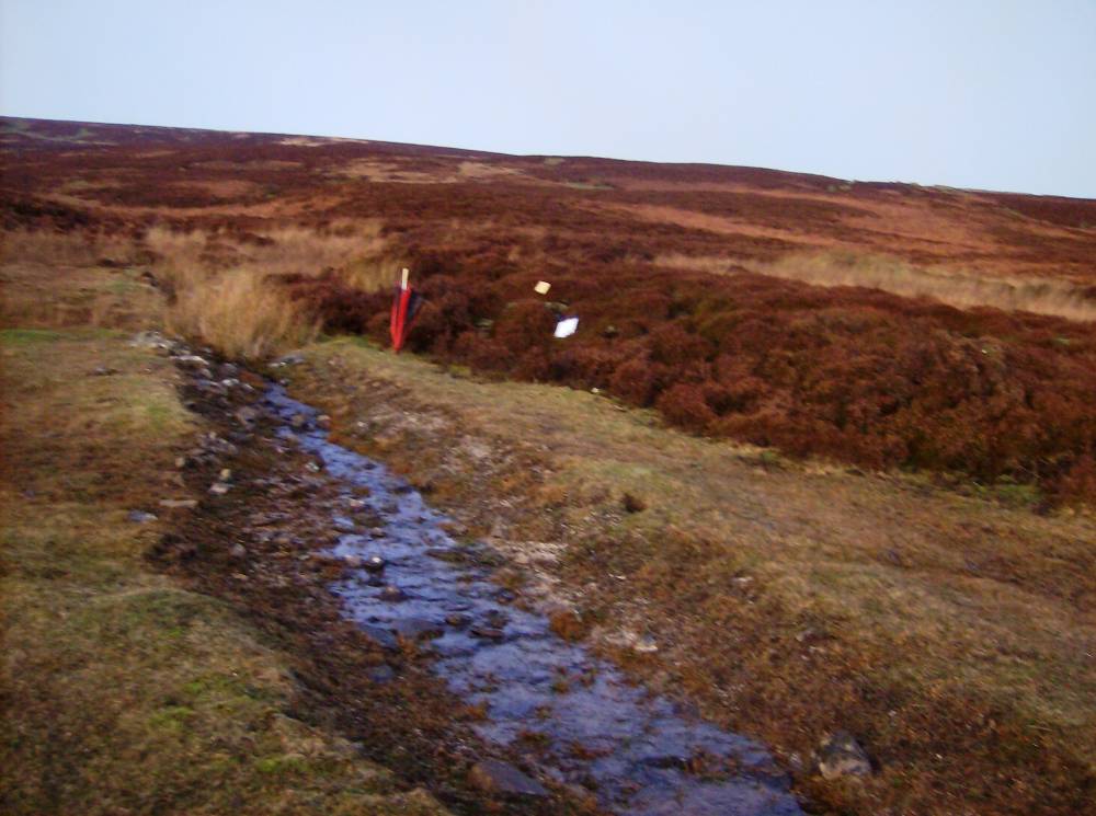
| Image 1 Description | Oncolites in stream south of Black Beck Gill. |  |
| Image 2 ID | 2131 Click image to enlarge |
| Image 2 Description | Oncolite streams south of Black Beck Gill. Black Beck flows east to Walburn, then northward as Gill Beck to , this spring stream has been enlarged as a land drain but is recovering. |  |
| Image 3 ID | 2132 Click image to enlarge |
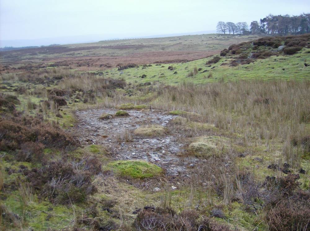
| Image 3 Description | Spring rise south of Black Beck. This spring is a source of the small stream which runs into Park Gill and hence to the Ure. | 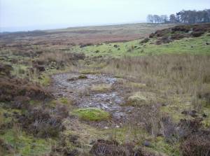 |
| Image 4 ID | 851 Click image to enlarge |
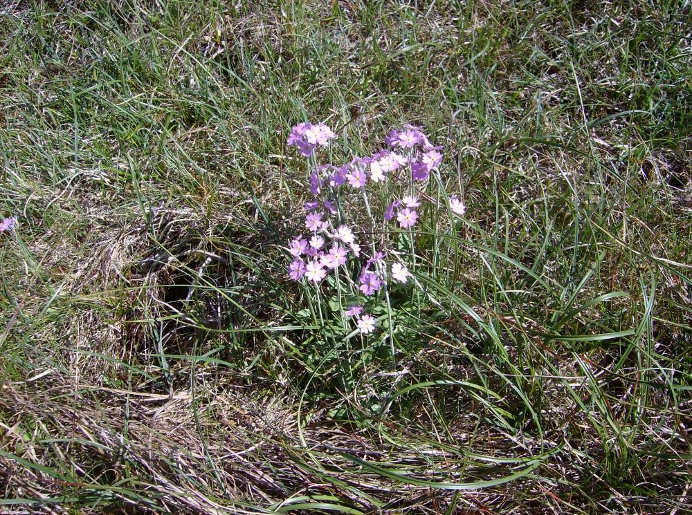
| Image 4 Description | Primula farinosa, Thornton Rust Moor | 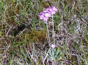 |
| Image 5 ID | 854 Click image to enlarge |
| Image 5 Description | Primula farinosa, Thornton Rust Moor | 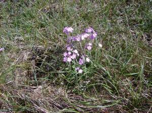 |