|
| *****SWAAG_ID***** | 625 |
| Date Entered | 26/10/2012 |
| Updated on | 26/10/2012 |
| Recorded by | Will Swales |
| Category | Vernacular Record |
| Record Type | General HER |
| SWAAG Site Name | |
| Site Type | |
| Site Name | |
| Site Description | |
| Site Access | Public Access Land |
| Record Date | 26/10/2012 |
| Location | Grinton-Redmire road between Grinton Bridge and How Hill |
| Civil Parish | Grinton |
| Brit. National Grid | SE 046 985 |
| Altitude | |
| Geology | |
| Record Name | OS bench marks between Grinton Bridge and How Hill |
| Record Description | This record describes the results of a brief survey, conducted on 24 October 2012, of the Ordnance Survey bench marks along a one-mile stretch of the Grinton-Redmire road from Grinton Bridge to How Hill. The reference used was the 1914 OS map of Yorkshire, scale 1:10,560. The map indicates 22 bench marks, which are listed below together with comments. As will be seen only eight were found and photographed, which leaves plenty of opportunity for others to try to fill in the gaps. Contributions to this record are welcome. Some of those not found in this brief survey may be covered in moss or heather, or may have been removed. For an explanation of bench marks see Additional Notes below.
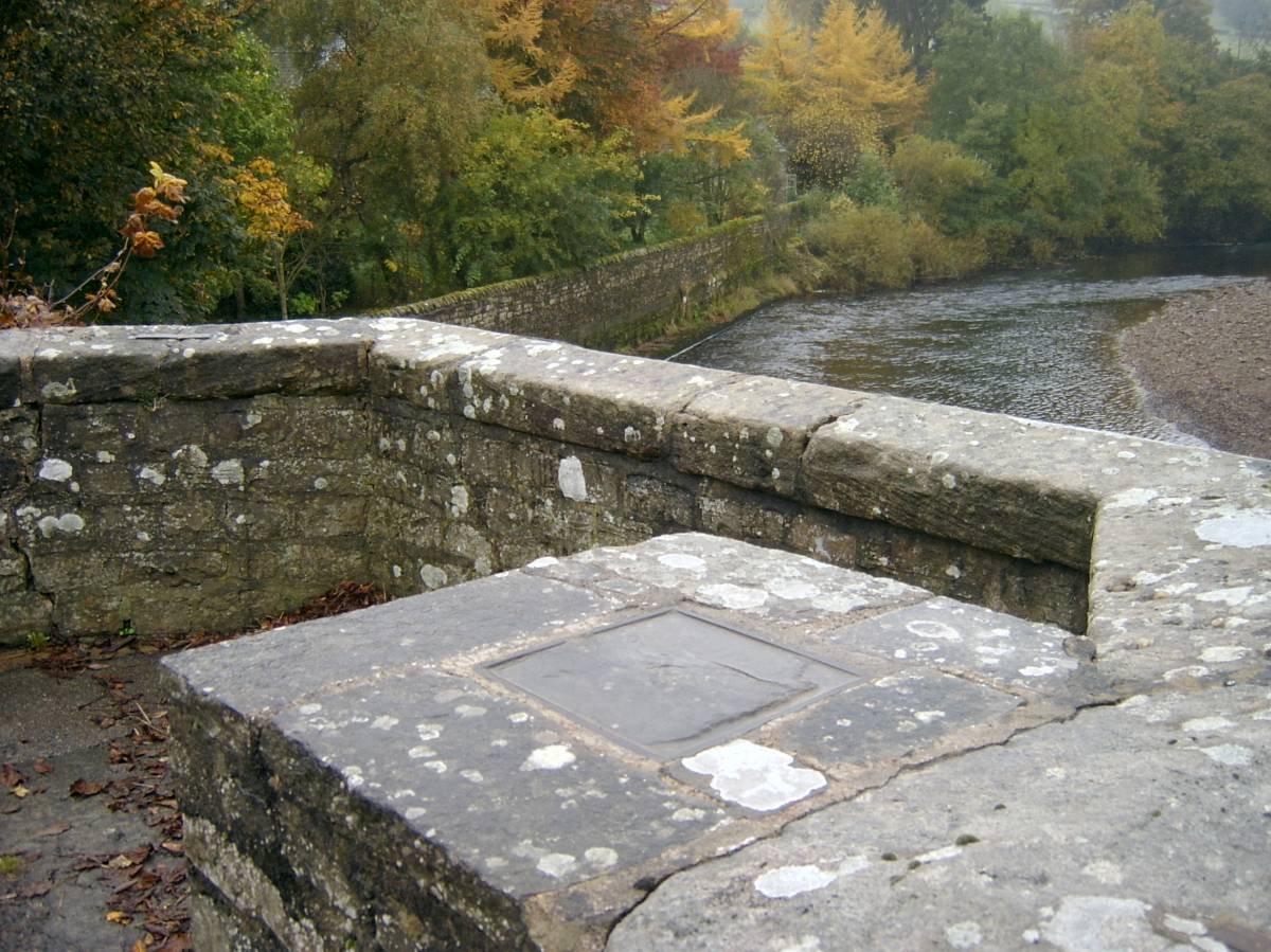
Grinton Bridge – rectangular metal plate - see photo below
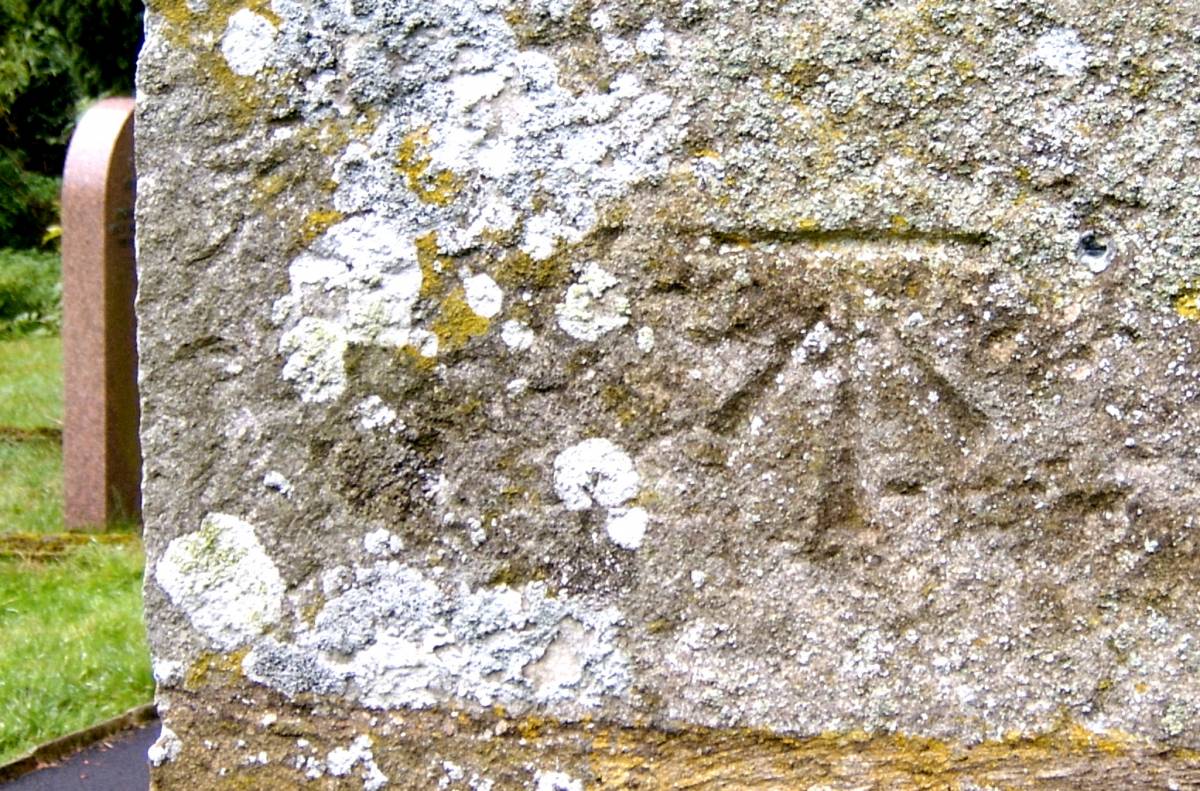
Grinton Church – mark on south corner of the tower – see photo below
Near junction with Swale Hall Lane – not found
Gateway to Manor House – not found
Vicarage Bridge – not found
Midway between Vicarage Bridge and Moor House – not found
Footpath beginning next to Moor House – not found
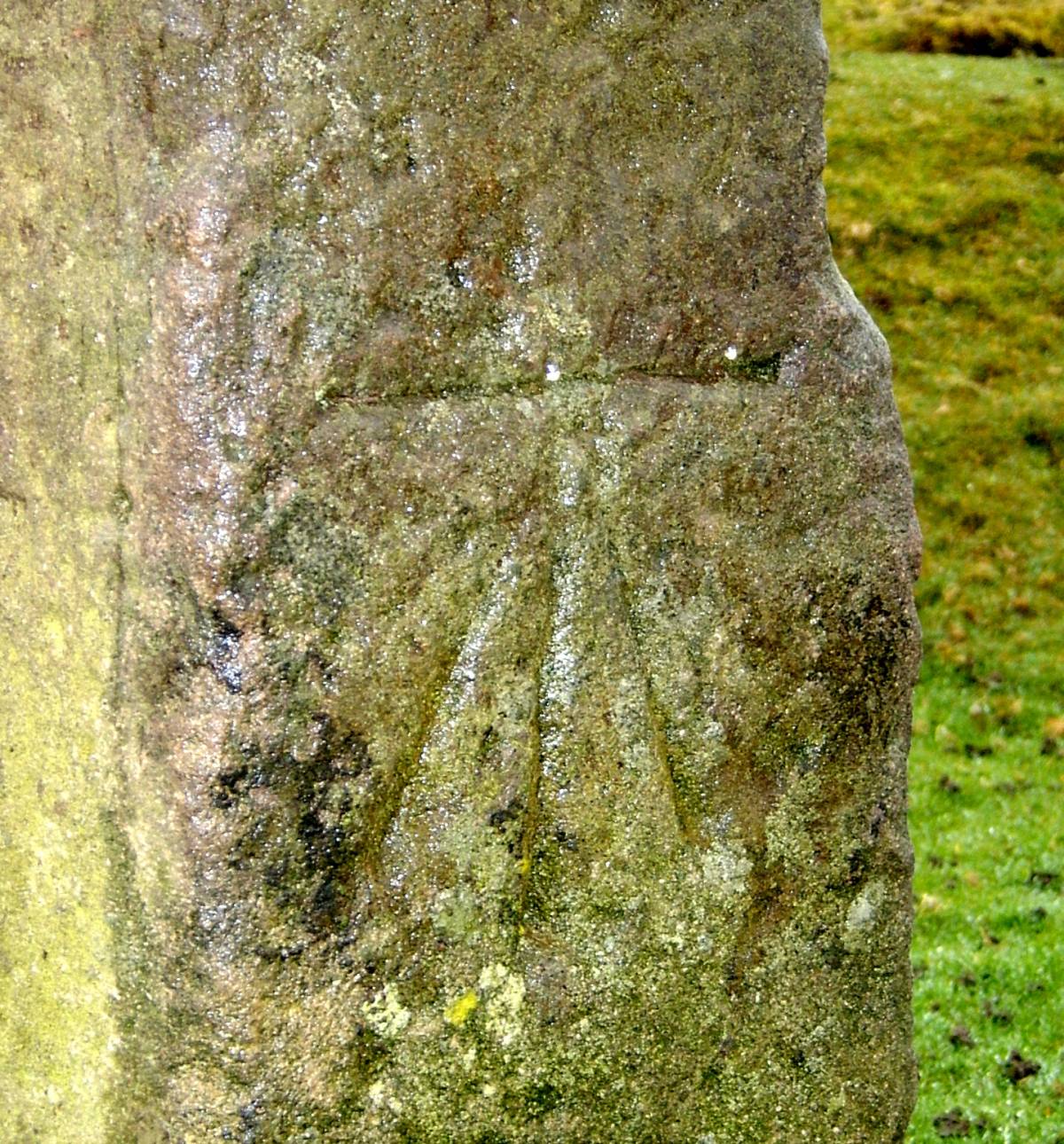
Gatepost near junction of roads from Leyburn and Redmire – see photo below
Footpath crossing from Grinton Lodge to Sheepfold – not found
Bridleway crossing from Grinton Lodge to John Moss’s Chair – not found
Below right-angle bend – not found
Apex of right-angle bend – not found
Above right-angle bend – mark on boulder – see photo below
Near Bridleway crossing at Hirst Ridge – mark on boulder – see photo below
Swinston Brow – mark on boulder – see photo below
Higher on Swinston Brow – mark on boulder – see photo below
Five more locations between 360m and 400m contour lines – not found
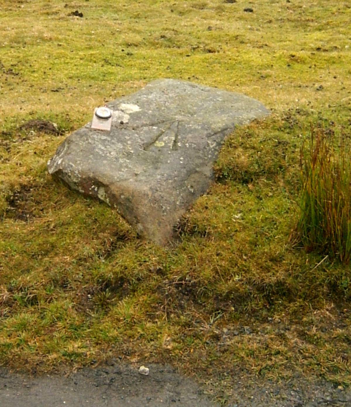
400m contour line – mark on boulder – see photo below
|
| Dimensions | |
| Geographical area | |
| Species | |
| Scientific Name | |
| Common / Notable Species | |
| Tree and / or Stem Girth | |
| Tree: Position / Form / Status | |
| Tree Site ID | 0 |
| Associated Site SWAAG ID | 0 |
| Additional Notes | Ordnance Survey bench marks are elements of a system of marking altitudes above sea level that was implemented in the UK between 1841 and 1860. There were various standards of mark representing different grades of reliability; the most reliable being a set of 198 Fundamental Bench Marks (FBMs) constructed with metal plates or rods set in granite and fixed to the bedrock; and the most prevalent being Bench Marks (BMs), which are masons’ marks of an arrow and bar cut into semi-permanent features such as buildings, gateposts, and boulders. There are thought to be at least 500,000 BMs throughout the UK. In between these two best-known standards of bench mark there are other grades and styles that appear to be later additions to the network. FBMs are still maintained by the Ordnance Survey, but all other standards of bench mark ceased to be maintained in 1972 and were formally abandoned in 2000 in favour of Global Positioning Systems (GPS). Bench marks are not indicated on any modern OS maps, and the absence of maintenance combined with the semi-permanent nature of their hosts means that they are slowly disappearing from the landscape. For these reasons they are worth recording. |
| Image 1 ID | 3495 Click image to enlarge |
| Image 1 Description | Unusual bench mark in the form of a rectangular metal plate housed in a stone pillar on Grinton Bridge. It might have been intended to have a higher degree of reliability than the general benchmark, and indeed if not a FBM it may at least have been the base against which all other bench marks in upper Swaledale were calculated. Height indicated on the map is 587ft | 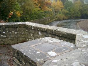 |
| Image 2 ID | 3496 Click image to enlarge |
| Image 2 Description | Bench mark on the south side of the tower of Grinton Church. Height indicated on the map is 589ft | 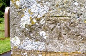 |
| Image 3 ID | 3497 Click image to enlarge |
| Image 3 Description | Bench mark on the solitary surviving gate post by the parking area at the junction of the roads into Grinton from Leyburn and Redmire. Height indicated on the map is 810ft | 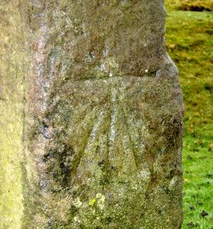 |
| Image 4 ID | 3498 Click image to enlarge |
| Image 4 Description | Bench mark by the road side just above the right-angle bend on the Redmire Road. Height indicated on the map is 1002ft | 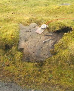 |
| Image 5 ID | 3499 Click image to enlarge |
| Image 5 Description | Bench mark on the road side just below the bridleway crossing at Hirst Ridge. Height on the map is 1040ft | 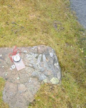 |
| Image 6 ID | 3500 Click image to enlarge |
| Image 6 Description | Bench mark on the road side at Swinston Brow. Height indicated on the map is 1097ft | 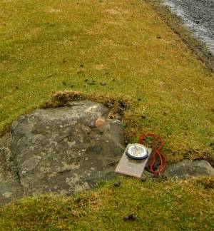 |
| Image 7 ID | 3501 Click image to enlarge |
| Image 7 Description | Bench mark on the road side higher on Swinston Brow. Height indicated on the map is 1144ft |  |
| Image 8 ID | 3502 Click image to enlarge |
| Image 8 Description | Bench mark unusually located 10m away from the road side, around the 400m contour line on the modern map. Height indicated on the 1914 map is 1311ft | 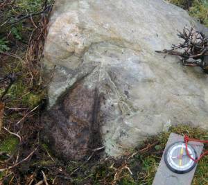 |