|
| *****SWAAG_ID***** | 832 |
| Date Entered | 21/08/2014 |
| Updated on | 21/08/2014 |
| Recorded by | Tim Laurie |
| Category | Enclosure |
| Record Type | Archaeology |
| SWAAG Site Name | |
| Site Type | |
| Site Name | |
| Site Description | The Google Earth Image shows that the enclosures have been reworked, are sub- circular and that several lengths of the perimeter of individual enclosures are very markedly circular as though respecting and enclosing circular timber huts or palisades. These timber structures or huts would leave no visible surface trace today. If this proves to be the case, the enclosures may be prehistoric and prove to have been adapted and reused by the Galloway Drovers at a much later date. |
| Site Access | Public Access Land |
| Record Date | 29/07/2014 |
| Location | Vale of Eden. Pennine Escarpment. Murton CP. Trundale. |
| Civil Parish | Not known |
| Brit. National Grid | |
| Altitude | 475m |
| Geology | Namurian sandstone and mudstones above the Main Limestone |
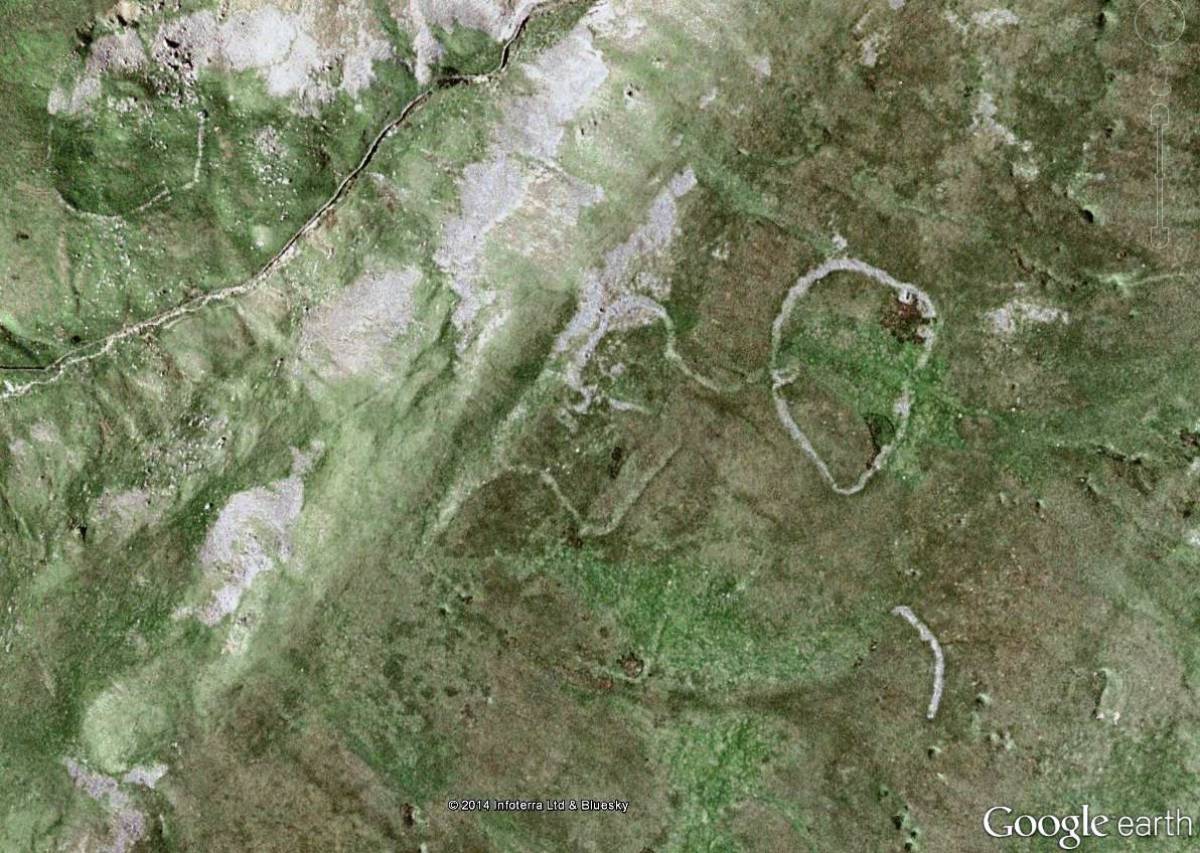
| Record Name | Google Earth Image of two stone banked enclosures, one on either side of Trundale Gill |
| Record Description | This Record should be read together with SWAAG Record No 831 and provides a fine Google Earth Image of the complex enclosures located at 475m Elevation high on the South-Eastern slopes above Trundale Gill Beck. These enclosures were described as SWAAG Record No 831 following a walk to this site . The images included here will allow a more comprehensive consideration of the nature of this complex of stock enclosures.
The Google Earth Image also shows a second stone banked sub circular enclosure which is located on the opposite, North-Western side of Trundale Beck but at 410m AOD which is a much lower elevation, this second enclosure is located below Middle Tongue Scar, the cliffs formed by the Main Limestone. |
| Dimensions | See images |
| Geographical area | |
| Species | |
| Scientific Name | |
| Common / Notable Species | |
| Tree and / or Stem Girth | |
| Tree: Position / Form / Status | |
| Tree Site ID | 0 |
| Associated Site SWAAG ID | 0 |
| Additional Notes | My initial and preferred interpretation of the group of enclosures at 475m elevation on the South-Eastern side of Trundale Beck as stock enclosures associated with the driving of Galloway Cattle southward, pausing before their descent to Murton and Brackenber Common in the Vale of Eden still stands.
However the second isolated lower enclosure is located below limestone cliffs above the stream within the steep sided and enclosed Gill, and not well placed to be of use to the Galloway Drovers. This second enclosure is more probably a shieling type settlement located to take advantage of the good grazing below the limestone cliff and on Middle Tongue the spur between High Cup Gill and Trundale, (See the coaxial field system on Middle Tongue recorded as SWAAG Record NO 830). |
| Image 1 ID | 5779 Click image to enlarge |
| Image 1 Description | Google Earth Image of (1) The enclosure complex on the Southern side of Trundale Gill prescribed on SWAAG Record 831. (2) A single curvilinear enclosure lower down on the Northern side of Trundale Beck. | 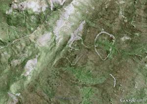 |
| Image 2 ID | 5781 Click image to enlarge |
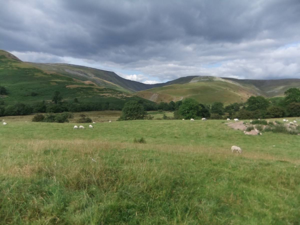
| Image 2 Description | High Cup Gill, Middle Tongue and Trundale viewed from Harbour Flatt Farm. | 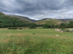 |
| Image 3 ID | 5782 Click image to enlarge |
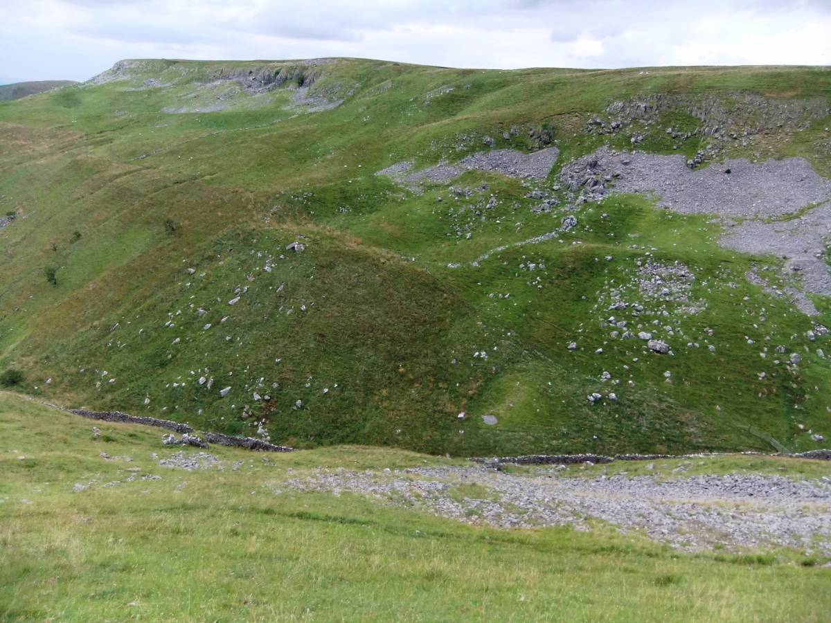
| Image 3 Description | The Lower Enclosure located on the north western side of Trundale Beck, below the Main Limestone Cliffs. |  |